Dačov Lom
Dačov Lom | |
|---|---|
Municipality | |
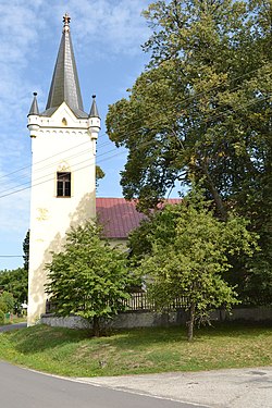 Evangelical church | |
 Dačov Lom Location of Dačov Lom in the Banská Bystrica Region | |
| Coordinates: 48°19′N 19°16′E / 48.317°N 19.267°ECoordinates: 48°19′N 19°16′E / 48.317°N 19.267°E | |
| Country | |
| Region | Banská Bystrica |
| District | Veľký Krtíš |
| First mentioned | 1333 |
| Area | |
| • Total | 24.33 km2 (9.39 sq mi) |
| Elevation | 605 m (1,985 ft) |
| Time zone | UTC+1 (CET) |
| • Summer (DST) | UTC+2 (CEST) |
| Postal code | 991 35 |
| Area code(s) | +421-47 |
| Car plate | VK |
| Website | www.obecdacovlom.sk |


Dačov Lom (Hungarian: Felsődacsólam + Alsódacsólam) is a village and municipality in the Veľký Krtíš District of the Banská Bystrica Region of southern Slovakia.
History[]
It arose in 1943 with the union of Dolný (first mention in 1511 Lam Inferior) and Horný Dačov Lom (first mention in 1333 Lom). In 1333, Horný Dačov Lom belonged to nobles Dobáky, in 1337 to local feudatories Dacsóy and in the 18th century to Maitheény, Balassa and Zichy.
Genealogical resources[]
The records for genealogical research are available at the state archive "Statny Archiv in Banska Bystrica, Slovakia"
- Roman Catholic church records (births/marriages/deaths): 1792-1890 (parish B)
- Lutheran church records (births/marriages/deaths): 1731-1896 (parish A)
See also[]
External links[]
 Media related to Dačov Lom at Wikimedia Commons
- Official website

- https://web.archive.org/web/20070427022352/http://www.statistics.sk/mosmis/eng/run.html
- http://www.e-obce.sk/obec/dacovlom/dacov-lom.html
- Surnames of living people in Dacov Lom
| Authority control |
|
|---|
This article about a location in the Veľký Krtíš District of Slovakia is a stub. You can help Wikipedia by . |
Categories:
- Villages and municipalities in Veľký Krtíš District
- Veľký Krtíš District geography stubs