Deurningen
Deurningen | |
|---|---|
Village | |
 | |
| Nickname(s): Plagnstekkers | |
 | |
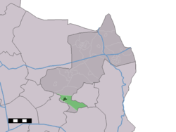 The village centre (dark green) and the statistical district (light green) of Deurningen in the municipality of Dinkelland. | |
| Coordinates: 52°18′24″N 6°50′22″E / 52.30667°N 6.83944°ECoordinates: 52°18′24″N 6°50′22″E / 52.30667°N 6.83944°E | |
| Country | Netherlands |
| Province | Overijssel |
| Municipality | Dinkelland |
| Population | |
| • Total | 1,948 |
| Demonym(s) | Deurningers |
| Time zone | UTC+1 (CET) |
| • Summer (DST) | UTC+2 (CEST) |

Deurningen is a village in the Dutch province of Overijssel. It is a part of the municipality of Dinkelland, and lies about 5 km northeast of Hengelo.
In 2001, the village of Deurningen had 1132 inhabitants. The built-up area of the town was 0.39 km², and contained 388 residences.[1] The statistical area "Deurningen", which also can include the peripheral parts of the village, as well as the surrounding countryside, has a population of around 1580.[2]
References[]
- ^ Statistics Netherlands (CBS), Bevolkingskernen in Nederland 2001. (Statistics are for the continuous built-up area).
- ^ Statistics Netherlands (CBS), Statline: Kerncijfers wijken en buurten 2003-2005 Archived 2006-07-24 at WebCite. As of 1 January 2005.
| Authority control |
|
|---|
This Overijssel location article is a stub. You can help Wikipedia by . |
Categories:
- Populated places in Overijssel
- Twente
- Dinkelland
- Overijssel geography stubs