Diamondhead, Mississippi
Diamondhead, Mississippi | |
|---|---|
| Motto(s): "Where living is easy."[1] | |
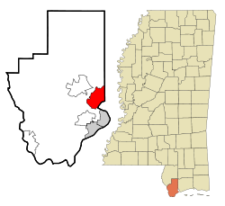 Location of Diamondhead, Mississippi | |
 Diamondhead, Mississippi Location in the United States | |
| Coordinates: 30°23′0″N 89°22′22″W / 30.38333°N 89.37278°WCoordinates: 30°23′0″N 89°22′22″W / 30.38333°N 89.37278°W | |
| Country | United States |
| State | Mississippi |
| County | Hancock |
| Incorporated | February 6, 2012 |
| Government | |
| • Mayor | Nancy Depreo[2] |
| Area | |
| • Total | 12.57 sq mi (32.55 km2) |
| • Land | 10.11 sq mi (26.18 km2) |
| • Water | 2.46 sq mi (6.36 km2) |
| Elevation | 66 ft (20 m) |
| Population (2010) | |
| • Total | 8,425 |
| • Estimate (2019)[4] | 8,048 |
| • Density | 796.12/sq mi (307.38/km2) |
| Time zone | UTC-6 (Central (CST)) |
| • Summer (DST) | UTC-5 (CDT) |
| ZIP code | 39525 |
| Area code(s) | 228 |
| FIPS code | 28-19100 |
| GNIS feature ID | 0689399 |
| Website | www |

Diamondhead is a city in southeastern Hancock County, Mississippi, United States. The city is located just over 50 miles (80 km) northeast of New Orleans, Louisiana. It is part of the Gulfport−Biloxi Metropolitan Statistical Area. In February 2012, Diamondhead was officially incorporated as a city. At the time of the 2010 census, when Diamondhead was an unincorporated census-designated place, the population was 8,425.[5] The city population, with slightly different boundaries, was estimated at 8,048 in 2019.[6]
History[]
Resort community[]
On October 25, 1961, NASA announced the formation of the Mississippi Test Facility, now the John C. Stennis Space Center. The center would be located in an area bordering the Pearl River in Hancock County.[7] During and following the construction of the facility, an influx of government workers, contractors, and their families moved into the area.[8]
Much of the land that became Diamondhead had been purchased by Walter Gex Sr., in 1937 from the Gulf State Paper Company and the Easy Opener Bag Company. Additional land was purchased by Gex, bringing his acquisition to nearly 5,000 acres (2,000 ha).[9] In the late 1960s, D.E.A.R., Inc., later known as the Diamondhead Corporation, a large corporation interested in resort developments, began operations on the Mississippi Gulf Coast, with Diamondhead as its first project.[10] Coastal Mississippi had been a popular vacation destination for years, particularly with Midwesterners. Its location was ideal as a second home development given the convenient access via Interstate 55.[11] The land on which Diamondhead is located is the highest point of elevation (100 feet (30 m) above sea level) on the Gulf Coast in Mississippi. Therefore, the project was named "Diamondhead" after Diamond Head, an iconic volcanic cone on the Hawaiian island of Oahu.[12]
Plans for the largest resort-type community in the southern United States were unveiled at a press conference in 1969. Hawaiian-style architecture, landscape, and road names were featured in the development. The company became interested in purchasing 6,000 acres (2,400 ha) of property adjacent to Interstate 10, which was still under construction in the Mississippi Gulf Coast area in the 1960s.[8] The development would be located north of the Bay of Saint Louis, with 2 miles (3 km) of shoreline along the bay and 9 miles (14 km) of shoreline on the Jourdan River and Rotten Bayou. An interchange on I-10 would be located near the center of the development. When completed, Diamondhead was expected to represent a total investment cost of $10 million.[13]
The corporation was scheduled to close on the purchase on August 18, 1969, one day after Hurricane Camille made landfall in Hancock County. Shortly after the storm left the area, the investment team was able to survey the damage and found that the area around current-day Diamondhead received far less damage than other coastal areas. Seeing such little damage from Camille, the investment team decided to go ahead with the project.[8] Soon after, Diamondhead had streets, lots, infrastructure, model homes, a country club, an airport, a driving range, and a pavilion that would become the community center. Construction of I-10 to the exit at Diamondhead was completed in October 1970, allowing greater traffic access to Diamondhead. By June 1973, 3,700 lots had been sold and 31 homes had been constructed, with another 29 under construction.[14][15] Diamondhead was responsible for much economic growth by creating opportunities for builders, tradesmen, and service industries related to the construction industry. The community also benefitted from other growth along the coast as employees from the Naval Oceanographic Office at Stennis Space Center, the Michoud Assembly Facility in New Orleans East, and other developments around the area chose to live in Diamondhead.[16] By the end of the 1970s, 6,500 of the 10,000 lots offered at Diamondhead had been sold. Most of the early residents came from New Orleans, but later residents came from all over the United States.[17] A survey taken in the late 1970s revealed that a large percentage of property owners came from New Orleans to escape overcrowding conditions.[16]
Diamondhead was organized as a property owners association (POA). On January 1, 1985, the Purcell Company (formerly the Diamondhead Corporation) turned over the POA to a homeowner-elected board of directors.[18] Diamondhead continued to grow after the turnover. As more people and families moved into the community, the demographics became more diverse and less of a second home for retirees. The demographic makeup of Diamondhead changed from that of a retirement community to that of any small suburban-type area.[19] The population of the community became younger, with 54.6% of the population over age 45 in 2000, down from 61.1% in 1990.[20][21] Tensions began to develop among different groups. Many began to question the POA's decisions, especially over increasing monthly dues and spending large amounts of money on golf course maintenance. In 1994, those who did not want the POA to lead the community began to advocate incorporation and conducted a petition drive for Diamondhead to become a city. This initial attempt at incorporation ultimately stalled but did not ease tensions between advocates and opponents.[8]
Hurricane Katrina[]

On August 29, 2005, Hurricane Katrina made its third landfall on the Mississippi Gulf Coast. Before and during landfall, water poured into the Bay of St. Louis, and the initial flooding occurred in low-lying areas along the Jourdan River and its tributary bayous. Therefore, Diamondhead and Kiln began to flood before the bulk of the surge came.[22] A record storm surge of nearly 30 feet (9.1 m) caused extensive damage. Many homes were badly damaged or completely destroyed, especially those homes on the south side of Diamondhead, facing the Bay of Saint Louis. The commercial center, including stores and restaurants, was mostly destroyed.[23] A 1,000-gallon aviation fuel tank from the airport in Diamondhead floated onto I-10.[24] The north side fared better, and many of the people whose homes had been destroyed in neighboring cities, as well as in Diamondhead, moved into the houses which remained on the north side. Overnight, the population swelled from 6,500 to 9,000.[citation needed]
Incorporation[]
Following Hurricane Katrina, the POA found itself facing issues that it had not anticipated that brought back the issue regarding incorporation. A city would be eligible for federal or state financial resources that the POA would not have access to as a private entity. Concerns about the expiration of the various covenants that governed different areas within the POA also created anxiety among homeowners.[8] In July 2006, the POA commissioned a study to determine how to best protect its assets. The study ultimately determined that incorporation would be the best route.
In 2009, a petition supported by the Property Owners Association (POA) to hold an incorporation election was filed with the Hancock Chancery Court, and an election approved the incorporation. Opponents contended that the petition lacked a sufficient number of signatures and that incorporation requirements were not complied with. In 2010, the Hancock Chancery Court ruled against the opponents, who then appealed to the Supreme Court of Mississippi. The appeal further claimed irregularities during the hearing on the original objection. On October 29, 2011, the Supreme Court of Mississippi upheld the Hancock Chancery Court and ruled against the irregularity claims.[25] In January 2012, a motion for extension to appeal the decision was denied by the Supreme Court, and a final edict mandating the incorporation was issued. The City of Diamondhead was presented its charter as the 111th city in Mississippi by Secretary of State Delbert Hosemann on February 6, 2012.[26]
Geography[]
Unlike most of the Mississippi Gulf Coast, which is relatively level, the Diamondhead area has more rolling topography, with elevations ranging from sea level to over 100 feet (30 m). The city is bordered to the south by the Bay of Saint Louis. Rotten Bayou runs west and northwest of the city. Harrison County borders Diamondhead to the east.
According to the United States Census Bureau, in 2010 the Diamondhead CDP had a total area of 11.7 square miles (30.3 km2), of which 11.1 square miles (28.7 km2) were land and 0.58 square miles (1.5 km2), or 5.04%, were water.[5]
Major highways[]
 Interstate 10 runs through the southern part of the city, with access from Exit 16. I-10 leads east 35 miles (56 km) to Biloxi and southwest 56 miles (90 km) to New Orleans.
Nearby cities and towns[]
- Bay St. Louis (11 miles [18 km] south by road)
- DeLisle (7 miles [11 km] east)
- Kiln (7 miles northwest)
- Shoreline Park (6 miles [10 km] south)
- Waveland (10 miles [16 km] south)
Climate[]
The average temperature of Diamondhead is 67 °F, which is higher than the Mississippi average temperature of 64 °F and is much higher than the national average temperature of 54 °F.[27]
| Diamondhead | ||||||||||||||||||||||||||||||||||||||||||||||||||||||||||||
|---|---|---|---|---|---|---|---|---|---|---|---|---|---|---|---|---|---|---|---|---|---|---|---|---|---|---|---|---|---|---|---|---|---|---|---|---|---|---|---|---|---|---|---|---|---|---|---|---|---|---|---|---|---|---|---|---|---|---|---|---|
| Climate chart (explanation) | ||||||||||||||||||||||||||||||||||||||||||||||||||||||||||||
| ||||||||||||||||||||||||||||||||||||||||||||||||||||||||||||
| ||||||||||||||||||||||||||||||||||||||||||||||||||||||||||||
Demographics[]
| Historical population | |||
|---|---|---|---|
| Census | Pop. | %± | |
| 1980 | 1,011 | — | |
| 1990 | 2,661 | 163.2% | |
| 2000 | 5,912 | 122.2% | |
| 2010 | 8,425 | 42.5% | |
| 2019 (est.) | 8,048 | [4] | −4.5% |
| U.S. Census data[28][29][30][31] | |||
As of the 2010 census, there were 8,425 people, 3,586 households, and 2,507 families residing in the CDP. The population density was 745.6 people per square mile (286.6/km2). There were 4,308 housing units at an average density of 381.2/sq mi (146.5/km2). The racial makeup of the CDP was 93.9% White, 2.9% African American, 0.4% Native American, 1.1% Asian, 0.1% Pacific Islander, 0.3% from other races, and 1.2% from two or more races. Hispanic or Latino of any race were 3.3% of the population.
There were 3,586 households, out of which 23.8% had children under the age of 18 living with them, 59.3% were married couples living together, 7.4% had a female householder with no husband present, and 30.1% were non-families. 25.9% of all households were made up of individuals, and 12.2% had someone living alone who was 65 years of age or older. The average household size was 2.31 and the average family size was 2.77.
In the CDP the population was spread out, with 21.1% under the age of 18, 3.6% from 18 to 24, 20.7% from 25 to 44, 28.9% from 45 to 64, and 25.7% who were 65 years of age or older. The median age was 48 years. For every 100 females, there were 93.9 males. Females made up 52% of the population.
The median income for a household in the CDP was $51,361, and the median income for a family was $58,533. Males had a median income of $41,725 versus $29,595 for females. The per capita income for the CDP was $26,631. About 4.3% of families and 7.2% of the population were below the poverty line, including 10.7% of those under age 18 and 2.7% of those age 65 or over.
Economy[]
Casinos[]
This section does not cite any sources. (January 2015) |
A casino deal between Donald Trump and Diamondhead Casino Corporation fell through around March 1, 2007. DHCC still wishes to proceed and establish a casino. The Isle of Capri construction plans at the Kiln-DeLisle exit of Interstate 10 had been canceled as of November 8, 2007.
As of late 2008, casinos had applied for zoning in the south side of Diamondhead that was obliterated by Hurricane Katrina. The Silver Slipper Casino from nearby Lakeshore built a seafood restaurant, the Pier House now named Hula Club, at the former site of the yacht club over the water. The eighty-eight acres north of there is also planned to be a major resort casino. It would be the only casino in Mississippi with virtually direct interstate access (I-10).
As of June 27, 2014, the Mississippi Gaming Commission denied the site application as not being on the Bay of Saint Louis.
Parks and recreation[]
This section does not cite any sources. (January 2015) |

Since most of Diamondhead was a planned community it has many facilities designed to attract home buyers. Some of these facilities include:
- Marina, Yacht Club, Tennis World, and Country Club with multiple dining facilities
- The Pines and Cardinal 18-Hole professional golf courses (36 holes)
- community pools throughout the area
- community center and separate adult learning center
- community grocery and hardware stores
- multiple ponds and lakes
- several homes have direct access to the Gulf of Mexico, as well as the marina and yacht club
- several restaurants, bowling, hotels, automotive stations
- Private airstrip including direct access between the airstrip and private homes allowing planes to be housed at a home owners house.
- Military Order of the Purple Heart, Chapter 771
Education[]
Diamondhead is served by the Hancock County School District.
Local schools of note[]
References[]
- ^ "Welcome to the City of Diamondhead, Where Living Is Easy!". City of Diamondhead, Mississippi. Retrieved August 15, 2017.
- ^ "LIVE REPORT: Diamondhead Mayor Nancy Depreo officially sworn into office". www.wlox.com. Retrieved December 15, 2020.
- ^ "2019 U.S. Gazetteer Files". United States Census Bureau. Retrieved July 26, 2020.
- ^ Jump up to: a b "Population and Housing Unit Estimates". United States Census Bureau. May 24, 2020. Retrieved May 27, 2020.
- ^ Jump up to: a b "Geographic Identifiers: 2010 Census Summary File 1 (G001): Diamondhead CDP, Mississippi". American Factfinder. U.S. Census Bureau. Archived from the original on February 13, 2020. Retrieved August 15, 2017.
- ^ "Population and Housing Unit Estimates". Retrieved May 21, 2020.
- ^ Scharff, p. 588
- ^ Jump up to: a b c d e "The formation of the City of Diamondhead"
- ^ Ellis, Dan (August 22, 2000). Kiln Kountry: Home of Brett Favre. CreateSpace Independent Publishing Platform. p. 40.
- ^ "Diamondhead - A Growing Coast Community". Mississippi EPA News. Electric Power Associations of Mississippi. April 1979. p. 6. Retrieved August 7, 2017.
- ^ "Vertical Files: Diamondhead". Hancock County Historical Society. Retrieved August 8, 2017.
- ^ Scharff, Robert G. (1999). Louisiana's Loss, Mississippi's Gain: A History of Hancock County, Mississippi: From the Stone Age to the Space Age. Lawrenceville, Virginia: Brunswick Publishing Corporation. pp. 599–600.
- ^ Scharff, 599-600.
- ^ "About Diamondhead". Diamondhead.ms.gov. Retrieved August 7, 2017.
- ^ "The Formation of the City of Diamondhead". Hancock County Historical Society. Retrieved August 7, 2017.
- ^ Jump up to: a b Mississippi EPA News, p. 6
- ^ Scharff, p. 637
- ^ "About Diamondhead"
- ^ "Diamondhead, Mississippi: 25 Year Comprehensive Plan" (PDF). Diamondhead.ms.gov. Retrieved August 8, 2017.
- ^ "1990 Census of the Population: General Population Characteristics: Mississippi" (PDF). Census.gov. U.S. Department of Commerce, Economics and Statistics Administration, Bureau of the Census. Retrieved August 8, 2017.
- ^ "Census of Population and Housing". Census.gov. Retrieved June 4, 2015.
- ^ "Katrina's Surge: Part 10". Weather Underground. Retrieved August 5, 2017.
- ^ "Diamondhead Community in Hancock County Still Trying to Clean Up After Katrina". GulfCoastNews.com. Retrieved August 8, 2017.
- ^ Smith, James Patterson (2012). Hurricane Katrina: The Mississippi Story. Jackson, Mississippi: University Press of Mississippi. p. 5. ISBN 978-1-61703-023-9.
- ^ "Archived copy". Archived from the original on April 25, 2012. Retrieved November 7, 2011.CS1 maint: archived copy as title (link)
- ^ "Diamondhead receives charter as Mississippi's 111th city". Sunherald.com. Retrieved May 2, 2017.
- ^ "Diamondhead, MS Weather". USA.com. Retrieved March 13, 2021.
- ^ 1980 Census of Population: Characteristics of the Population: Number of Inhabitants: Mississippi, "Population of Places, 1960-1980", p. Mississippi 26-17. U.S. Department of Commerce, Bureau of the Census.
- ^ Census '90: 1990 Census of Population: General Population Characteristics: Mississippi, "Summary of General Characteristics of Persons, 1990", p. 2 Mississippi. U.S. Department of Commerce, Economics and Statistics Administration, Bureau of Statistics.
- ^ Mississippi 2000: Summary Population and Housing Characteristics: 2000 Census of Population and Housing "Age and Sex 2000", p. Mississippi 34. U.S. Department of Commerce, Economics and Statistics Administration, U.S. Census Bureau.
- ^ Mississippi: 2010: Summary Population and Housing Characteristics: 2010 Census of Population and Housing, "Age and Sex 2010", p. Mississippi 10. U.S. Department of Commerce, Economics and Statistics Administration, U.S. Census Bureau.
External links[]
| show Municipalities and communities of Hancock County, Mississippi, United States |
|---|

| show Authority control |
|---|
- Cities in Mississippi
- Cities in Hancock County, Mississippi
- Gulfport–Biloxi metropolitan area
- Populated places established in 2012