Diffa
Diffa | |
|---|---|
Urban Commune | |
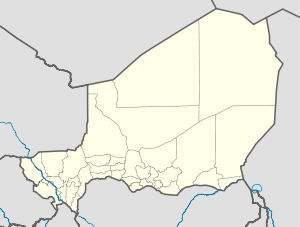 Diffa Location in Niger | |
| Coordinates: 13°18′53″N 12°37′4″E / 13.31472°N 12.61778°E | |
| Country | |
| Region | Diffa Region |
| Department | Diffa Department |
| Urban Commune | Diffa |
| Elevation | 938 ft (285 m) |
| Population (2011)[1] | |
| • Total | 48,005 |
| Time zone | UTC+1 (WAT) |

Diffa is a city and Urban Commune in the extreme southeast of Niger, near the border with Nigeria. It is the administrative seat of both Diffa Region, and the smaller Diffa Department.[2][3] As of 2011, the commune had a total population of 48,005 people.[4]
History[]
In 2002, it was the centre of the first military uprising in the country since President Tandja Mamadou instituted civilian rule and led to a crackdown by the government against the civilian press.[5][6][7]
Nigerian refugees[]
In recent years refugees from Nigeria fleeing violence from Boko Haram have settled in Diffa and surrounding area.[8]
Geography[]

Diffa is situated on the north bank of the Komadougou Yobe river; the river's seasonal floodplain lies immediately to the south and east.[2] Much of the riverbank is lined with gardens and small allotments which grow the town's well-known red peppers.[3][2] The town is bisected in an arc by the Route Nationale 1 road; the eastern part of town is centred on the Grand Marché, which also acts as the transport hub for the city.[2]
Architecture[]
Sports buildings[]

A traditional wrestling arena is located to the northeast of the Grand Marché.[2] Diffa Stadium can be found west of the RN1.[2]
Religious buildings[]
The town contains several mosques, most notably the Grande Mosquée de Diffa on the RN1.[2]
Transport[]
Diffa marks the eastern end of the paved section of Route Nationale 1, the main east-west highway across Niger, although the section between Zinder and Diffa is only partially paved in places.[2] RN1 continues north to N'guigmi more than 100 km. Maïné-Soroa, the other major town of the Region, lies less than 100 km to the west of Diffa. The border with Nigeria, at the Nigerian town of , is 5.5 km to the south of Diffa. Diffa Airport lies to the north of the town.
Gallery[]
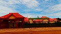
Headquarters of the Regional council
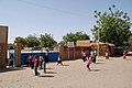
A school in Diffa
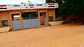
The Palais de Justice


References[]
- ^ Population figures from citypopulation.de, citing (2001) Institut National de la Statistique du Niger.
- ^ Jump up to: a b c d e f g h Geels, Jolijn, (2006) Bradt Travel Guide - Niger, pgs. 229-31
- ^ Jump up to: a b Idrissa, Abdourahmane & Decalo, Samuel, Historical Dictionary of Niger (4th ed.). Scarecrow Press, Boston & Folkestone, (2012) ISBN 0-8108-3136-8
- ^ "Annuaires_Statistiques" (PDF). Institut National de la Statistique du Niger. Retrieved 2 May 2013.
- ^ NIGER: Army mutineers free civilian hostages. 2 August 2002 (IRIN)
- ^ Attacks on the Press 2002: Niger. Committee to Protect Journalists. 31 March 2003
- ^ Niger's Army Pursuing Mutinous Soldiers. Voice of America. 1 August 2002
- ^ Damon, Arwa (11 June 2014). "Where are Nigeria's missing girls? On the hunt for Boko Haram". CNN.com. Retrieved 12 June 2014.
Coordinates: 13°18′53″N 12°37′4″E / 13.31472°N 12.61778°E
| show Authority control |
|---|
- Communes of Niger