Dihing River
This article needs additional citations for verification. (October 2014) |
| Dihing River Burhi Dihing River | |
|---|---|
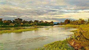 Dihing river at Namsai, Arunachal Pradesh | |
 Location in Assam, India | |
| Location | |
| Country | India |
| Physical characteristics | |
| Source | Patkai Hills |
| • elevation | 2,375 m (7,792 ft)[2] |
| Mouth | Brahmaputra River |
• coordinates | 27°14′0″N 94°42′0″E / 27.23333°N 94.70000°ECoordinates: 27°14′0″N 94°42′0″E / 27.23333°N 94.70000°E[1] |
| Length | 380 km (240 mi)[2] |
| Basin size | 6,000 km2 (2,300 sq mi)[2] |


Dihing or Burhi Dihing (Dihong = wide river ) is a large tributary, about 380 kilometres (240 mi) long,[2] of the Brahmaputra River in Upper Assam in northeastern India. The river originates at 2,375 metres (7,792 ft) above sea level in the Eastern Himalayas (the Patkai Hills)[2] in Arunachal Pradesh and flows through Tinsukia (Tinicukeeya) and Dibrugarh Districts in Assam to its confluence with the Brahmaputra at Dihingmukh. Its watershed covers about 6,000 square kilometres (2,300 sq mi).[2] The Dihing has created number of oxbow lakes in the area.
The Disang is a tributary of the Dihing in its southern bank. The Jeypore-Dihing Rainforest, numerous petroleum fields, wet-paddy fields, bamboo orchards and tea gardens provide a unique landscape along its course. Ledo, Margherita, Digboi, Duliajan and Naharkatia (Nahorkotiya) are the small towns in its valley. Dihing is the one of the most important contributors to the Brahmaputra River. The plains of the Dihing Valley has a rich variety of flora and fauna. The Betel nuts are produced most in the areas of the Dihing Plains.
History[]
According to historical as well as geographical records, the Dihing once flowed through entire Upper Assam and met the Brahmaputra at Mahuramukh in Bokakhat. At that time the rivers Disang, Dikhou, Disai, Dhansiri were all tributaries to the Dihing. The river later dried out during the 17th century (as mentioned in Buranjis) and changed course to join the Brahmaputra at Dihingmukh.
Even before that, the river met the Brahmaputra near the confluence of Subansiri river. At that time the Dikhou river had an independent route and flowed as Kolong and joined the Brahmaputra at Kajalimukh in Nagaon district.[3]
References[]
- ^ National Geospatial-Intelligence Agency. "Burhi Dihing River". Geographical Names. ITA. Retrieved 12 October 2014.
- ^ a b c d e f Sarma, Jogendra N.; Basumallik, Sudhir (1986). "Channel Form and Process of the Burhi Dihing River, India". Geografiska Annaler: Series A, Physical Geography. 68 (4): 373–81. doi:10.2307/521528. JSTOR 521528.
- ^ Prakash, Col. Ved (2007). Encyclopedia of Northeast India Volume 1. Atlantic Publishers. p. 98. ISBN 978-81-269-0703-8.
- Rivers of Assam
- Tributaries of the Brahmaputra River
- Rivers of Arunachal Pradesh
- Ahom kingdom
- Rivers of India