Tinsukia
This article needs additional citations for verification. (June 2018) |
Tinsukia | |
|---|---|
City | |
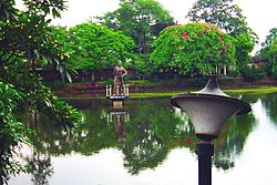 A view of the Tinikunia Pukhuri | |
| Nickname(s): Commercial Hub of Assam | |
 Tinsukia Location in Assam, India | |
| Coordinates: 27°30′00″N 95°22′01″E / 27.500°N 95.367°ECoordinates: 27°30′00″N 95°22′01″E / 27.500°N 95.367°E | |
| Country | |
| State | Assam |
| Region | Upper Assam |
| District | Tinsukia |
| No. Of Wards | 20 |
| Established | 1889 |
| Government | |
| • Type | Municipality |
| • Body | Tinsukia Municipal Board |
| • Mayor | Sri Sanjoy Kishan, BJP |
| • Deputy Commissioner | Sri Pawar Narsing Sambhaji, IAS |
| • Superintendent Of Police | Sri Debojit Deuri, APS[disambiguation needed] |
| Area | |
| • Total | 30 km2 (10 sq mi) |
| Area rank | 7th in Assam |
| Elevation | 116 m (381 ft) |
| Population (2011)[2] | |
| • Total | 126,389 |
| • Rank | 7th in Assam |
| • Density | 4,200/km2 (11,000/sq mi) |
| Demonym(s) | Tinsukian |
| Time zone | UTC+5:30 (IST) |
| PIN | 7861XX |
| Telephone code | 91-374 |
| ISO 3166 code | IN-AS |
| Vehicle registration | AS-23 |
| Sex Ratio | 910 ♀️/ 1000 ♂️ |
| Climate | Cwa |
| Official Language | Assamese |
| Literacy Rate | |
| Lok Sabha Constituency | Dibrugarh |
| Vidhan Sabha Constituency | Tinsukia, Digboi, Doom Dooma, Sadiya, Margherita |
| Website | www |


Tinsukia (Pron: ˌtɪnˈsʊkiə) is an industrial town. It is situated 480 kilometres (298 mi) north-east of Guwahati and 84 kilometres (52 mi) away from the border with Arunachal Pradesh.
It is the administrative headquarters of Tinsukia District of Assam, India.
History[]
Tinsukia is the site of Bengmara, which was originally known as Changmai Pathar. It was the capital of the Motok kingdom which was founded by Swargadeo Sarbananda Singha.[3]

Swargadeo Sarbananda Singha, known as Mezara, was a member of the erstwhile Chutia royal family and rose to become an able administrator.[4] Mezara adopted the name Sarbananda Singha after he became the king. Swargadeo Sarbananda Singha introduced coins in his name and in Saka 1716 and 1717, he inscribed the title Swargadeo in the coins.
Geography[]
Tinsukia is located at 27°30′N 95°22′E / 27.5°N 95.37°E.[5] It has an average elevation of 116 metres (380 feet).
Demographics[]
According to the 2011 census, Tinsukia had a population of 126,389.[6] Males constituted 55% of the population and females 45%. Tinsukia had an average literacy rate of 70.15%, higher than the national average of 64.84%; male literacy was 77.89%, and female literacy 63.54%. 13.29% of the population was under 6 years of age.[7]
Tinisukia city have a population of 126,389 as per 2011 census. Hindi is spoken at 40,087, Bangali at 38,452, Assamese by 24,762 people, Nepali at 2,194 and 13,548 people speaks other languages.[9]
Politics[]
Tinsukia is part of Dibrugarh (Lok Sabha constituency).[10] Sanjoy Kishan of BJP is the current MLA of Tinsukia (Vidhan Sabha constituency).
Media[]
The Assamese daily Dainik Janambhumi is published from Tinsukia along with Guwahati and Jorhat.
Notable people from Tinsukia[]
Notes[]
- ^ "Tinsukia City".
- ^ http://www.censusindia.gov.in/pca/SearchDetails.aspx?Id=298235
- ^ "Tinsukia". Retrieved 2 May 2012.
- ^ "The Buruk-Chutiyas, according to P. Saikia are the direct descendants of the Chutia royal family. Sarbananda Singha, the rulers of the Mataks is said to be a Buruk-Chutiya by caste."(Dutta 1985:31)
- ^ Falling Rain Genomics, Inc - Tinsukia
- ^ "Census of India / Assam / Tinsukia". Census of India. Retrieved 2 May 2012.
- ^ "Census Of India". Retrieved 2 May 2012.
- ^ https://censusindia.gov.in/2011census/C-16T/DDW-C16-TOWN-STMT-MDDS-1800.XLSX
- ^ https://censusindia.gov.in/2011census/C-16T/DDW-C16-TOWN-STMT-MDDS-1800.XLSX
- ^ "List of Parliamentary & Assembly Constituencies" (PDF). Assam. Election Commission of India. Archived from the original (PDF) on 4 May 2006. Retrieved 6 October 2008.
References[]
- Dutta, Sristidhar (1985), The Mataks and their Kingdom, Allahabad: Chugh Publications
External links[]
| Wikimedia Commons has media related to Tinsukia. |
- Tinsukia district official website
 Tinsukia travel guide from Wikivoyage
| Authority control |
|---|
- Tinsukia