Dhemaji district
Dhemaji district | |
|---|---|
District of Assam | |
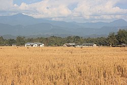 Paddy fields near Dhemaji | |
 Dhemaji district's location in Assam | |
| Country | India |
| State | Assam |
| Division | Upper Assam |
| Headquarters | Dhemaji |
| Government | |
| • Lok Sabha constituencies | Lakhimpur |
| • Vidhan Sabha constituencies | Dhemaji, Jonai |
| Area | |
| • Total | 3,237 km2 (1,250 sq mi) |
| Population (2011)[1] | |
| • Total | 686,133 |
| • Density | 210/km2 (550/sq mi) |
| Time zone | UTC+05:30 (IST) |
| ISO 3166 code | IN-AS-DM |
| Website | http://dhemaji.nic.in/ |
Dhemaji district (Pron:deɪˈmɑ:ʤi or di:ˈmɑ:ʤi) is an administrative district in the state of Assam in India. The district headquarters are located at Dhemaji and commercial headquarters being located Silapathar. The district occupies an area of 3237 km² and has a population of 686,133 (as of 2011). Main Religions are Hindus 548,780, Muslims 10,533, Christians 6,390.
Etymology[]
The district's name Dhemaji is derived from the Deori-Chutia word Dema-ji which means great water indicating it to be a flood-prone region.[2]
History[]
The areas of the present district was part of the greater Chutiya kingdom along with Lakhimpur, Tinsukia, Jorhat, Dibrugarh and Sonitpur district from the 12th century to the 16th century until the Ahom-Chutiya war during the early period of the 16th century. The Ahoms created a new position Banlungia Gohain to control the area. Monuments built during the Chutia rule include Malinithan, Garakhia Than, Bordoloni Than and Basudev temple. A number of monuments Ghuguha Dol, Ma Manipuri Than, Padumani Than built by the Ahom kings are worth visiting.
Dhemaji became a fully-fledged district on 14 October 1989 when it was split from Lakhimpur district.[3]
Geography[]
Dhemaji district occupies an area of 3,237 square kilometres (1,250 sq mi),[4] comparatively equivalent to Solomon Islands' Makira Island.[5] It is one of the most developing districts of India, at the easternmost part of Assam. Situated in the foothills of the lower Himalayas it is relatively a small town.
Being in a confluence of rivers with the mighty Brahmaputra river flanking the district and its numerous tributaries running through the district, the region is perennially affected by floods.
The heart of Dhemaji district is Dhemaji Mouza (an area demarcated by the British regime for the purpose of tax collection, equivalent to a taluk or pargana in the pan-Indian context). Secondly, Silapathar is the main business place of Dhemaji. The Bogibil project was running nearest to these place and is completed which connects dibrugarh.
Education[]
The schools in the district include Borpataria L. P. School, Bhairabpur Netaji M. E. School, St.Francis De sales school, Dhemaji public school, Mothers pride School, Silapathar Town Hanuman Gadhi Hindi High School, Dhemaji Boy's Higher Secondary School, and many more. Colleges include Dhemaji college,Dhemaji Engineering College, Dhemaji Commerce College,Moridhal College and many others.List of colleges in Dhemaji District are-
1.Dhemaji College.
2.Dhemaji Commerce College
3.Dhemaji Girls College
4.Moridhal College.
5.Machkhowa Degree College.
6.Sisiborgaon College.
7.Pachim Dhemaji College.
9.Simen Chapori College.
10.Gugamukh College.
11.Bordoloni Central College.
12.Dimow College.
13.Silapathar College.
14.Silapathar Science College.
15.Purbanchal College.
16.Murkongselek College
17.Jonai Girls College.
18.Jonai Science College.
19.Akajan College
20. Dhemaji Engineering College
21.Dhemaji Polytechnic
22.Industrial Training Institute, Dhemaji.
23.DIET College Dhemaji.
24.Dhemaji PGT College.(Pvt.)
Economy[]
In 2006 the Indian government named Dhemaji one of the country's 250 most backward districts (out of a total of 640).[6] It is one of the eleven districts in Assam currently receiving funds from the Backward Regions Grant Fund Programme (BRGF),but Silapathar being the most developed city in dhemaji district it mainly depend upon trade and commerce.[6]
Divisions[]
There are two Assam Legislative Assembly constituencies in this district: Dhemaji and Jonai.[7] Both are designated for scheduled tribes.[7] They make up a part of the Lakhimpur Lok Sabha constituency.[8] Dhemaji district is politically very poor. Community politics is main reason for this. As of 2019, Pradhan Baruah is MP (Member of Parliament), Ranuj Pegu is MLA from Dhemaji and Bhubon Pegu from Jonai.[9]
Demographics[]
| Year | Pop. | ±% p.a. |
|---|---|---|
| 1901 | 21,324 | — |
| 1911 | 26,930 | +2.36% |
| 1921 | 36,106 | +2.98% |
| 1931 | 44,742 | +2.17% |
| 1941 | 54,896 | +2.07% |
| 1951 | 64,745 | +1.66% |
| 1961 | 113,439 | +5.77% |
| 1971 | 230,762 | +7.36% |
| 1991 | 478,830 | +3.72% |
| 2001 | 571,944 | +1.79% |
| 2011 | 686,133 | +1.84% |
| source:[10] | ||
According to the 2011 census Dhemaji district has a population of 686,133,[1] roughly equal to the nation of Equatorial Guinea[11] or the US state of North Dakota.[12] This gives it a ranking of 504th in India (out of a total of 640).[1] The district has a population density of 213 inhabitants per square kilometre (550/sq mi) .[1] Its population growth rate over the decade 2001-2011 was 20.3%.[1] Dhemaji has a sex ratio of 949 females for every 1000 males,[1] and a literacy rate of 69.07%. Scheduled Castes and Scheduled Tribes made up 6.45% and 47.45% of the population respectively.[1]
Hindus are 95.47% of the population. There are small minorities of Muslims (1.96%) and Christians (1.27%).
According to the 2011 census, 39.21% of the district's population speaks Assamese, 32.53% Mising, 9.80% Bengali, 6.95% Boro, 5.26% Nepali and 1.49% Hindi as their first language.[14]
Township areas[]
- Dhemaji
- Dimow
- Gogamukh
- Jonai
- Silapathar
- Simen Chapori
- Sissiborgaon
- Telam
Flora and fauna[]
In 1996 Dhemaji district became home to the Bardoibum-Beelmukh Wildlife Sanctuary, which has an area of 11 km2 (4.2 sq mi).[15] It shares the park with Lakhimpur district.
References[]
- ^ Jump up to: a b c d e f g "District census 2011 - Dhemaji" (PDF). Office of the Registrar General & Census Commissioner, India. 2011.
- ^ Brown, W.B. An Outline of the Deori-Chutia language. Assam secretariat printing office,1895, p. 70.
- ^ Law, Gwillim (2011-09-25). "Districts of India". Statoids. Retrieved 2011-10-11.
- ^ Srivastava, Dayawanti et al. (ed.) (2010). "States and Union Territories: Assam: Government". India 2010: A Reference Annual (54th ed.). New Delhi, India: Additional Director General, Publications Division, Ministry of Information and Broadcasting (India), Government of India. p. 1116. ISBN 978-81-230-1617-7.CS1 maint: extra text: authors list (link)
- ^ "Island Directory Tables: Islands by Land Area". United Nations Environment Program. 1998-02-18. Retrieved 2011-10-11.
Makira 3,190
- ^ Jump up to: a b Ministry of Panchayati Raj (September 8, 2009). "A Note on the Backward Regions Grant Fund Programme" (PDF). National Institute of Rural Development. Archived from the original (PDF) on April 5, 2012. Retrieved September 27, 2011.
- ^ Jump up to: a b "List of Assembly Constituencies showing their Revenue & Election District wise break - up" (PDF). Chief Electoral Officer, Assam website. Archived from the original (PDF) on 22 March 2012. Retrieved 26 September 2011.
- ^ "List of Assembly Constituencies showing their Parliamentary Constituencies wise break - up" (PDF). Chief Electoral Officer, Assam website. Archived from the original (PDF) on 22 March 2012. Retrieved 26 September 2011.
- ^ "MEMBERS OF ASSAM LEGISLATIVE ASSEMBLY". Government of Assam, Directorate of Information & Public Relations. Archived from the original on 26 July 2013. Retrieved 7 November 2013.
- ^ Decadal Variation In Population Since 1901
- ^ US Directorate of Intelligence. "Country Comparison:Population". Retrieved 2011-10-01.
Equatorial Guinea 668,225 July 2011 est.
- ^ "2010 Resident Population Data". U. S. Census Bureau. Archived from the original on 2013-10-19. Retrieved 2011-09-30.
North Dakota 672,591
- ^ "C-16 Population By Religion - Assam". census.gov.in. Retrieved 17 July 2020.
- ^ 2011 Census of India, Population By Mother Tongue
- ^ Indian Ministry of Forests and Environment. "Protected areas: Assam". Archived from the original on August 23, 2011. Retrieved September 25, 2011.
External links[]
| show Places adjacent to Dhemaji district |
|---|
| show |
|---|
| show Authority control |
|---|

- Dhemaji district
- Districts of Assam
- 1989 establishments in Assam