
Nalbari district
Nalbari district | |
|---|---|
District of Assam | |
 Daul Mandir | |
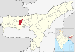 Nalbari district's location in Assam | |
| Country | |
| State | Assam |
| Division | Lower Assam |
| Headquarters | Nalbari |
| Government | |
| • Lok Sabha constituencies | Mangaldoi, Gauhati, Barpeta |
| • Vidhan Sabha constituencies | Nalbari, Barkhetry, Dharmapur |
| Area | |
| • Total | 2,257 km2 (871 sq mi) |
| Population (2011) | |
| • Total | 771,639 |
| • Density | 340/km2 (890/sq mi) |
| Demographics | |
| • Literacy | 79.89% |
| • Sex ratio | 945 |
| Time zone | UTC+05:30 (IST) |
| ISO 3166 code | IN-AS |
| Website | http://nalbari.nic.in/ |
Nalbari (Pron: nɔ:lˈbɑ:ri) is an administrative district in the state of Assam in India. The district headquarters is located at Nalbari.
History[]
Nalbari was declared a sub division of undivided Kamrup District in 1967. The district was created on 14 August 1985 when it was split from Kamrup district.[1] 1 June 2004 saw the formation of Baksha District from parts of three districts, including Nalbari.[1]
Geography[]
Nalbari district occupies an area of 2,257 square kilometres (871 sq mi),[2] The latitude of Nalbari is 26 degrees north and 27 degrees north and the longitude is 91 degrees east and 97 degrees east. The tributaries of the Brahmaputra, the Nona, Buradia, Pagaldia, Borolia and Tihu, which originate in the foothills of the Himalayan Range, are wild in nature and make an enormous contribution to the agrarian economy of the district.
Administration[]
Gitimoni Phukan is the current deputy commissioner of Nalbari district.[3]
Demographics[]
According to the 2011 census Nalbari district has a population of 771,639,[4] This gives it a ranking of 488th in India (out of a total of 640).[4] The district has a population density of 763 inhabitants per square kilometre (1,980/sq mi) .[4] Its population growth rate over the decade 2001-2011 was 11.74%.[4] Nalbari has a sex ratio of 945 females for every 1000 males,[4] and a literacy rate of 79.89%. Scheduled Castes and Scheduled Tribes made up 7.80% and 3.03% of the population respectively.[4]
| Year | Pop. | ±% p.a. |
|---|---|---|
| 1901 | 91,724 | — |
| 1911 | 103,949 | +1.26% |
| 1921 | 118,705 | +1.34% |
| 1931 | 151,846 | +2.49% |
| 1941 | 196,535 | +2.61% |
| 1951 | 231,698 | +1.66% |
| 1961 | 329,736 | +3.59% |
| 1971 | 429,760 | +2.68% |
| 1991 | 603,307 | +1.71% |
| 2001 | 689,053 | +1.34% |
| 2011 | 771,639 | +1.14% |
| source:[5] | ||
Hindu population in the district is 491,582 (63.71%), while Muslim population is 277,488 (35.96%) according to 2011 census.
According to the 2011 census, 85.87% of the population spoke Assamese, 11.00% Bengali and 2.53% Boro as their first language while other constitute 0.61% of the total population.
Religious places[]
- Billeswar Devalaya
Billeswar Devalaya in Belsor of Nalbari district is an ancient Hindu temple and is dedicated to Lord Shiva.[7]
- Basudev Devalaya
Basudev Devalaya in Balikaria of Nalbari district is an ancient Hindu temple and is dedicated to Basudev.[8]
- Ganga Pukhuri
is a large pond situated in Barkuriha of Nalbari district. Every year there is a festival held in Ganga Pukhuri on Ashok Astami and devotees throng here from different parts of the country to pay homages to departed souls.[9]
- Thetha Gohain Than
Thetha Gohain Than in Dokoha of Nalbari district is a Hindu temple dedicated to Lord Krishna.[10]
Education[]
The rate of total literacy of the Nalbari District, according to 2011 census, is 79.89% as against 80.95% in 2001. The rural literacy rate is 78.44%, while the urban rate is 91.46%. Male literacy is 85.58% consisting of Rural 84.38% and Urban 95.24%. Female literacy is 73.85% consisting of Rural 72.14% and Urban 87.48%. The total literacy rate of the state as a whole is 73.18%.[11]
See also[]
References[]
- ^ a b Law, Gwillim (25 September 2011). "Districts of India". Statoids. Retrieved 11 October 2011.
- ^ Srivastava, Dayawanti et al. (ed.) (2010). "States and Union Territories: Assam: Government". India 2010: A Reference Annual (54th ed.). New Delhi, India: Additional Director General, Publications Division, Ministry of Information and Broadcasting (India), Government of India. p. 1116. ISBN 978-81-230-1617-7.
{{cite book}}:|last1=has generic name (help) - ^ "List of DC's in Nalbari District". Nalbari district website. Retrieved 17 May 2021.
{{cite web}}: CS1 maint: url-status (link) - ^ a b c d e f "District Census 2011". Census2011.co.in. 2011. Retrieved 30 September 2011.
- ^ Decadal Variation In Population Since 1901
- ^ "C-16 Population By Mother Tongue - Nalbari". censusindia.gov.in. Retrieved 16 August 2020.
- ^ "About Billeswar Devalaya". Nalbari District Website, Government of Assam.
- ^ "About Basudev Devalaya". Krishi Vigyan Kendra, Nalbari. Retrieved 1 September 2020.
- ^ "About Ganga Pukhuri". District portal of Nalbari district. Retrieved 2 September 2020.
- ^ "About Thetha Gohain Than". Assam Panchayat, Nalbari district portal. Retrieved 3 September 2020.
- ^ "Census 2011". censusindia.gov.in. Retrieved 24 May 2012.
External links[]
Places adjacent to Nalbari district | ||||||||||||||||
|---|---|---|---|---|---|---|---|---|---|---|---|---|---|---|---|---|
| ||||||||||||||||
Authority control | |
|---|---|
| General |
|
| National libraries | |
- Nalbari district
- Districts of Assam
- 1985 establishments in Assam
- Kamrup region