Division No. 2, Saskatchewan
Division No. 2 | |
|---|---|
Census division in Saskatchewan | |
| Country | |
| Province | |
| Area | |
| • Total | 16,859.18 km2 (6,509.37 sq mi) |
| As of 2016 | |
| Population (2016) | |
| • Total | 22,825 |
| • Density | 1.4/km2 (3.5/sq mi) |
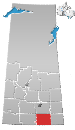
Division No. 2 is one of eighteen census divisions in the province of Saskatchewan, Canada, as defined by Statistics Canada. It is located in the south-southeastern part of the province, on the United States border. The most populous community in this division is Weyburn.
Demographics[]
In the 2016 Census, Division 2 had a population of 22,825 living in 9,389 of its 10,741 total dwellings, a 2.5% increase from its 2011 population of 22,266. With a land area of 16,859.18 km2 it had a population density of 1.4 people per square kilometre in 2016.[1]
Census subdivisions[]
The following census subdivisions (municipalities or municipal equivalents) are located within Saskatchewan's Division No. 2.
Cities[]
Towns[]
Villages[]
|
|
Rural municipalities[]
|
|
Indian reserves[]
- Piapot Cree Nation
- Piapot Cree First Nation 75H[2]
See also[]
References[]
- ^ "Population and dwelling counts, for Canada, provinces and territories, and census divisions, 2011 and 2016 censuses (Saskatchewan)". Statistics Canada.
- ^ a b Statistics Canada. 2002 2001 Community Profiles. Released June 27, 2002. Last modified: 2005-11-30. Statistics Canada Catalogue no. 93F0053XIE. Page accessed January 5, 2007
- Division. No. 2, Saskatchewan Statistics Canada
Places adjacent to Division No. 2, Saskatchewan | ||||||||||||||||
|---|---|---|---|---|---|---|---|---|---|---|---|---|---|---|---|---|
| ||||||||||||||||
Subdivisions of Saskatchewan | |
|---|---|
| Subdivisions | |
| Communities | |
| Cities | |
| Census divisions | |
| Topics |
|
| |
| Cities |  | ||||||
|---|---|---|---|---|---|---|---|
| Towns | |||||||
| Villages | |||||||
| Rural municipalities | |||||||
| First Nations |
| ||||||
| Indian reserves | |||||||
| Unincorporated communities |
| ||||||
Coordinates: 49°40′12″N 103°51′36″W / 49.67000°N 103.86000°W

This article about a location in the Census Division No. 2 of Saskatchewan is a stub. You can help Wikipedia by . |
- Census divisions of Saskatchewan
- Division No. 2, Saskatchewan
- Saskatchewan Division No. 2 geography stubs