Drouwen
Drouwen | |
|---|---|
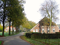 Farmhouses in 2013 | |
 Drouwen Location in the province of Drenthe in the Netherlands | |
| Coordinates: 52°57′N 6°48′E / 52.950°N 6.800°ECoordinates: 52°57′N 6°48′E / 52.950°N 6.800°E | |
| Country | Netherlands |
| Province | Drenthe |
| Municipality | Borger-Odoorn |
| Area (2015)[1] | |
| • Total | 73 km2 (28 sq mi) |
| • Land | 73 km2 (28 sq mi) |
| • Water | 0 km2 (0 sq mi) |
| Population (2015)[1] | |
| • Total | 430 |
| • Density | 5.9/km2 (15/sq mi) |

Drouwen (Dutch pronunciation: [drʌuʋən]) is a village in the Dutch province of Drenthe. It is a part of the municipality of Borger-Odoorn, and lies about 17 km east of Assen.
In 2012, the village of Drouwen had 430 inhabitants.[2] The built-up area of the village was 0.73 km², and contained 220 residences.[2] The statistical area "Drouwen", which can also include the surrounding countryside, has a population of around 490.[2]

Schoolstraat

Dolmen at Drouwen
References[]
- ^ a b (in Dutch) Kerncijfers wijken en buurten 2015, Statistics Netherlands, 2015. Retrieved 15 January 2016.
- ^ a b c Statistics Netherlands (CBS) Statline: Kerncijfers wijken en buurten 2012
External links[]
 Media related to Drouwen at Wikimedia Commons
This Drenthe location article is a stub. You can help Wikipedia by . |
Categories:
- Populated places in Drenthe
- Borger-Odoorn
- Drenthe geography stubs