Dualla, County Tipperary
Dualla
Dumha Aille | |
|---|---|
Village | |
 Boherlahan-Dualla tourist sign in Dualla village | |
 Dualla Location in Ireland | |
| Coordinates: 52°32′28″N 7°48′57″W / 52.541111°N 7.815833°WCoordinates: 52°32′28″N 7°48′57″W / 52.541111°N 7.815833°W | |
| Country | Ireland |
| Province | Munster |
| County | County Tipperary |
| Time zone | UTC+0 (WET) |
| • Summer (DST) | UTC-1 (IST (WEST)) |

Dualla (Irish: Dumha Aille) is a village in County Tipperary, Ireland, near Cashel on the R691 road. A number of small housing estates have been built in the area in recent years adding to the few scattered houses along the road and parish church that constituted the village. Dualla National School began educating pupils in May 1861 and officially opened a new school in June 2012.[1]
(There is a local 'Big House' known as Dually and the settlement is marked as Dually[2] on roadmaps. However all local signage refers to the place as Dualla; as do the Local Council and residents - see thumbnail).
People[]
- Charles Bianconi died in Longfield House in nearby Boherlahan.
Sport[]
- Boherlahen-Dualla GAA
See also[]
- List of towns and villages in Ireland
References[]
- ^ "About School". Dualla National School. Archived from the original on 13 February 2015. Retrieved 13 February 2015.
- ^ "Placenames Database of Ireland". Dublin City University. Archived from the original on 25 September 2021. Retrieved 13 February 2015.
External links[]
- Dualla National School
- Dually House - Buildings of Ireland
- Boherlahan Dualla Parish Website
- Dualla Show
Places in County Tipperary | ||
|---|---|---|
| Towns | 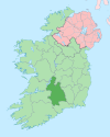 | |
| Villages |
| |
| Baronies | ||
| ||
This article related to the geography of County Tipperary, Ireland is a stub. You can help Wikipedia by . |
Categories:
- Towns and villages in County Tipperary
- Articles on towns and villages in Ireland possibly missing Irish place names
- County Tipperary geography stubs