Two-Mile Borris
Two-Mile Borris
Buiríos Léith | |
|---|---|
Village | |
 Entrance to the village | |
 Two-Mile Borris Location in Ireland | |
| Coordinates: 52°40′22″N 7°42′45″W / 52.67290°N 7.71262°WCoordinates: 52°40′22″N 7°42′45″W / 52.67290°N 7.71262°W | |
| Country | Ireland |
| Province | Munster |
| County | Tipperary |
| Elevation | 120 m (390 ft) |
| Population (2016)[1] | 572 |
| Time zone | UTC+0 (WET) |
| • Summer (DST) | UTC-1 (IST (WEST)) |
| Irish Grid Reference | S194580 |

Two-Mile Borris (also written Twomileborris or Two Mile Borris; also called Borrisleigh and locally Borris or TMB) is a village in County Tipperary, Ireland. The village is located on the L4202 road at the junction with the Ballyduff Road, close to the N75 and 4.7 mi (7.6 km) from Thurles town centre. It is also situated 1 mile from junction 5 of the M8 motorway. Its population was 572 as of the 2016 census,[1] up from 502 in 2006.[2] It is situated in the townland of Borris which is part of the civil parish of Twomileborris in the ancient barony of Eliogarty.[3]
History[]
In the 1830s, the village was the property of Hugh Nugent O'Reilly.[4]
History of the placename[]
The name Borris is generally believed to have come from the Norman word for a borough, district or stronghold. The Irish name Buiríos Léith was historically anglicised as Borrisleigh or Borris Leigh.[5] The use of Leigh in the placename would seem to be related to the monastic settlement of in Leigh, about a mile and a half to the north-east of the village. Those who prefer the Irish name of Buirgheas Dhá Mhíle say that the name refers to King Mile, ancestor of Niall of the Nine Hostages and numerous Irish Kings and heroes.[citation needed]
Amenities and facilities[]

It has a primary school, Catholic church, two pubs and two shops. There are a number of housing estates. The village is located right at the edge of the Golden Vale and the Bog of Allen and so the quality of the land varies around the area, with most of the best farming land located to the west of the village. Parts of the land to the east are too boggy to be used, even for extracting turf. The village proper is bounded on the west by the Black River, a tributary of River Drish, which goes on to join River Suir. The approach to the village is dominated by a Norman tower-house.
In June 2011 planning permission was given by An Bord Pleanála for a casino, hotel with 500 rooms and a racetrack, known as the Tipperary Venue.[6] An Taisce opposed the project, telling a planning tribunal that it had concerns about the impact on local water and other ecological factors as well as the commercial impact on Limerick and Tipperary.[7] In September 2011 then Minister for Justice Alan Shatter said that the casino project had been "ruled out" based on a cabinet decision.[8]
See also[]
- List of towns and villages in the Republic of Ireland
- List of civil parishes of Tipperary
References[]
| Wikimedia Commons has media related to Two-Mile Borris. |
- ^ a b "Sapmap Area - Settlements - Twomileborris". 2016 Census. Central Statistics Office. April 2016. Retrieved 30 October 2021.
- ^ Irish census 2006 Archived 2011-07-17 at the Wayback Machine
- ^ Placenames database of Ireland Archived 2012-09-05 at the Wayback Machine - Twomileborris civil parish
- ^ Samuel Lewis, Topographical Dictionary of Ireland, 1837
- ^ Placenames Database of Ireland Archived 2012-09-05 at the Wayback Machine (see archival records)
- ^ "Two-Mile Borris casino given go ahead". RTÉ News and Current Affairs. 13 June 2011. Archived from the original on 15 June 2011. Retrieved 13 June 2011.
- ^ "An Taisce against planned 'Tipperary Venue'". RTÉ News. 8 March 2011. Archived from the original on 11 April 2021. Retrieved 18 May 2020.
- ^ "Two-Mile Borris super casino ruled out". RTÉ News. 22 September 2011. Archived from the original on 12 November 2020. Retrieved 18 May 2020.
Places in County Tipperary | ||
|---|---|---|
| Towns | 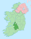 | |
| Villages |
| |
| Baronies | ||
| ||
- Towns and villages in County Tipperary
- Eliogarty