Dunbar, Tennessee
Dunbar, Tennessee | |
|---|---|
Unincorporated community | |
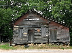 Derelict building in Dunbar | |
 Dunbar | |
| Coordinates: 35°27′32″N 88°08′40″W / 35.45889°N 88.14444°WCoordinates: 35°27′32″N 88°08′40″W / 35.45889°N 88.14444°W | |
| Country | United States |
| State | Tennessee |
| County | Decatur |
| Elevation | 541 ft (165 m) |
| Time zone | UTC-6 (Central (CST)) |
| • Summer (DST) | UTC-5 (CDT) |
| Area code(s) | 731 |
| GNIS feature ID | 1314982[1] |


Dunbar is an unincorporated community in Decatur County, Tennessee, United States. The community is at the intersection of Tennessee State Route 114 and Tennessee State Route 202 8.7 miles (14.0 km) south of Decaturville.[2]
References[]
- ^ "Dunbar". Geographic Names Information System. United States Geological Survey.
- ^ General Highway Map: Decatur County, Tennessee (PDF) (Map). Tennessee Department of Transportation. 1998. Archived from the original (PDF) on April 12, 2015.
Municipalities and communities of Decatur County, Tennessee, United States | ||
|---|---|---|
| City | ||
| Towns | ||
| Unincorporated communities | ||
| Footnotes | ‡This populated place also has portions in an adjacent county or counties | |
| ||
This Decatur County, Tennessee geography–related article is a stub. You can help Wikipedia by . |
Categories:
- Unincorporated communities in Decatur County, Tennessee
- Unincorporated communities in Tennessee
- West Tennessee geography stubs