Dunswell
| Dunswell | |
|---|---|
 Coach and Horses | |
 Dunswell Location within the East Riding of Yorkshire | |
| OS grid reference | TA073351 |
| • London | 155 mi (249 km) S |
| Civil parish | |
| Unitary authority | |
| Ceremonial county | |
| Region | |
| Country | England |
| Sovereign state | United Kingdom |
| Post town | HULL |
| Postcode district | HU6 |
| Dialling code | 01482 |
| Police | Humberside |
| Fire | Humberside |
| Ambulance | Yorkshire |
| UK Parliament | |

Dunswell is a village in the East Riding of Yorkshire, England, and in the civil parish of Woodmansey.
Historically also known as Beer-Houses due to the presence of two Inns in close proximity, the village is located on the main Kingston upon Hull to Beverley road. A significant drinking water extraction works was opened in 1931 west of the village, helping to supplying Hull and the surrounding area.
Geography[]
Dunswell is situated at the junction of Dunswell Lane and A1174 road Hull to Beverley road approximately 4 and 3.5 miles (6.4 and 5.6 km) from the centres of Kingston upon Hull and Beverley respectively. It is approximately 440 yards (400 m) west of the River Hull; the Beverley and Barmston Drain also runs north–south, adjacent to the west of the village.
The village has a hall, Dunswell Village Institute;[2] and a primary school Dunswell Primary, since 2014 Dunswell Academy.[3]
The Ship Inn is located at the junction of the main road and Ings Lane leading to Skidby Landing on the River Hull.[note 1]
Hull Livestock Market, the last remaining livestock market in East Riding of Yorkshire, has been located in the village since 2002.[5]
Governance[]
The village was in the Beverley and Holderness parliamentary constituency until the 2010 general election when it was transferred to the constituency of Haltemprice and Howden.[1]
History[]

According to Charles Overton, Dunswell was once known as Douceville, a reference to its many springs and wells.[6] At one time it was also known as Beer-Houses due to the two public houses in close vicinity.[7][8] The two pubs in the village, The Coach and Horses (aka The Plough) and The Wagon and Horses,[note 2] are thought to originate from the 17th century. The Hull to Beverley road was turn-piked in 1741.[9]
An act allowing the construction of the Beverley and Skidby Drain was passed in 1785, and the Beverley and Barmston Drain allowed by an act of 1798.[note 3] In 1880 improvements to the lower reaches of the drainage system enabled further extraction, and a steam engine for drainage was installed at Dunswell for the Skidby Drain.[11] The drainage of the land reduced flooding, but caused some local wells to become dry.[9]
In around 1814 a non-conformist chapel ("Bethel") was built in the village for the Methodist New Connexion branch.[12] In the 1850s the village consisted of two Inns on the Hull and Beverley road, with the village west along Dunswell Lane, with fewer than twenty houses.[13] The village school opened in 1881.[9]
In 1893 the gained authorisation to open a water supply works at Dunswell to replace a source at Swanland that had become contaminated by salt.[14] The company was taken over by the Hull Corporation shortly after.[15] In 1911 permission was given for additional water works at Dunswell, and after being halted by the First World War, they were restarted in 1923 on a larger scale – the water pumping station was opened in 1931.[16][note 4] The works included a 16 feet (4.9 m) diameter well, with 5,200 feet (1,600 m) of adits.[18] The works was one of the three main water supplies for the area, along with and Mill Dam in Cottingham.[19] The adit system was expanded in the early 1950s to meet demand from the borough of Beverley but the works did not yield an increase in supply.[20]
St Faiths Church of England church opened in 1951; the non-conformist chapel held its last service in 1968.[9]
Low level housing development took place in the second half of the 20th century, with houses on Ings Lane, and houses and new cul-de-sac streets south of the Dunwell Lane/Beverley Road junction (The Meadows, Dene Close).[21] In 1985 the village became part of the civil parish of Woodmansey.[22]
In 2013 Dunswell primary school was listed for closure by East Riding of Yorkshire Council; the closure, which was opposed by many nearby residents was averted by transferring to academy status, as a subsidiary of the primary school in Swanland.[3]
Gallery[]

St Faiths Church (2008)

The Ship Inn (2006)
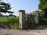
Gates to the enclosed water reservoir (2005)


Notes[]
- ^ There was once a ferry across the Hull at Dunswell (1913).[4]
- ^ Replaced with houses.[9] demolished in the early 20th century,[10]
- ^ The Skidby Drain passed east of the village, the much larger Barmston Drain west of the village.
- ^ The main pumping station building was a white concrete structure resembling an Egyptian temple. (see Egyptian Revival architecture.) The above ground building was demolished in 1987.[17]
References[]
- ^ a b "Are you ready to vote in the next election?". East Riding News. East Riding of Yorkshire Council. April 2010. p. 3.
- ^ "Dunswell Village Institute". www.ruralcommunitybuildings.org.uk. Retrieved 23 June 2014.
- ^ a b Sources:
- "Primary schools at Dunswell and Gembling face closure – and more could be at risk". Hull Daily Mail. 24 January 2013. Archived from the original on 2 December 2014. Retrieved 23 June 2014.
- "Parents grill East Riding Council over closure of Dunswell Primary School". Hull Daily Mail. 15 March 2013. Archived from the original on 2 December 2014. Retrieved 23 June 2014.
- "Saved: Dunswell Primary School to survive as academy". Hull Daily Mail. 13 August 2013. Archived from the original on 2 December 2014. Retrieved 23 June 2014.
- ^ Baggs, A. P.; Cooper, T. N.; Davidson-Cragoe, C.; Walker, J. (2002). "Wawne". In Allison, K. J.; Kent, G. H. R. (eds.). Holderness Wapentake, Middle and North Divisions. A History of the County of York East Riding. Vol. 7.
- ^ "Auctions with Frank Hill & Son (Auctioneers & Valuers) Ltd". www.frankhillandson.co.uk. Retrieved 29 October 2020.
- ^ Overton, Charles (1861). The History of Cottingham. p. 10.
- ^ Langdale, Thomas (1822). A Topographical Dictionary of Yorkshire: Containing the Names of All the Towns, Villages, Hamlets ... pp. 140, 156.
- ^ Nicholson, John (1926). Place-names of the East Riding of Yorkshire. p. 35.
- ^ a b c d e East Yorkshire Federation of Women's Institutes 1991.
- ^ Ordnance Survey. 1909, 1926. Sheet 226.NW
- ^ Sheppard 1976, pp. 14, 21.
- ^ Wollfe, John, ed. (2000). Introduction, City of York and East Riding. Yorkshire Returns of the 1851 Census of Religious Worship. Vol. 1. University of York – Borthwick Institute. 359, p.57.
- ^ Ordnance Survey. 1852–3. Sheet 226
- ^ Aylwin & Ward 1969, p. 45.
- ^ Allison, K. J., ed. (1969). "Water Supply". The City of Kingston upon Hull. A History of the County of York East Riding. Vol. 1.
- ^ Jones 1955, pp. 388–391.
- ^ Pevsner, Nikolaus; Neave, David (1995). Yorkshire: York and the East Riding. The Buildings of England (2nd ed.).
- ^ Aylwin & Ward 1969, p. 46.
- ^ "Abstracts of Water Works Literature". Journal of the American Water Works Association. New York: American Water Works Association. 40 (7): 798. 1948. ISSN 0003-150X.
- ^ Aylwin & Ward 1969, p. 47.
- ^ Ordnance Survey. 1:10560, 1938–52; 1956; 1973–4; 1982–4; 1989–92
- ^ Baggs, A. P.; Brown, L. M.; Forster, G. C. F.; Hall, I.; Horrox, R. E.; Kent, G. H. R.; Neave, D. (1989). "Thearne and Woodmansey". In Allison, K. J. (ed.). The borough and liberties of Beverley. A History of the County of York East Riding. Vol. 6.
Sources[]
- Gazetteer — A–Z of Towns Villages and Hamlets. East Riding of Yorkshire Council. 2006. p. 5.
- East Yorkshire Federation of Women's Institutes (1991). Dunswell. The East Yorkshire Village Book. Countryside Books. ISBN 1853061387.
- Aylwin, E.; Ward, R. C. (1969). Development and utilisation of water supplies in the East Riding of Yorkshire. University of Hull.
- Jones, T. H. (1955). "The Water Supply of Kingston Upon Hull from 1292 to 1954, and the Future Sources of Supply". The Journal of the Royal Society for the Promotion of Health. 75 (6): 386–400. doi:10.1177/146642405507500614. PMID 14396231.
- Sheppard, June A. (1976) [1958]. Allison, K. J. (ed.). The Draining of the Hull Valley (PDF). East Yorkshire Local History Series. East Yorkshire Local History Society.
External links[]
 Media related to Dunswell, East Riding of Yorkshire at Wikimedia Commons
- "St Faith's Church, Dunswell". www.stjohnnewland.org.uk.
- "Dunswell Academy". www.dunswellacademy.co.uk.
- "Dunswell Water Pumping Station". www.flickr.com., entrance detail
- Villages in the East Riding of Yorkshire
- Holderness