West Beck
Coordinates: 53°57′04″N 0°20′53″W / 53.951°N 0.348°W

| West Beck | |
|---|---|
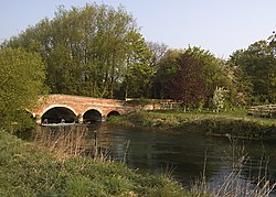 Wansford Bridge spanning the West Beck | |
 Point at which West Beck becomes the River Hull shown within the East Riding of Yorkshire | |
| Location | |
| Country | England |
| Physical characteristics | |
| Length | 15.3 miles (24.6 km)[1][2] |
| Basin size | 90.5 square miles (234.3 km2)[1][2] |
| Basin features | |
| River system | River Hull[3] |
| Tributaries | |
| • left | Little Driffield Beck |
| • right | Gipsey Race Driffield Trout Stream Main Drain Skerne Beck |
| West Beck (River Hull) | |||||||||||||||||||||||||||||||||||||||||||||||||||||||||||||||||||||||||||||||||||||||||||||||||||||||||||||||||||||||||||||||||||||||||||||||||||||||||||||||||||||||||||||||||||||||||||||||||||||||||||||||||||||||||||||||||||||||||||||||||||||||||||||||||||||||||||||||||||||||||||||||||||||||||||||||||||||||||||||||||||||||||||||||||||||||||||||||||||||||||||||||||||||||||||||||||||||||||||||||||||||||||||||||||||||||||||||||||||||||||||||||||||||||||||||||||||||||||||||||||||||||||||||||||||||||||||||||||||||||||||||||||||||||||||||||||||||||||||||||||||||||||||||||||||||||||||||||||||||||||||||||||||||||||||||||||||||||||||||||||||||||||||||||||||||||||||||||
|---|---|---|---|---|---|---|---|---|---|---|---|---|---|---|---|---|---|---|---|---|---|---|---|---|---|---|---|---|---|---|---|---|---|---|---|---|---|---|---|---|---|---|---|---|---|---|---|---|---|---|---|---|---|---|---|---|---|---|---|---|---|---|---|---|---|---|---|---|---|---|---|---|---|---|---|---|---|---|---|---|---|---|---|---|---|---|---|---|---|---|---|---|---|---|---|---|---|---|---|---|---|---|---|---|---|---|---|---|---|---|---|---|---|---|---|---|---|---|---|---|---|---|---|---|---|---|---|---|---|---|---|---|---|---|---|---|---|---|---|---|---|---|---|---|---|---|---|---|---|---|---|---|---|---|---|---|---|---|---|---|---|---|---|---|---|---|---|---|---|---|---|---|---|---|---|---|---|---|---|---|---|---|---|---|---|---|---|---|---|---|---|---|---|---|---|---|---|---|---|---|---|---|---|---|---|---|---|---|---|---|---|---|---|---|---|---|---|---|---|---|---|---|---|---|---|---|---|---|---|---|---|---|---|---|---|---|---|---|---|---|---|---|---|---|---|---|---|---|---|---|---|---|---|---|---|---|---|---|---|---|---|---|---|---|---|---|---|---|---|---|---|---|---|---|---|---|---|---|---|---|---|---|---|---|---|---|---|---|---|---|---|---|---|---|---|---|---|---|---|---|---|---|---|---|---|---|---|---|---|---|---|---|---|---|---|---|---|---|---|---|---|---|---|---|---|---|---|---|---|---|---|---|---|---|---|---|---|---|---|---|---|---|---|---|---|---|---|---|---|---|---|---|---|---|---|---|---|---|---|---|---|---|---|---|---|---|---|---|---|---|---|---|---|---|---|---|---|---|---|---|---|---|---|---|---|---|---|---|---|---|---|---|---|---|---|---|---|---|---|---|---|---|---|---|---|---|---|---|---|---|---|---|---|---|---|---|---|---|---|---|---|---|---|---|---|---|---|---|---|---|---|---|---|---|---|---|---|---|---|---|---|---|---|---|---|---|---|---|---|---|---|---|---|---|---|---|---|---|---|---|---|---|---|---|---|---|---|---|---|---|---|---|---|---|---|---|---|---|---|---|---|---|---|---|---|---|---|---|---|---|---|---|---|---|---|---|---|---|---|---|---|---|---|---|---|---|---|---|---|---|---|---|---|---|---|---|---|---|---|---|---|---|---|---|---|---|---|---|---|---|---|---|---|---|---|---|---|---|---|---|---|---|---|---|---|---|---|---|---|---|---|---|---|---|---|---|---|---|---|---|---|---|---|---|---|---|---|---|---|---|---|---|---|---|---|---|---|---|---|---|---|---|---|---|---|---|---|---|---|---|---|---|---|---|---|---|---|---|---|---|---|---|---|---|---|---|---|---|---|---|---|---|---|---|---|---|---|---|---|---|---|---|---|---|---|---|---|---|---|---|---|---|---|---|---|---|---|---|---|---|---|---|---|---|---|---|---|---|---|---|---|---|---|---|---|---|---|---|---|---|---|---|---|---|---|---|---|---|---|---|---|
| |||||||||||||||||||||||||||||||||||||||||||||||||||||||||||||||||||||||||||||||||||||||||||||||||||||||||||||||||||||||||||||||||||||||||||||||||||||||||||||||||||||||||||||||||||||||||||||||||||||||||||||||||||||||||||||||||||||||||||||||||||||||||||||||||||||||||||||||||||||||||||||||||||||||||||||||||||||||||||||||||||||||||||||||||||||||||||||||||||||||||||||||||||||||||||||||||||||||||||||||||||||||||||||||||||||||||||||||||||||||||||||||||||||||||||||||||||||||||||||||||||||||||||||||||||||||||||||||||||||||||||||||||||||||||||||||||||||||||||||||||||||||||||||||||||||||||||||||||||||||||||||||||||||||||||||||||||||||||||||||||||||||||||||||||||||||||||||||
West Beck is the common name given to the upper section of the old River Hull, as it rises in the foothills of the Yorkshire Wolds. After reaching at Emmotland, it becomes called the River Hull. It is noteworthy for being the most northerly chalk stream in England. It provides fly fishing for wild brown trout and grayling.
Course[]
Starting at Elmswell as a spring from a chalk aquifer,[4] it follows a course which takes it past Little Driffield, around the southern edge of Driffield, through Wansford, past , and joins the Driffield Navigation at Emmotland. In the upper reaches it is known as Elmswell Beck, then Driffield Beck and finally West Beck.[5] As it leaves Driffield, it is referred to as the River Hull as well as West Beck on Environment Agency mapping[1] despite the River Hull traditionally being called so when the beck reaches Emmotland and merges with other watercourses.[6] For the last 1.5 miles (2.4 km) of the river approaching Corpslanding Bridge it is known as Driffield Navigation (West Beck).[7] Because of the abundance of springs that feed the beck in its upper reaches, it has been observed that West Beck contributes over 80% of the inflow to the River Hull.[4]
History[]
The beck was used to power two corn mills; Kings Mill and Bell Mills, both on the upper reach.[8] Kings Mill is a private residence and Bell Mills are in industrial use. Bell Mills were built in 1792 and there are still sluice gates and a mill race adjacent.[9]
The lower sections of the west beck are navigable, and used to reach Wansford. Due to the shallowness of the river, an Act of Parliament was passed in 1801 to create the Driffield Navigation and other associated works.[10] The main route was made further north using Frodingham Beck, and then a new canal from Fisholme through Wansford to Driffield, but the act included navigation to Corpslanding.[10]
The village of Hutton Cranswick created a wharf at Corpslanding, and this has now become the upper legal limit of navigation on the waterway.
The river is for fly fishing only using either dry flies or nymph imitative patterns. Large stretches of the river are owned by fishing syndicates, however day ticket fishing is available at Mulberry Whin. Mulberry Whin offers over a mile of double bank chalk stream fishing on a day ticket basis.[11]
Ecology[]
The beck flows past two wetland areas promoted and maintained by Yorkshire Wildlife Trust: Snakeholm Pastures and Skerne Wetlands.[12] The entire headwaters are designated as an SSSI on account of the chalk base, water quality and plant life.[13]
See also[]
References[]
- ^ a b c "West Beck Upper". Catchment Data Explorer. Environment Agency. Retrieved 7 November 2016.
- ^ a b "West Beck Lower to River Hull". Catchment Data Explorer. Environment Agency. Retrieved 7 November 2016.
- ^ "Get to know your rivers; the Hull Catchment" (PDF). environment data.org. Environment Agency. p. 3. Retrieved 8 November 2016.
- ^ a b Gale, I N; Rutter, H K (2006). "The Chalk Aquifer of Yorkshire" (PDF). nora.nerc.uk. British Geological Society. Retrieved 8 November 2016.
- ^ "Chalk Streams". Yorkshire Wildlife Trust. Retrieved 7 November 2016.
- ^ Mackintosh, Alexander (1821). The modern fisher : or, Driffield angler. Derby: Henry Mozley. p. 31. OCLC 54151930.
- ^ "Waterway Gazetteer for Driffield Navigation (West Beck) – CanalPlanAC". canalplan.org.uk. Retrieved 17 October 2017.
- ^ "Driffield". Mills archive. Retrieved 7 November 2016.
- ^ Rayner, Steven; Dennis, Ian (June 2010). "Restoring the River Hull Headwaters" (PDF). therr.co.uk. Appendix D: Weir Information Sheets: Natural England. p. 191. Retrieved 8 November 2016.
- ^ a b Duckham 1972, p. 24.
- ^ "About Mulberry Whin Chalkstream Flyfishing - Mulberry Whin Chalkstream Flyfishing". mulberrywhin.com. Retrieved 18 October 2017.
- ^ "Skerne Wetlands". Yorkshire Wildlife Trust. 22 April 2016. Retrieved 7 November 2016.
- ^ "River Hull Headwaters" (PDF). Natural England. Retrieved 7 November 2016.
Bibliography[]
- Duckham, Baron F (1972). The inland waterways of East Yorkshire, 1700-1900. East Yorkshire Local History Society. ISBN 9780900349294.
External links[]
| Wikimedia Commons has media related to West Beck, East Riding of Yorkshire. |
- Mulberry Whin
- Driffield Beck at fishpal.com
- Rivers of the East Riding of Yorkshire