River Seph
| River Seph | |
|---|---|
 Footbridge over the River Seph | |
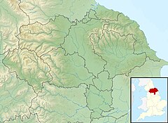 Location within North Yorkshire | |
| Etymology | Slow Stream |
| Physical characteristics | |
| Source | |
| • location | Chop Gate |
| • coordinates | 54°23′10″N 1°08′27″W / 54.386121°N 1.140853°W |
| • elevation | 520 feet (160 m) |
| Mouth | Seph Mouth |
• coordinates | 54°17′28″N 1°08′46″W / 54.291175°N 1.146138°W |
| Length | 13 miles (20.5 km) |
| Basin features | |
| Tributaries | |
| • left | Ledge Beck Todhill Beck |
| • right | Hollow Bottom Beck Fangdale Beck |

The River Seph (or River Sep) is a tributary of the River Rye (itself a tributary of the River Derwent) in North Yorkshire, England.[1] The river flows for 13 miles (20.5 km) down Bilsdale and meets the Rye near the village of Hawnby.[2] The name derives from Old Swedish and means either Slow Stream or Calm.[3] When the surrounding land was owned by Roger de Mowbray, the river was referred to as the Sep.[4]
Course[]
The river starts in Bilsdale at the village of Chop Gate where the waters of the Bilsdale and Raisdale Becks meet, though some of the sources start on Urra Moor.[5] The river from source to where it meets the River Rye at Seph Mouth, is 13 miles (21 km) long.[6][7] Historically, parts of the river were the delineating boundaries between ancient parishes.[8]
Bilsdale is narrow and densely wooded at the head of the valley, but further down becomes wider and the water meanders before it joins the Rye.[9]
Natural History[]
The river has suffered with invasive species such as Himalayan balsam and Japanese Knotweed which have been the subject of various programmes to eradicate them.[10][11] The river has also benefitted from a government grant to help fish navigation and a reduction in pollution.[12]
It was known to be a good trout stream in the late 19th/early 20th centuries,[13] and various agencies came together in 2015 to improve fish passages on the watercourse to allow the migration of trout from the River Rye.[14][15]
The river flows across the south western edge of the North York Moors and as such has limestone, gritstone, mudstone and siltstone as its bedrock. During dry summers, the waters disappear into the bedrock and the river becomes totally subterranean.[16] The sides of Bilsdale where the Seph meanders, are lined with ancient Oak trees and the North York Moors National Park Authority were granted Heritage Lottery Funding in 2017 to protect the land and study the wildlife along the upper reaches of the River Rye. This will include the Seph and will look at some of the native species which make use of the watercourse such as the alcathoe bat and the white-clawed crayfish.[17]
Settlements[]
Bilsdale is a remote valley populated mainly with hamlets as opposed to villages and towns.[18] From the source of the Seph downstream, these are;
References[]
- ^ "River Factfiles; The Derwent Catchment" (PDF). ea-lit.freshwaterlife.org. Environment Agency. p. 2. Retrieved 4 November 2018.
- ^ "BILSDALE VALLEY: WALKING with Rodger Matthews". Hull Daily Mail. 21 July 2012. ProQuest 1027225602.
- ^ Ekwall, Eilert (1960). The concise Oxford dictionary of English place-names (4 ed.). Oxford: Oxford University Press. p. 412. ISBN 0-19-869103-3.
- ^ Farrer, William, ed. (2013). Early Yorkshire Charters : Being a Collection of Documents Anterior to the Thirteenth Century Made from the Public Records, Monastic Chartularies, Roger Dodsworth's Manuscripts and Other Available Sources. Volume 3 (Digital ed.). Cambridge: Cambridge University Press. p. 453. ISBN 978-1-108-05825-4.
- ^ Colbeck, Maurice (1983). Yorkshire moorlands. London: B.T. Batsford. p. 46. ISBN 0-7134-3803-7.
- ^ "Seph from Source to Ledge Beck Overview". environment.data.gov.uk. Retrieved 6 November 2018.
- ^ "Seph from Ledge Beck to River Rye Overview". environment.data.gov.uk. Retrieved 6 November 2018.
- ^ "Parishes: Hawnby | British History Online". www.british-history.ac.uk. Retrieved 4 December 2018.
- ^ Pevsner, Nikolaus (1981). Yorkshire, the North Riding. New Haven: Yale University Press. p. 80. ISBN 0-300-09665-8.
- ^ "Natural heritage and land management: North York Moors National Park". northyorkmoors.org.uk. Retrieved 4 November 2018.
- ^ "Battle against invasive plants starts on local riverbanks". ITV News. 3 August 2016. Retrieved 4 November 2018.
- ^ "East Yorkshire River Trust - The River Seph Project". www.eastyorkshireriverstrust.org.uk. Retrieved 4 November 2018.
- ^ Wilson, Alfred P (1910). Yorkshire moors and dales. London: Brown & sons. p. 19. OCLC 504885165.
- ^ "East Yorkshire River Trust - The River Seph Project". www.eastyorkshireriverstrust.org.uk. Retrieved 4 December 2018.
- ^ "Fisheries in Yorkshire" (PDF). ifm.org.uk. Retrieved 4 December 2018.
- ^ Pedley, Gareth (20 October 2017). "Advisory Visit Ryedale Anglers' Club River Rye (North Yorkshire)" (PDF). wild trout.org. p. 3. Retrieved 4 December 2018.
- ^ Pantry, Lindsay (25 September 2017). "£3m project could 'redefine' River Rye". The Yorkshire Post. Retrieved 4 December 2018.
- ^ Reid, Mark (1 April 2010). "Fangdale Beck" (PDF). www.thenorthernecho.co.uk. Retrieved 9 December 2018.
- ^ "OL26" (Map). North York Moors - Western area. 1:25,000. Explorer. Ordnance Survey. 2016. ISBN 9780319242650.
External links[]
| Wikimedia Commons has media related to River Seph, North Yorkshire. |
- Rivers of North Yorkshire
- Ouse catchment