Duparquet
Duparquet | |
|---|---|
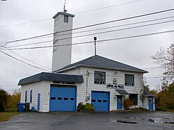 Town Hall of Duparquet | |
 Location within Abitibi-Ouest RCM. | |
 Duparquet Location in western Quebec. | |
| Coordinates: 48°30′N 79°14′W / 48.500°N 79.233°WCoordinates: 48°30′N 79°14′W / 48.500°N 79.233°W[1] | |
| Country | Canada |
| Province | Quebec |
| Region | Abitibi-Témiscamingue |
| RCM | Abitibi-Ouest |
| Constituted | April 13, 1933 |
| Government | |
| • Mayor | Gilbert Rivard |
| • Federal riding | Abitibi—Témiscamingue |
| • Prov. riding | Abitibi-Ouest |
| Area | |
| • Total | 154.90 km2 (59.81 sq mi) |
| • Land | 123.63 km2 (47.73 sq mi) |
| Population | |
| • Total | 711 |
| • Density | 5.75/km2 (14.9/sq mi) |
| • Pop 2016-2020 | |
| • Dwellings | 389 |
| Time zone | UTC−05:00 (EST) |
| • Summer (DST) | UTC−04:00 (EDT) |
| Postal code(s) | J0Z 1W0 |
| Area code(s) | 819 |
| Highways | |
| Website | duparquet |


Duparquet is a ville in northwestern Quebec, Canada in the MRC d'Abitibi-Ouest. It covers 157.4 km2 (60.8 sq mi) and had a population of 666 as of the Canada 2016 Census.
History[]

In 1912, a rich gold vein was discovered near Lake Duparquet by a prospector named Beattie. He set up the Beattie Gold Mine company that began operation in 1933. That same year, the new community forming at the mine was incorporated as Ville de Duparquet, named after the geographic township in which it is located. The township was named in 1916 in honour of Jean-Annet Chabreuil Du Parquet, a grenadier captain of the La Sarre Regiment, that was part of General Montcalm's army.[1]
After producing 1 million ounces of gold and killing at least 27 miners, including 4 in a landslide on 9 July 1946, the mine closed in 1956. But the owners of the mining rights are currently considering reopening it as an open-pit mine.[5]
Demographics[]
| hideCanada census – Duparquet, Quebec community profile | |||
|---|---|---|---|
| 2016 | 2011 | 2006 | |
| Population: | 666 (1.4% from 2011) | 657 (2.8% from 2006) | 639 (-5.3% from 2001) |
| Land area: | 123.57 km2 (47.71 sq mi) | 123.63 km2 (47.73 sq mi) | 122.21 km2 (47.19 sq mi) |
| Population density: | 5.4/km2 (14/sq mi) | 5.3/km2 (14/sq mi) | 5.2/km2 (13/sq mi) |
| Median age: | 50.9 (M: 51.2, F: 50.2) | 48.3 (M: 48.3, F: 48.2) | 44.1 (M: 45.2, F: 43.1) |
| Total private dwellings: | 389 | 359 | 360 |
| Median household income: | $62,464 | $.N/A | $.N/A |
| References: 2016[6] 2011[7] 2006[8] earlier[9] | |||
|
|
|
Private dwellings occupied by usual residents: 324 (total dwellings: 389)
Mother tongue:[11]
- English as first language: 1.49%
- French as first language: 97.76%
- English and French as first language: 0.75%
- Other as first language: 0%
Residents of note[]
- Birthplace of Chicago Black Hawks player Elmer "Moose" Vasko of the 1960s.
- Johanne Morasse (born March 12, 1957), a Quebec politician and teacher
- Tim Horton, hockey player and entrepreneur, lived in Duparquet as a child
Municipal council[]
- Mayor: Gilbert Rivard
- Councillors: Denis Blais, Sylvain Audet, Claudette Macameau, Marlène Doroftei, Jacques Ricard, Solange Gamache
- General Director: Chantal Poirier
References[]
- ^ Jump up to: a b "Duparquet (Ville)" (in French). Commission de toponymie du Québec. Retrieved 4 January 2011.
- ^ Jump up to: a b c "Duparquet". Répertoire des municipalités (in French). Ministère des Affaires municipales et de l'Habitation. Retrieved 6 April 2021.
- ^ "Duparquet census profile". 2011 Census data. Statistics Canada. Retrieved 4 January 2011.
- ^ "Décret de population 2021" (in French). Ministère des Affaires municipales et de l'Habitation. Retrieved 31 March 2021.
- ^ Patrick Rodrigue (18 September 2009). "Une mine à ciel ouvert à Duparquet?" (in French). canoe.ca. Archived from the original on 11 July 2012. Retrieved 4 January 2010.
- ^ "2016 Community Profiles". 2016 Canadian Census. Statistics Canada. 21 February 2017.
- ^ "2011 Community Profiles". 2011 Canadian Census. Statistics Canada. 5 July 2013.
- ^ "2006 Community Profiles". 2006 Canadian Census. Statistics Canada. 30 March 2011.
- ^ "2001 Community Profiles". 2001 Canadian Census. Statistics Canada. 17 February 2012.
- ^ Statistics Canada: 1941, 1951, , , , , , , , , 1996, 2001, 2006, 2011, 2016 census
- ^ "Duparquet Census Profile, 2016 Census". 2016 Census data. Statistics Canada. Retrieved 5 July 2020.
| show Adjacent Municipal Subdivisions |
|---|
| hide | |
|---|---|
| Towns | |
| Municipalities | |
| Townships | |
| Parishes | |
| Unorganized territories | |
| |
- Cities and towns in Quebec
- Incorporated places in Abitibi-Témiscamingue
- Populated places established in 1933