East Bay Bike Path
| East Bay Bike Path | ||
|---|---|---|
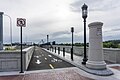
 Facing south near the path's southern terminus in Bristol | ||
| East Bay Bike Path | ||
| Length | 14.5 miles (23.3 km) | |
| Location | Providence County and Bristol County, Rhode Island | |
| Established | 1992 | |
| Designation | East Coast Greenway | |
| Trailheads | India Point Park Bristol, Rhode Island | |
| Use | Hiking, Walking, Cycling | |
| Hiking details | ||
| Sights | Narragansett Bay | |
| Surface | Asphalt | |
| Website | East Bay Bike Path | |
| ||
The East Bay Bike Path is a 14.5-mile (23.3 km) paved rail trail in Rhode Island. The path begins in Providence and India Point Park, crosses the Seekonk River via the George Redman Linear Park (opened September 2015[1]) and Washington Bridge and continues southeast to Bristol along the shoreline of Narragansett Bay. The path passes through the city of East Providence, the hamlet of Riverside, and the towns of Barrington and Warren. It is part of the East Coast Greenway, a 3,000-mile system of trails connecting the Canada–US border in Maine to Key West. and provides access to Haines State Park, Brickyard Pond (Barrington), and Colt State Park. It is used annually by 1.1 million people.
History[]

The East Bay Bike Path was originally part of the Providence, Warren and Bristol Railroad which opened in 1855 to take trains from Providence to Bristol, Rhode Island. The line changed hands several times through the years, eventually falling under the ownership of the New York, New Haven & Hartford railroad and all passenger service was discontinued in 1937.[2] Freight service continued intermittently until the railroad went bankrupt, and the branch was completely abandoned by New Haven successor Penn Central in 1973. Despite having been out of service by trains for 45+ years, tracks still remain along many parts of the old route as the trail in some places was constructed beside the right-of-way, rather than on top. [2]
The plan for Rhode Island's first major bike path was approved in April 1983 by Governor Edward DiPrete. It was built between 1987 and 1992,[3] following the abandoned rail bed of the Providence, Warren and Bristol Railroad. The property was acquired and constructed in four phases:
- Riverside Square to Barrington County Road (4.17 miles or 6.71 kilometres)
- County Road, Barrington to Franklin Street, Warren (2.38 miles or 3.83 kilometres)
- Franklin Street, Warren to Independence Park, Bristol (3.87 miles or 6.23 kilometres)
- Riverside Square to India Point Park, Providence (3.98 miles or 6.41 kilometres)
The completed path was dedicated on May 31, 1992 by Governor Bruce Sundlun. An 8.5 mile on-road bike lane was completed in 2011, linking the East Bay Bike Path with the south tip of the Blackstone River Bikeway, a 48-mile (77 km) trail that will link Providence with Worcester, Massachusetts. Rhode Island's next project will be connecting the East Bay Bike Path with the Washington Secondary Rail Trail.[citation needed]
Repairs and upgrade[]
Tree roots, erosion, and weather necessitated repairs to the asphalt in 2002, 2007, and 2009.[4] Repairs in mid-2016 targeted the most hazardous areas of the path.[4] Pavement was repaired, destructive tree roots removed, eroded areas reinforced, and new planks were installed on the Barrington bridges.[4] In October 2019, the dangerously deteriorated condition of the 1911 railroad trestles carrying the Bike Path over the Barrington and Warren Rivers necessitated their closure as of November 1. Replacements may not be built for some time. The state had allocated $10 to $15 Million. As of Spring 2021, the estimated costs have risen to $25 Million. The state is now exploring alternative solutions.[5]
A section of the bike path was renovated and rebuilt along the Washington Bridge between 2012 and 2015.[6] The park was christened the George Redman Linear Park, opened in September 2015 at a total cost of $21.8-million.[1] It consists of an 11-foot wide bicycle lane, a separated footpath paved with stamped concrete, and several seating areas[1] and is completely separated from I-195 automobile traffic. It was named in honor of East Providence cyclist George Redman.[7][8] A plaque honoring Redman can be seen on the west end of the park.
Gallery[]


References[]
- ^ Jump up to: a b c Kuffner, Alex (21 September 2015). "$21.8-million George Redman Linear Park is dedicated to pioneer of R.I. bike paths". The Providence Journal. Retrieved 22 September 2015.
- ^ Jump up to: a b "East Bay Bike Path History". TrailLink. Rails to Trails Conservancy. Retrieved 2020-09-20.
- ^ "East Bay Bike Path". Rhode Island Department of Transportation.
- ^ Jump up to: a b c Salit, Richard (4 July 2016). "RIDOT to smooth brain-rattling, spine jarring stretches of East Bay Bike Path". The Providence Journal. Retrieved 5 July 2016.
- ^ "East Bay Bike Path bridge work facing more delays". EastBayRI.com. Retrieved 2021-08-30.
- ^ "RIDOT to begin Washington Bridge linear park project". RI.GOV. State of Rhode Island. 5 July 2012. Retrieved 22 September 2015.
- ^ http://www.constructionequipmentguide.com/Legendary-Local-Cyclist-Inspires-Washington-Bridge-Replacement/21959/
- ^ http://www.dot.ri.gov/community/bikeri/washingtonbridge.php
External links[]
| ( • help)
|
| Wikimedia Commons has media related to East Bay Bike Path. |
- "East Bay Bike Path". TrailLink. Rails to Trails Conservancy. Retrieved 2020-09-20.
- East Bay Bike Path Rhode Island Department of Environmental Management Parks and Recreations Division
- East Bay Bike Path Rhode Island Department of Transportation
- East Coast Greenway Greenways Alliance of Rhode Island
- Barrington, Rhode Island
- Bristol, Rhode Island
- East Providence, Rhode Island
- Tourist attractions in Providence, Rhode Island
- Rail trails in Rhode Island
- State parks of Rhode Island
- East Coast Greenway
- Warren, Rhode Island
- Protected areas of Providence County, Rhode Island
- Protected areas established in 1992
- 1992 establishments in Rhode Island
