East Dorset
East Dorset District | |
|---|---|
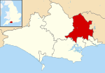 East Dorset shown within Dorset | |
| Sovereign state | United Kingdom |
| Constituent country | England |
| Region | South West England |
| Non-metropolitan county | Dorset |
| Status | Abolished |
| Admin HQ | Wimborne |
| Incorporated | 1 April 1974 to 30 March 2019 |
| Government | |
| • Type | Non-metropolitan district council |
| • Body | East Dorset District Council |
| • Leadership | Alternative - Sec.31 (Conservative) |
| • MPs | Christopher Chope Simon Hoare[1] Michael Tomlinson |
| Area | |
| • Total | 136.8 sq mi (354.4 km2) |
| Area rank | (of 309) |
| Population (mid-2018) | |
| • Total | 89,400 |
| • Density | 650/sq mi (250/km2) |
| • Ethnicity | 99.0% White |
| Time zone | UTC0 (GMT) |
| • Summer (DST) | UTC+1 (BST) |
| ONS code | 19UD (ONS) E07000049 (GSS) |
| OS grid reference | SU0130301959 |
| Website | www |

East Dorset was a local government district in Dorset, England. Its council met in Wimborne Minster between 2016 and 2019.[2][3]
The district (as Wimborne) was formed on 1 April 1974 by merging with parts of Ringwood and Fordingbridge (in Hampshire) and the . It was known as East Dorset from 1988-2019. The district was abolished on 1 April 2019 at the same time as the County Council was abolished. The area was incorporated into Dorset (unitary authority) meaning the historic county obtained one main tier of local government for the first time since the c.1500-c.1850 vestry system.
The popularity of the area, being close to the New Forest, Bournemouth and the Dorset coast saw a rapid expansion in housing from the 1970s with the Verwood, Ferndown, West Moors and Corfe Mullen populations more than quadrupling. Rural landscape prevailed in the north and west of the area. Wimborne Minster retained its identity as a historic market town.
The most notable geography is lowland heath, managed by East Dorset Countryside Management Services in partnership with the Forestry Commission. The expansion of housing has led to a massive decrease in the area of this unusual and unique habitat, which once covered 500 km² but now covers only 15% of that.
Statistics released[4] by the Office for National Statistics show that life expectancy at birth for males in East Dorset was 80.1 years in 2001-2003, the highest in the United Kingdom. Female life expectancy at birth for the same period was 83.4 years, ranking seventh in the UK. The figures for East Dorset during 1991-1993 were 77.9 years for males and 82.5 for females.
Governance[]
East Dorset District Council was elected every four years, with latterly 36 councillors being elected at each election. After 1976 the Conservative party held a majority on the council apart from a period between the 1995 and 1999 elections when the Liberal Democrats had control. Following the 2015 election the council's politicians were:-[5]
| Party | Councillors | |
| Conservative Party | 24 | |
| Liberal Democrats | 3 | |
| Independent | 2 | |
The district and its council were abolished on 1 April 2019 and, together with the other 4 Dorset districts outside the greater Bournemouth area, formed a new Dorset unitary authority.[6]
Settlements[]
- Settlements with a population over 2,500 are in bold.
- Alderholt
- Chalbury, Colehill, Corfe Mullen, Cranborne
- Edmondsham
- Ferndown
- Gussage
- Hinton Martell, Hinton Parva, Holt, Horton
- Long Crichel
- Moor Crichel
- Pamphill, Pentridge
- St Ives, St Leonards, Shapwick, Sixpenny Handley, Sturminster Marshall
- Verwood
- West Moors, West Parley, Wimborne Minster, Wimborne St Giles, Witchampton, Woodlands
See also[]
- List of civil parishes in East Dorset
- List of churches in East Dorset
References[]
- ^ "Dorset North Parliamentary constituency". Election 2015. BBC. Retrieved 11 May 2015.
- ^ "Relocation of East Dorset District Council offices". news.dorsetforyou.gov.uk.
- ^ "Contact East Dorset District Council". www.dorsetforyou.gov.uk.
- ^ Life expectancy at birth in the United Kingdom, Office for National Statistics
- ^ "Local election results for Christchurch and East Dorset". dorsetforyou.com. 13 May 2015. Archived from the original on 13 May 2015. Retrieved 17 May 2015.
- ^ Ministry of Housing, Communities and Local Government (25 May 2018). "The Bournemouth, Dorset and Poole (Structural Changes) Order 2018". legislation.gov.uk. Retrieved 28 May 2018.
| Wikimedia Commons has media related to East Dorset. |
Coordinates: 50°48′59.84″N 1°58′53.36″W / 50.8166222°N 1.9814889°W
- East Dorset District
- Non-metropolitan districts of Dorset
- 2019 disestablishments in England