East Harriet, Minneapolis
East Harriet
East Harriet Farmstead | |
|---|---|
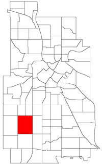 Location of East Harriet within the U.S. city of Minneapolis | |
| Country | United States |
| State | Minnesota |
| County | Hennepin |
| City | Minneapolis |
| Community | Southwest |
| City Council Ward | 10 |
| Government | |
| • Council Member | Aisha Chughtai |
| Area | |
| • Total | 1.224 sq mi (3.17 km2) |
| Population (2010)[2] | |
| • Total | 3,604 |
| • Density | 2,900/sq mi (1,100/km2) |
| Time zone | UTC-6 (CST) |
| • Summer (DST) | UTC-5 (CDT) |
| ZIP code | 55408, 55409 |
| Area code(s) | 612 |
| Historical population | |||
|---|---|---|---|
| Census | Pop. | %± | |
| 1980 | 3,864 | — | |
| 1990 | 3,954 | 2.3% | |
| 2000 | 3,999 | 1.1% | |
| 2010 | 3,604 | −9.9% | |
East Harriet is a neighborhood in the Southwest community in Minneapolis. Its boundaries are West 36th Street to the north, Lyndale Avenue South to the east, West 46th Street to the south, and Lake Harriet, Lakewood Cemetery, and William Berry Parkway to the west.
The home of Theodore Wirth, longtime architect of the Minneapolis park system, is located on the west side of this neighborhood.
Schools[]
- Lyndale Community School (K-5), 312 West 34th Street, Minneapolis, MN 55408 : (612) 668-4000 : Map
- Ramsey Middle School (6-8), 1 West 49th Street Minneapolis, MN 55419 : (612) 668.0455 Map
- Washburn Senior High School (9-12), 201 West 49th Street, Minneapolis, MN 55419-5588 : (612) 668-3400 : Map
Businesses[]
Coordinates: 44°55′45″N 93°17′37″W / 44.9292°N 93.2935°W[3]

References[]
- ^ "East Harriet neighborhood in Minneapolis, Minnesota (MN), 55409 detailed profile". City-Data. 2011. Retrieved 2013-11-19.
- ^ "Minneapolis Neighborhood Profile: East Harriet" (PDF). Minnesota Compass. October 2011. Retrieved 2013-11-14.
- ^ East Harriet, Minneapolis, MN. Google Earth. Retrieved 2011-03-09.
External links[]
- Minneapolis Neighborhood Profile - East Harriet
- East Harriet Farmstead Neighborhood Association
- Lyndale Community School
- Families Building Community
- Experience Southwest : Southwest Minneapolis Business Directory (NEHBA Sponsored)
Places adjacent to East Harriet, Minneapolis | ||||||||||||||||
|---|---|---|---|---|---|---|---|---|---|---|---|---|---|---|---|---|
| ||||||||||||||||
Categories:
- Neighborhoods in Minneapolis