Google Earth
Screenshot  Google Earth 9 on Google Chrome and Safari | |
| Original author(s) | Keyhole, Inc. |
|---|---|
| Developer(s) | |
| Initial release | June 11, 2001 |
| Stable release | |
| Preview release | Windows, macOS, Linux 7.3.3 (April 20, 2020[6]) |
| Written in | C++ |
| Operating system | Google Chrome Web App, Windows, macOS, Linux, Android 5.0 +, iOS 12.2 + |
| Available in | Various languages |
| Type | Virtual globe |
| License | Freeware |
| Website | google |
Google Earth is a computer program, formerly known as Keyhole EarthViewer, that renders a 3D representation of Earth based primarily on satellite imagery. The program maps the Earth by superimposing satellite images, aerial photography, and GIS data onto a 3D globe, allowing users to see cities and landscapes from various angles. Users can explore the globe by entering addresses and coordinates, or by using a keyboard or mouse. The program can also be downloaded on a smartphone or tablet, using a touch screen or stylus to navigate. Users may use the program to add their own data using Keyhole Markup Language and upload them through various sources, such as forums or blogs. Google Earth is able to show various kinds of images overlaid on the surface of the earth and is also a Web Map Service client. Recently Google has revealed that Google Earth now covers more than 98 percent of the world, and has captured 10 million miles of Street View imagery, a distance that could circle the globe more than 400 times.[citation needed]
In addition to Earth navigation, Google Earth provides a series of other tools through the desktop application, including a measure distance tool. Additional globes for the Moon and Mars are available, as well as a tool for viewing the night sky. A flight simulator game is also included. Other features allow users to view photos from various places uploaded to Panoramio, information provided by Wikipedia on some locations, and Street View imagery. The web-based version of Google Earth also includes Voyager, a feature that periodically adds in-program tours, often presented by scientists and documentarians.
Google Earth has been viewed by some as a threat to privacy and national security, leading to the program being banned in multiple countries. Some countries have requested that certain areas be obscured in Google's satellite images, usually areas containing military facilities.
History[]
The core technology behind Google Earth was originally developed at Intrinsic Graphics in the late 1990s. At the time, the company was developing 3D gaming software libraries.[7] As a demo of their 3D software, they created a spinning globe that could be zoomed into, similar to the Powers of Ten film.[7] The demo was popular, but the board of Intrinsic wanted to remain focused on gaming, so in 1999, they created Keyhole, Inc., headed by John Hanke.[7] Keyhole then developed a way to stream large databases of mapping data over the internet to client software, a key part of the technology,[8] and acquired patchworks of mapping data from governments and other sources.[7] The product, called "Keyhole EarthViewer", was sold on CDs for use in fields such as real estate, urban planning, defense, and intelligence; users paid a yearly fee for the service.[8] Despite making a number of capital deals with Nvidia and Sony,[8] the small company was struggling to pay and retain employees.[7]
Fortunes for the company changed in early 2003 when CNN received a discount for the software in exchange for placing the Keyhole logo on-air whenever the map was used.[8][7] Keyhole did not expect it would amount to more than brief 5- or 10-second prerecorded animation clips, but it was used extensively by Miles O'Brien live during the 2003 invasion of Iraq, allowing CNN and millions of viewers to follow the progress of the war in a way that had never been seen before.[8][7] Public interest in the software exploded and Keyhole servers were not able to keep up with demand.[8][7] Keyhole was soon contacted by the Central Intelligence Agency's venture capital firm, In-Q-Tel,[9] and the National Geospatial-Intelligence Agency,[10] for use with defense mapping databases, which gave Keyhole a much-needed cash infusion.[7] Intrinsic Graphics was sold in 2003 to Vicarious Visions after its gaming libraries did not sell well, and its core group of engineers and management transitioned to Keyhole with Hanke remaining at the head.[7]
At the time, Google was finding that over 25% of its searches were of a geospatial character, including searches for maps and directions.[7] In October 2004, Google acquired Keyhole as part of a strategy to better serve its users.[11]
In 2021 Google replaced its layers feature with a new one on its Google Earth software.[12] This replacement consolidated some layers, but also removed some layers and features. [13]
Imagery[]
Google Earth's imagery is displayed on a digital globe, which displays the planet's surface using a single composited image from a far distance. After zooming in far enough, the imagery transitions into different imagery of the same area with finer detail, which varies in date and time from one area to the next. The imagery is retrieved from satellites or aircraft.[14] Before the launch of NASA and the USGS's Landsat 8 satellite, Google relied partially on imagery from Landsat 7, which suffered from a hardware malfunction that left diagonal gaps in images.[15] In 2013, Google used datamining to remedy the issue, providing what was described as a successor to the Blue Marble image of Earth, with a single large image of the entire planet. This was achieved by combining multiple sets of imagery taken from Landsat 7 to eliminate clouds and diagonal gaps, creating a single "mosaic" image.[16] Google now uses Landsat 8 to provide imagery in a higher quality and with greater frequency.[17] Imagery is hosted on Google's servers, which are contacted by the application when opened, requiring an Internet connection.
Imagery resolution ranges from 15 meters of resolution to 15 centimeters. For much of the Earth, Google Earth uses digital elevation model data collected by NASA's Shuttle Radar Topography Mission.[18] This creates the impression of three-dimensional terrain, even where the imagery is only two-dimensional.
Google asserts that every image created from Google Earth using satellite data provided by Google Earth is a copyrighted map. Any derivative from Google Earth is made from data on which Google claims copyright under United States Copyright Law. Google grants licenses in this data allowing, among other things, non-commercial personal use of the images (e.g., on a personal website or blog) as long as copyrights and attributions are preserved.[19] By contrast, images created with NASA's globe software WorldWind use The Blue Marble, Landsat, or USGS imagery, each of which is in the public domain.
In version 5.0, Google introduced Historical Imagery, allowing users to view earlier imagery. Clicking the clock icon in the toolbar opens a time slider, which marks the time of available imagery from the past. This feature allows for observation of an area's changes over time.[20] Utilizing the timelapse feature allows for the ability to view a zoomable video as far back as 32 years.[21]
3D imagery[]

Google Earth shows 3D building models in some cities, including photorealistic 3D imagery made using photogrammetry.[22] The first 3D buildings in Google Earth were created using 3D modeling applications such as SketchUp and, beginning in 2009, Building Maker,[23] and were uploaded to Google Earth via the 3D Warehouse. In June 2012, Google announced that it would be replacing user-generated 3D buildings with an auto-generated 3D mesh.[24] This would be phased in, starting with select larger cities, with the notable exception of cities such as London and Toronto which required more time to process detailed imagery of their vast number of buildings. The reason given is to have greater uniformity in 3D buildings and to compete with Nokia Here and Apple Maps, which were already using this technology. The coverage began that year in 21 cities in four countries.[25] By early 2016, 3D imagery had been expanded to hundreds of cities in over 40 countries, including every U.S. state and encompassing every continent except Antarctica.
In 2009, in a collaboration between Google and the Museo del Prado in Madrid, the museum selected 14 of its paintings to be photographed and displayed at the resolution of 14,000 megapixels inside the 3D version of the Prado in Google Earth and Google Maps.[26][27]
Street View[]
On April 15, 2008, with version 4.3, Google fully integrated Street View into Google Earth.[28] Street View displays 360° panoramic street-level photos of select cities and their surroundings. The photos were taken by cameras mounted on automobiles, can be viewed at different scales and from many angles, and are navigable by arrow icons imposed on them.
Using the Street View on Google Earth, users can visit and explore 30 UNESCO world heritage sites with historical context and pins for each. The sites include The Great Pyramid, The Taj Mahal, Sagrada Família, The Dolomites, The Royal Botanic Gardens, Kew, and The Great Sphinx.[29]
In 2019, Walt Disney World partnered with Google to create Pixar Street View. A unique activation that enabled viewers to search for hidden Pixar Easter eggs in Toy Story Land at Disney's Hollywood Studios through street view. This creative collaboration elevated Pixar's iconic tradition of hiding Easter eggs in films and introduced it to an immersive new platform. [30]
Water and ocean[]
Introduced in Google Earth 5.0 in 2009, the Google Ocean feature allows users to zoom below the surface of the ocean and view the 3D bathymetry. Supporting over 20 content layers, it contains information from leading scientists and oceanographers.[31] On April 14, 2009, Google added bathymetric data for the Great Lakes.[32][33]
In June 2011, Google increased the resolution of some deep ocean floor areas from 1-kilometer grids to 100 meters.[34] The high-resolution features were developed by oceanographers at Columbia University's Lamont-Doherty Earth Observatory from scientific data collected on research cruises. The sharper focus is available for about 5 percent of the oceans. This can be seen in the Hudson off New York City, the Wini Seamount near Hawaii, and the Mendocino Ridge off the U.S. Pacific coast.[35]
Outer space[]


Google has programs and features, including within Google Earth, allowing exploration of Mars, the Moon, the view of the sky from Earth and outer space, including the surfaces of various objects in the Solar System.
Google Sky[]
Google Sky is a feature that was introduced in Google Earth 4.2 on August 22, 2007, in a browser-based application on March 13, 2008,[36] and to Android smartphones, with augmented reality features. Google Sky allows users to view stars and other celestial bodies.[37] It was produced by Google through a partnership with the Space Telescope Science Institute (STScI) in Baltimore, the science operations center for the Hubble Space Telescope. Dr. Alberto Conti and his co-developer Dr. Carol Christian of STScI planned to add the public images from 2007,[38] as well as color images of all of the archived data from Hubble's Advanced Camera for Surveys. Then-newly released Hubble pictures were added to the Google Sky program as soon as they were issued.
New features such as multi-wavelength data, positions of major satellites and their orbits as well as educational resources are provided to the Google Earth community and also through Christian and Conti's website for Sky.[39] Also visible on Sky mode are constellations, stars, galaxies, and animations depicting the planets in their orbits. A real-time Google Sky mashup of recent astronomical transients, using the VOEvent protocol, is provided by the VOEventNet collaboration.[40] Other programs similar to Google Sky include Microsoft WorldWide Telescope and Stellarium.
Google Mars[]
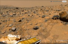
Google Mars is an application within Google Earth that is a version of the program for imagery of the planet Mars. Google also operates a browser-based version, although the maps are of a much higher resolution within Google Earth, and include 3D terrain, as well as infrared imagery and elevation data. There are also some extremely high-resolution images from the Mars Reconnaissance Orbiter's HiRISE camera that are of a similar resolution to those of the cities on Earth. Finally, there are many high-resolution panoramic images from various Mars landers, such as the Mars Exploration Rovers, Spirit and Opportunity, that can be viewed in a similar way to Google Street View.
Mars also has a small application found near the face on Mars. It is called Meliza, a robot character the user can speak with.[41]
Google Moon[]
Originally a browser application, Google Moon is a feature that allows exploration of the Moon. Google brought the feature to Google Earth for the 40th anniversary of the Apollo 11 mission on July 20, 2009.[42] It was announced and demonstrated to a group of invited guests by Google along with Buzz Aldrin at the Newseum in Washington, D.C.[43][44] Google Moon includes several tours, including one for the Apollo missions, incorporating maps, videos, and Street View-style panoramas, all provided by NASA.
Other features[]
Google Earth has numerous features that allow the user to learn about specific places. These are called "layers", and include different forms of media, including photo and video. Some layers include tours, which guide the user between specific places in a set order. Layers are created using the Keyhole Markup Language, or KML, which users can also use to create customized layers.[45] Locations can be marked with placemarks and organized in folders; For example, a user can use placemarks to list interesting landmarks around the globe, then provide a description with photos and videos, which can be viewed by clicking on the placemarks while viewing the new layer in the application.
In December 2006, Google Earth added a new integration with Wikipedia and Panoramio. For the Wikipedia layer, entries are scraped for coordinates via the Coord templates. There is also a community layer from the project Wikipedia-World. More coordinates are used, different types are in the display, and different languages are supported than the built-in Wikipedia layer.[46][47] The Panoramio layer features pictures uploaded by Panoramio users, placed in Google Earth based on user-provided location data. In addition to flat images, Google Earth also includes a layer for user-submitted panoramic photos, navigable in a similar way to Street View.
Google Earth includes multiple features that allow the user to monitor current events. In 2007, Google began offering users the ability to monitor traffic data provided by Google Traffic in real-time, based on information crowdsourced from the GPS-identified locations of cell phone users.[48]
Flight simulators[]

In Google Earth 4.2, a flight simulator was added to the application. It was originally a hidden feature when introduced in 2007, but starting with 4.3, it was given a labeled option in the menu. In addition to keyboard control, the simulator can be controlled with a mouse or joystick.[49][50] The simulator also runs with animation, allowing objects such as planes to animate while on the simulator.[51]
Another flight simulator, GeoFS, was created under the name GEFS-Online using the Google Earth Plug-in API to operate within a web browser. As of September 1, 2015, the program now uses the open-source program CesiumJS, due to the Google Earth Plug-in being discontinued.[52]
Liquid Galaxy[]
Liquid Galaxy is a cluster of computers running Google Earth creating an immersive experience. On September 30, 2010, Google made the configuration and schematics for their rigs public,[53] placing code and setup guides on the Liquid Galaxy wiki.[54] Liquid Galaxy has also been used as a panoramic photo viewer using KRpano, as well as a Google Street View viewer using Peruse-a-Rue[55] Peruse-a-Rue is a method for synchronizing multiple Maps API clients.[56]
Versions[]
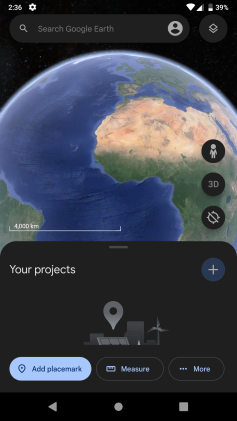
Google Earth has been released on macOS, Linux, iOS, and Android. The Linux version began with the version 4 beta of Google Earth, as a native port using the Qt toolkit. The Free Software Foundation consider the development of a free compatible client for Google Earth to be a High Priority Free Software Project.[57] Google Earth was released for Android on February 22, 2010,[58] and on iOS on October 27, 2008.[59][60] The mobile versions of Google Earth can make use of multi-touch interfaces to move on the globe, zoom or rotate the view, and allow to select the current location. An automotive version of Google Earth was made available in the 2010 Audi A8.[61] On February 27, 2020, Google opened up its web-based version of Earth to browsers like Firefox, Edge, and Opera.[62][63]
| Version | Release date | Changes |
|---|---|---|
| 1.0 | June 10, 2001 | |
| 1.4 | January 2002 | |
| 1.6 | February 2003 | |
| 1.7.2 | October 2003 | |
| 2.2 | August 2004 | |
| 3.0 | June 2005 |
|
| 4.0 | June 2006 | |
| 4.1 | May 2007 | |
| 4.2 | August 2007 |
|
| 4.3 | April 2008 |
|
| 5.0 | May 2009 |
|
| 5.1 | November 2009 | |
| 5.2 | July 2010 |
|
| 6.0 | March 2011 |
|
| 6.1 | October 2011 | |
| 6.2 | April 2012 |
|
| 7.0 | December 2012 |
|
| 7.1 | April 2013 |
|
| 7.3 | July 2017 |
|
| 9.0 | April 2017 |
|
Google Earth Pro[]
Google Earth Pro was originally the business-oriented upgrade to Google Earth, with features such as a movie maker and data importer. Up until late January 2015, it was available for $399/year, though Google decided to make it free to the public.[65][66] Google Earth Pro is currently the standard version of the Google Earth desktop application as of version 7.3.[67] The Pro version includes add-on software for movie making, advanced printing, and precise measurements, and is currently available for Windows, Mac OS X 10.8 or later, and Linux.[68]
Google Earth Plus[]
Discontinued in December 2008, Google Earth Plus was a paid subscription upgrade to Google Earth that provided customers with the following features, most of which have become available in the free Google Earth.[69] One such feature was GPS integration, which allowed users to read tracks and waypoints from a GPS device. A variety of third-party applications have been created which provide this functionality using the basic version of Google Earth by generating KML or KMZ files based on user-specified or user-recorded waypoints.
Google Earth Enterprise[]
Google Earth Enterprise is designed for use by organizations whose businesses could take advantage of the program's capabilities, for example by having a globe that holds company data available for anyone in that company.[70] As of March 20, 2015, Google has retired the Google Earth Enterprise product, with support ended on March 22, 2017.[71] Google Earth Enterprise allowed developers to create maps and 3D globes for private use, and host them through the platform. GEE Fusion, GEE Server, and GEE Portable Server source code was published on GitHub under the Apache2 license in March 2017.[72]
Google Earth Studio[]
Google Earth Studio is a web-based version of Google Earth used for animations using Google Earth's 3D imagery. As of June 2021, it is preview-only and requires signing up to use it.[73] It features keyframe animation, presets called "Quick-Start Projects", and 3D camera export.[74]
Google Earth 9[]
Google Earth 9 is a version of Google Earth first released on April 18, 2017, having been in development for two years.[75] The main feature of this version was the launching of a new web version of Google Earth.[76] This version added the "Voyager" feature, whereby users can view a portal page containing guided tours led by scientists and documentarians.[77] The version also added an "I'm Feeling Lucky" button, represented by a die, which takes the user to a random location on Earth along with showing them a "Knowledge Card" containing a short excerpt from the location's Wikipedia article.[77]
Google Earth Plug-in[]
The Google Earth API was a free beta service, allowing users to place a version of Google Earth into web pages. The API enabled sophisticated 3D map applications to be built.[78] At its unveiling at Google's 2008 I/O developer conference, the company showcased potential applications such as a game where the player controlled a milktruck atop a Google Earth surface.[79] The Google Earth API has been deprecated as of December 15, 2014 and remained supported until December 15, 2015.[80] Google Chrome ended support for the Netscape Plugin API (which the Google Earth API relies on) by the end of 2016.[81]
Google Earth VR[]
On November 16, 2016, Google released a virtual reality version of Google Earth for Valve's Steam computer gaming platform.[82][83] Google Earth VR allows users to navigate using VR controllers, and is currently compatible with the Oculus Rift and HTC Vive virtual reality headsets. On September 14, 2017, as part of Google Earth VR's 1.4 update, Google added Street View support.[84]
Google Earth Outreach[]
Google Earth Outreach is a charity program, through which Google promotes and donates to various non-profit organizations. Beginning in 2007, donations are often accompanied by layers featured in Google Earth, allowing users to view a non-profit's projects and goals by navigating to certain related locations.[85] Google Earth Outreach offers online training on using Google Earth and Google Maps for public education on issues affecting local regions or the entire globe. In June 2008, training was given to 20 indigenous tribes in the Amazon rainforest, such as the Suruí, to help them preserve their culture and raise awareness for the problem of deforestation.[86]
Non-profit organizations featured in Google Earth via the Outreach program include Arkive, the Global Heritage Fund, WaterAid, and the World Wide Fund for Nature.[87][88]
Google Earth Engine[]

Google Earth Engine is a cloud computing platform for processing satellite imagery and other geospatial and observation data. It provides access to a large database of satellite imagery and the computational power needed to analyze those images.[89] Google Earth Engine allows observation of dynamic changes in agriculture, natural resources, and climate using geospatial data from the Landsat satellite program, which passes over the same places on the Earth every sixteen days.[90][91] Google Earth Engine has become a platform that makes Landsat and Sentinel-2 data easily accessible to researchers in collaboration with the Google Cloud Storage.[90] Google Earth Engine provides a data catalog along with computers for analysis; this allows scientists to collaborate using data, algorithms, and visualizations.[92] The platform uses Python and JavaScript application programming interfaces for making requests to the servers.[93]
Google Earth Engine has been used multiple times as a tool for tracking deforestation. Initial applications of the engine have included mapping the forests of Mexico, identifying water in the Congo basin, and detecting deforestation in the Amazon rainforest.[94] Using Google Earth Engine to track global forest loss or gain, the University of Maryland reported an overall loss in global forest cover.[95] The Carnegie Institute for Science's CLASlite system and Imazon’s Sistema de Alerta de Desmatamento (SAD) are two institutions that partnered with Google in the development of Google Earth Engine. Both organizations use the program to build maps of forests that measure environmental disturbances.[96] Additionally, Google Earth Engine has been expanded to further applications. These include: Tiger Habitat Monitoring,[97] Malaria Risk Mapping,[98] Global Surface Water,[99] increases in vegetation around Mount Everest,[100] and the annual Forest Landscape Integrity Index[101]
Controversy and criticism[]
The software has been criticized by a number of special interest groups, including national officials, as being an invasion of privacy or posing a threat to national security. The typical argument is that the software provides information about military or other critical installations that could be used by terrorists. Google Earth has been blocked by Google in Iran[102] and Sudan[103] since 2007, due to United States government export restrictions. The program has also been blocked in Morocco since 2006 by Maroc Telecom, a major service provider in the country.[104]

In the academic realm, increasing attention has been devoted to both Google Earth and its place in the development of digital globes. In particular, the International Journal of Digital Earth features multiple articles evaluating and comparing the development of Google Earth and its differences when compared to other professional, scientific, and governmental platforms.[105] Google Earth's role in the expansion of "earth observing media" has been examined to understand how it is shaping a shared cultural consciousness regarding climate change and humanity's capacity to treat the earth as an engineerable object.[106]
Defense[]
- In 2006, one user spotted a large topographical replica in a remote region of China. The model is a small-scale (1/500) version of the Karakoram Mountain Range, which is under the control of China but claimed by India. When later confirmed as a replica of this region, spectators began entertaining military implications.[107][108]
- In July 2007, it was reported that a new Chinese Navy Jin-class nuclear ballistic missile submarine was photographed at the Xiaopingdao Submarine Base south of Dalian.[109]
- Hamas and the al-Aqsa Martyrs' Brigades have reportedly used Google Earth to plan Qassam rocket attacks on Israel from Gaza (See: Palestinian rocket attacks on Israel.)[110][111]
- On February 13, 2019, 3D imagery was launched in four of Taiwan's cities: Taipei, New Taipei, Taoyuan, and Taichung. This has caused concerns from Taiwanese officials, such as Taiwan's Defense Minister Yen Teh-fa, saying that the 3D imagery exposed some of its Patriot missile sites. Ten days later on February 23, Google confirmed that it would be removing all of its 3D imagery from Taiwan.[112][113][114]
National security[]
- Former President of India A. P. J. Abdul Kalam expressed concern over the availability of high-resolution pictures of sensitive locations in India.[115] Google subsequently agreed to censor such sites.[116]
- The Indian Space Research Organisation said Google Earth poses a security threat to India and seeks dialogue with Google officials.[117]
- The South Korean government expressed concern that the software offers images of the presidential palace and various military installations that could possibly be used by its hostile neighbor North Korea.[118]
- In 2006, Google Earth began offering detailed images of classified areas in Israel. The images showed Israel Defense Forces bases, including secret Israeli Air Force facilities, Israel's Arrow missile defense system, military headquarters and Defense Ministry compound in Tel Aviv, a top-secret power station near Ashkelon, and the Negev Nuclear Research Center. Also shown was the alleged headquarters of Mossad, Israel's foreign intelligence service, whose location is highly classified.[119]
- As a result of pressure from the United States government, the residence of the Vice President at Number One Observatory Circle was obscured through pixelization in Google Earth and Google Maps in 2006, but this restriction has since been lifted. The usefulness of this downgrade is questionable, as high-resolution photos and aerial surveys of the property are readily available on the Internet elsewhere.[120] Capitol Hill also used to be pixelized in this way. The Royal Stables in The Hague, Netherlands also used to be pixelized. This is also true for airports in Greece.
- The lone surviving gunman involved in the 2008 Mumbai attacks admitted to using Google Earth to familiarise himself with the locations of buildings used in the attacks.[121]
- Michael Finton, aka Talib Islam, used Google Earth in planning his attempted September 24, 2009, bombing of the Paul Findley Federal Building and the adjacent offices of Congressman Aaron Schock in Springfield, Illinois.[122]
Other concerns[]
- Operators of the Lucas Heights nuclear reactor in Sydney, New South Wales, Australia asked Google to censor high-resolution pictures of the facility.[123] They later withdrew the request.[124]
- In 2009, Google superimposed old woodblock prints of maps from 18th- and 19th-century Japan over Japan today. These maps marked areas inhabited by the burakumin caste, formerly known as eta (穢多), literally "abundance of defilement", who were considered "non-humans" for their "dirty" occupations, including leather tanning and butchery. Descendants of members of the burakumin caste still face discrimination today and many Japanese people feared that some would use these areas, labeled etamura (穢多村 "eta village"), to target current inhabitants of them. These maps are still visible on Google Earth, but with the label removed where necessary.[125]
- Late 2000s versions of Google Earth require a software component running in the background that will automatically download and install updates. Several users expressed concerns that there is not an easy way to disable this updater, as it runs without the permission of the user.[126]
- In February 2014, the Berlin based ART+COM charged that Google Earth products infringe U.S. Patent No. RE44,550, entitled "Method and Device for Pictorial Representation of Space-related Data" and had remarkable similarity to Terravision which was developed by ART+COM in 1993 and patented in 1995.[127] The court decided against Art+Com both at trial[128] and on appeal[129] because trial testimony showed that Art+Com was aware of an existing, substantially similar invention that it failed to mention as "prior art" in its patent application, thereby invalidating their patent. Stephen Lau, a former employee of federally funded, not-for-profit Stanford Research Institute ("SRI") testified that he helped develop SRI TerraVision, an earth visualization application, and that he wrote 89% of the code. He further testified that he shared and discussed SRI Terravision code with Art+Com. Both systems used a multi-resolution pyramid of imagery to let users zoom from high to low altitudes, and both were called Terravision. Art+Com agreed to rename their product because SRI's came first. Stephen Lau died from COVID-19 in March of 2020.[1]
In popular culture[]
Google Earth is featured prominently in the 2021 German miniseries The Billion Dollar Code, which serves as a fictionalized account of a 2014 patent infringement lawsuit brought against Google by the German creators of Terravision.[130] The series, which was shown on Netflix is prefaced by an episode of interviews with the ART+COM developers of TerraVision and their legal representative.[131]
One of the co-founders of Keyhole has published a first-hand account claiming to debunk the origins, timelines and interpretations depicted in the fictionalized miniseries.[132]
See also[]
- Space flight simulation game
- List of space flight simulation games
- Planetarium software
- List of observatory software
- Orthophotomap, the type of aerial and satellite imagery present in Google Earth
- Virtual globe, the category of software that includes Google Earth
- Web mapping
References[]
- ^ "Google Earth". Google. Retrieved January 1, 2021.
- ^ a b "Google Earth". Google. Retrieved January 1, 2021.
- ^ "Google Earth". earth.google.com. Retrieved January 1, 2021.
- ^ "Google Earth APKs". APKMirror. Retrieved March 26, 2021.
- ^ "Google Earth". App Store. Retrieved January 1, 2021.
- ^ "Google Earth Release Notes". Google. Retrieved November 1, 2013.
- ^ a b c d e f g h i j k Bill Kilday (2018). Never Lost Again: The Google Mapping Revolution That Sparked New Industries and Augmented Our Reality. HarperBusiness. ISBN 978-0062673046.
- ^ a b c d e f Kevin Manney (March 21, 2003). "Tiny tech company awes viewers". USA Today.
- ^ "Meet The CIA's Venture Capitalist". Bloomberg Businessweek. Archived from the original on June 5, 2013.
- ^ "Oakland emails give another glimpse into the Google-Military-Surveillance Complex". PandoDaily. March 7, 2014.
- ^ "Google Acquires Keyhole". Wall Street Journal. October 27, 2004. Retrieved December 3, 2017.
- ^ "New layers set in Google Earth Pro!". Google Earth Help. Google. July 20, 2021. Retrieved November 9, 2011.
|first=missing|last=(help) - ^ "County boundaries and other information missing from new Borders and Labels layer". Google Earth Help. September 4, 2021. Retrieved November 9, 2021.
- ^ "How images are collected". Retrieved August 6, 2017.
- ^ "SLC-off Products: Background". United States Geological Survey. Archived from the original on August 7, 2017. Retrieved August 6, 2017.
- ^ "Only clear skies on Google Maps and Earth". June 26, 2013. Retrieved August 6, 2017.
- ^ "Google Earth and Maps get sharper satellite imagery with new update". Tech Crunch. June 27, 2016. Retrieved August 6, 2017.
- ^ Farr, Tom G.; Rosen, Paul A.; Caro, Edward; Crippen, Robert; Duren, Riley; Hensley, Scott; Kobrick, Michael; Paller, Mimi; Rodriguez, Ernesto; Roth, Ladislav; Seal, David; Shaffer, Scott; Shimada, Joanne; Umland, Jeffrey; Werner, Marian; Oskin, Michael; Burbank, Douglas; Alsdorf, Douglas (2007). "The Shuttle Radar Topography Mission". Reviews of Geophysics. 45 (2): RG2004. Bibcode:2007RvGeo..45.2004F. CiteSeerX 10.1.1.102.9372. doi:10.1029/2005RG000183.
- ^ "Can I post images to the web?". Google Earth Help Center.
- ^ "Dive into New Google Earth". Retrieved February 3, 2009.
- ^ “Timelapse.” Google Earth Engine, earthengine.google.com/timelapse/.
- ^ Gopal Shah, Google Earth’s Incredible 3D Imagery, Explained, April 18, 2017
- ^ "Introducing Google Building Maker". Retrieved July 24, 2016.
- ^ "Explore the world with tour guide and 3D imagery in Google Earth 7". Google LatLong Blog. Retrieved July 24, 2016.
- ^ "Google Earth adds new 3D imagery in 21 cities to its 11,000 guided tours of our planet". November 2012. Retrieved July 24, 2016.
- ^ Giles Tremlett (January 14, 2009). "Online gallery zooms in on Prado's masterpieces (even the smutty bits)". The Guardian. London.
- ^ "14 masterpieces from the Museo del Prado in mega-high resolution on Google Earth". Museo del Prado. January 14, 2009. Retrieved December 3, 2017.
- ^ Hoffman, Tony (May 6, 2008). "Google Earth 4.3". PC Magazine. Retrieved January 1, 2018.
- ^ "Check out 30 famous World Heritage sites you can virtually visit on Google Earth while social distancing". Business Insider. Retrieved March 22, 2020.
- ^ "Pixar Easter Eggs Hidden in Google Street View Imagery of Toy Story Land at Disney's Hollywood Studios". Disney Parks Blog.
- ^ "Google Earth dives under the sea". BBC News. February 2, 2009. Retrieved May 3, 2010.
- ^ "Google Earth now includes US "Third Coast"".
- ^ "New View of Ocean Floor in Google Earth". Gearthblog.com. January 18, 2009. Retrieved August 25, 2010.
- ^ "New Google Ocean Maps Dive Deep". The Earth Institute – Columbia University. June 8, 2011. Retrieved July 30, 2012.
- ^ "Google Lat Long: See the seafloor like never before on World Oceans Day". Google-latlong.blogspot.com. June 8, 2011. Retrieved June 15, 2013.
- ^ "Google Sky". Retrieved July 30, 2012.
- ^ "Explore the sky with Google Earth". August 22, 2007. Retrieved August 22, 2007.
- ^ "Celestial add-on points Google Earth at the stars – tech – August 22, 2007 – New Scientist Tech". Technology.newscientist.com. Retrieved August 25, 2010.
- ^ "Explore Astronomy – gSky Browser". HubbleSite. Retrieved July 30, 2012.
- ^ "Astronomers eager to add to Sky in Google Earth". University of California Berkeley. September 6, 2007. Retrieved December 3, 2017.
- ^ "Chat With a Martian in Google Earth 5". Googlesystem.blogspot.com. February 3, 2009. Retrieved July 30, 2012.
- ^ "Look at the Moon in Google Earth – Available Now! | Google Earth Blog". Gearthblog.com. July 20, 2009. Retrieved August 25, 2010.
- ^ "Google Earth Event on July 20th in DC – Expect the Moon | Google Earth Blog". Gearthblog.com. July 9, 2009. Retrieved August 25, 2010.
- ^ "Google LatLong: Fly yourself to the moon". Google-latlong.blogspot.com. July 20, 2009. Retrieved August 25, 2010.
- ^ "Keyhole Markup Language — Google Developers". March 1, 2012. Retrieved June 15, 2013.
- ^ "Earth". Retrieved November 19, 2012.
- ^ "Homepage von Stefan Kühn". webkuehn.de. Retrieved July 30, 2012.
- ^ Wang, David (February 28, 2007). "Stuck in traffic?".
- ^ "Use Google Earth flight simulator – Google Earth Help". Retrieved June 15, 2013.
- ^ Webwise: Google's flight simulator The Sunday Times, January 27, 2008
- ^ "Planes For Google Earth Flight Simulator | Google Earth Blog". Gearthblog.com. August 11, 2009. Retrieved July 30, 2012.
- ^ "Moving GEFS Online from Google Earth to Cesium". Cesium Blog.
- ^ "A galaxy of your own". Google-latlong.blogspot.com. September 30, 2010. Retrieved March 10, 2012.
- ^ "Liquid Galaxy wiki on code.google.com". September 30, 2010. Retrieved March 10, 2012.
- ^ "Peruse-a-Rue: Street View for Liquid Galaxy". September 3, 2013. Retrieved November 20, 2013.
- ^ "Liquid Galaxy and its Very Own Street View App". November 9, 2013. Retrieved November 20, 2013.
- ^ FSF.org Archived August 10, 2007, at the Wayback Machine: High Priority Free Software Projects
- ^ "Google Earth now available for Android". google-latlong.blogspot.com.
- ^ Sorrel, Charlie (October 27, 2008). "Google Earth Comes to the iPhone". Wired. Retrieved October 27, 2008.
- ^ "Google Earth now available for the iPhone". Google Mobile team. October 27, 2008. Retrieved October 27, 2008.
- ^ Redmer, Jens (December 16, 2009). "Google LatLong: Google & Audi take Google services in a car to the next level in the new Audi A8". Google-latlong.blogspot.com. Retrieved August 25, 2010.
- ^ Warren, Tom (February 27, 2020). "Google Earth finally available in browsers other than Chrome". The Verge. Retrieved February 27, 2020.
- ^ "Google Earth finally works on Firefox, Edge and Opera browsers". Engadget. Retrieved February 27, 2020.
- ^ "Update Google Earth Pro". Archived from the original on March 18, 2018. Retrieved April 23, 2018.
- ^ Kate Knibbs (February 2, 2015). "Google Earth Pro Is Now Available for Free".
- ^ Rose, Robert (February 11, 2015). "Good News Everyone! Google Earth Pro Now Free!". Mapshole. Archived from the original on July 26, 2019. Retrieved February 22, 2015.
- ^ Google (July 10, 2017). "notes on Google Earth releases".
- ^ "Google Earth for Desktop". Google Earth. Retrieved February 22, 2015.
- ^ "Google Earth Plus". Archived from the original on April 20, 2008. Retrieved February 1, 2017.
- ^ "Google Earth Enterprise – Google Earth and Maps Enterprise". Retrieved November 16, 2012.
- ^ "(Deprecated) Google Earth Enterprise Help". Retrieved July 12, 2016.
- ^ "Open-Sourcing Google Earth Enterprise". Retrieved January 31, 2017.
- ^ "FAQ". Google Earth Studio. Retrieved June 1, 2021.
- ^ "Google Earth Studio". Google Earth Studio. Retrieved June 1, 2021.
- ^ "Google Groups". productforums.google.com. Retrieved April 22, 2017.
- ^ "First Review of New Google Earth - Google Earth Blog". Google Earth Blog. April 18, 2017. Retrieved April 22, 2017.
- ^ a b "Google Earth gets a new home on the Web, fancy "guided tour" section". Ars Technica. Retrieved April 22, 2017.
- ^ "Google Earth API — Google Developers". February 24, 2012. Retrieved June 15, 2013.
- ^ Teglet, Traian (May 29, 2008). "Driving the Monster Milktruck in Google Earth". Softpedia. Retrieved March 30, 2012.
- ^ "Google Earth API Developer's Guide". Google Developers. May 8, 2015.
- ^ "Chromium Blog: Saying Goodbye to Our Old Friend NPAPI". Chromium Blog.
- ^ "Google Earth VR". Retrieved January 3, 2018.
- ^ "Google Earth VR Bringing the Whole Wide World to Virtual Reality". November 16, 2016. Retrieved January 3, 2018.
- ^ "Google Earth VR App Gets Support for Street View". TechCrunch. September 14, 2017. Retrieved January 3, 2018.
- ^ "Google Earth Outreach". Retrieved December 21, 2014.
- ^ "Google Earth Outreach Goes to the Amazon". Retrieved December 21, 2014.
- ^ "Exploring Global Awareness Layers in Google Earth". The Good Human. November 26, 2017. Retrieved January 2, 2018.
- ^ "Explore Arkive using Google Earth". Arkive. Archived from the original on November 25, 2017. Retrieved January 2, 2018.
- ^ Gardner, Timothy (December 2, 2010). "Google unveils satellite platform to aid forest efforts". reuters.
- ^ a b "FAQ – Google Earth Engine". earthengine.google.com.
- ^ Dunbar, Brian (n.d.). "New Public Application of Landsat Images Released". NASA. Retrieved March 19, 2014.
- ^ Gorelick, Noel (April 2013). "Google Earth Engine". Egu General Assembly Conference Abstracts. 15: EGU2013–11997. Bibcode:2013EGUGA..1511997G.
- ^ "Introduction | Google Earth Engine API | Google Developers". Google Developers. Retrieved March 20, 2018.
- ^ Regalado, Antonio (December 3, 2010). "New Google Earth Engine". Science. Archived from the original on May 1, 2013. Retrieved August 23, 2013.
- ^ Hansen, M. C.; et al. (November 15, 2013). "Global Forest Change". Retrieved February 27, 2014.
- ^ Butler, R. A. (December 16, 2009). "Google's earth engine to help tropical countries monitor forests".
- ^ Joshi, Anup R.; Dinerstein, Eric; Wikramanayake, Eric; Anderson, Michael L.; Olson, David; Jones, Benjamin S.; Seidensticker, John; Lumpkin, Susan; Hansen, Matthew C. (April 1, 2016). "Tracking changes and preventing loss in critical tiger habitat". Science Advances. 2 (4): e1501675. Bibcode:2016SciA....2E1675J. doi:10.1126/sciadv.1501675. ISSN 2375-2548. PMC 4820387. PMID 27051881.
- ^ "UCSF, Google Earth Engine Making Maps to Predict Malaria". UC San Francisco. Retrieved March 22, 2018.
- ^ "The nature of water: unveiling the most detailed view of water on Earth". Google. December 7, 2016. Retrieved March 22, 2018.
- ^ Barkham, Patrick (January 10, 2020). "Grass growing around Mount Everest as global heating intensifies". The Guardian. ISSN 0261-3077. Retrieved January 10, 2020 – via www.theguardian.com.
- ^ Grantham, H. S.; Duncan, A.; Evans, T. D.; Jones, K. R.; Beyer, H. L.; Schuster, R.; Walston, J.; Ray, J. C.; Robinson, J. G.; Callow, M.; Clements, T.; Costa, H. M.; DeGemmis, A.; Elsen, P. R.; Ervin, J.; Franco, P.; Goldman, E.; Goetz, S.; Hansen, A.; Hofsvang, E.; Jantz, P.; Jupiter, S.; Kang, A.; Langhammer, P.; Laurance, W. F.; Lieberman, S.; Linkie, M.; Malhi, Y.; Maxwell, S.; Mendez, M.; Mittermeier, R.; Murray, N. J.; Possingham, H.; Radachowsky, J.; Saatchi, S.; Samper, C.; Silverman, J.; Shapiro, A.; Strassburg, B.; Stevens, T.; Stokes, E.; Taylor, R.; Tear, T.; Tizard, R.; Venter, O.; Visconti, P.; Wang, S.; Watson, J. E. M. (2020). "Anthropogenic modification of forests means only 40% of remaining forests have high ecosystem integrity". Nature Communications. 11 (1): 5978. Bibcode:2020NatCo..11.5978G. doi:10.1038/s41467-020-19493-3. ISSN 2041-1723. PMC 7723057. PMID 33293507.
- ^ "Why is Google Earth being blocked in Iran?" Google Earth Help forums June 17, 2009
- ^ "Google Earth ban in Sudan is due to US export restrictions" Sudan Tribune, April 22, 2007
- ^ "Morocco censorship?". Ogleearth.com. August 24, 2006. Retrieved August 6, 2011.
- ^ Arza-García, Marcos; Gil-Docampo, Mariluz; Ortiz-Sanz, Juan; Martínez-Rodríguez, Santiago (May 4, 2019). "Virtual globes for UAV-based data integration: Sputnik GIS and Google Earth™ applications". International Journal of Digital Earth. 12 (5): 583–593. Bibcode:2019IJDE...12..583A. doi:10.1080/17538947.2018.1470205. hdl:10347/16754. ISSN 1753-8947. S2CID 134211000.
- ^ Gurevitch, Leon (2014). "Google Warming". Convergence: The International Journal of Research into New Media Technologies. 20: 85–107. doi:10.1177/1354856513516266. S2CID 144987331.
- ^ "Chinese X-file excites spotters". The Sydney Morning Herald. July 20, 2006. Retrieved January 25, 2007.
- ^ "From sky, see how China builds model of Indian border 2400 km away". Archived from the original on January 23, 2007. Retrieved January 25, 2007.
- ^ "New Chinese Ballistic Missile Submarine Spotted". Retrieved July 10, 2007.
- ^ Clancy Chassay in Gaza City and Bobbie Johnson (October 25, 2007). "Google Earth used to target Israel". Guardian. London. Retrieved August 25, 2010.
- ^ Levinson, Charles (October 26, 2007). "Google Earth used in rocket strikes on Israel". The Telegraph. Retrieved December 3, 2017.
- ^ "Google Maps launches 3D view of Taipei today". Taipei: Taiwan News. February 13, 2019. Retrieved February 25, 2019.
- ^ "Google Earth spills the beans, reveals Taiwan's secret military bases". Digital Trends. February 19, 2019. Retrieved February 25, 2019.
- ^ "3D images of Taiwan to be pulled from Google Maps". Taipei: Focus Taiwan. February 23, 2019. Retrieved February 25, 2019.
- ^ "Kalam Concerned Over Google Earth". Archived from the original on March 20, 2012. Retrieved January 25, 2007.
- ^ Deshpande, Rajeev (February 4, 2007). "Google Earth agrees to blur pix of key Indian sites". The Times of India. Archived from the original on August 11, 2011.
- ^ "Google Earth Poses Security Threat to India, ISRO Chief seeks Dialogue". July 10, 2006. Retrieved January 25, 2007.
- ^ "Google Earth images compromise secret installations in S. Korea". Archived from the original on July 1, 2007. Retrieved January 25, 2007.
- ^ "Google 'spying' on IDF". Ynetnews.com. June 20, 1995. Retrieved August 6, 2011.
- ^ "Eyeball-series.org". www.eyeball-series.org.
- ^ Bedi, Rahul (December 9, 2008). "Mumbai attacks: Indian suit against Google Earth over image use by terrorists". Telegraph.co.uk. Retrieved August 6, 2011.
- ^ Gruen, Madeleine,"Attempt to Attack the Paul Findley Federal Building in Springfield, Illinois"Archived March 1, 2012, at the Wayback Machine," The NEFA Foundation, December 2009, accessed December 18, 2009
- ^ "Google Earth prompts security fears". Archived from the original on January 24, 2007. Retrieved January 25, 2007.
- ^ "Aussie Nuclear Reactor on Google Earth". Archived from the original on October 17, 2006. Retrieved January 25, 2007.
- ^ "Google Earth maps out discrimination against burakumin caste in Japan". Timesonline.co.uk. May 22, 2009. Archived from the original on September 27, 2009. Retrieved January 10, 2018.
- ^ Gilbertson, Scott (February 13, 2009). "Why Google's Software Update Tool Is Evil". Wired.
- ^ Weiss, Todd R. (February 22, 2014). "Google Sued for Alleged Google Earth Patent Infringement". eWEEK. Retrieved October 23, 2021.
- ^ ART+COM Innovationpool GmbH v. Google LLC (Court case). 1:14-cv-00217. Retrieved October 24, 2021 – via CourtListener.
- ^ Art+Com Innovationpool v. Google (Court case). Retrieved October 24, 2021 – via Findlaw.
- ^ "'The Billion Dollar Code': The battle over Google Earth". Deutsche Welle. October 7, 2021. Archived from the original on October 11, 2021. Retrieved October 11, 2021.
- ^ "The Billion Dollar Code". Netflix.com. Netflix. Retrieved October 22, 2021.
- ^ Bar-Zeev, Avi (October 14, 2021). "Was Google Earth Stolen?". Medium. Retrieved October 17, 2021.
External links[]
| Wikimedia Commons has media related to Google Earth. |
Google | |||||||||||||||||||||||
|---|---|---|---|---|---|---|---|---|---|---|---|---|---|---|---|---|---|---|---|---|---|---|---|
| |||||||||||||||||||||||
| |||||||||||||||||||||||
| |||||||||||||||||||||||
| |||||||||||||||||||||||
| |||||||||||||||||||||||
| |||||||||||||||||||||||
| |||||||||||||||||||||||
Google Maps | |||||
|---|---|---|---|---|---|
| Related products |
| ||||
| Views and mapping sites |
| ||||
| Street View |
| ||||
| Other |
| ||||
Android (operating system) | ||||||||||||||||
|---|---|---|---|---|---|---|---|---|---|---|---|---|---|---|---|---|
| Software development |
| |||||||||||||||
| Releases |
| |||||||||||||||
| Derivatives |
| |||||||||||||||
| Phones, tablets |
| |||||||||||||||
| Custom distributions |
| |||||||||||||||
| Internals |
| |||||||||||||||
| APIs |
| |||||||||||||||
| Alternative UIs |
| |||||||||||||||
| Lists |
| |||||||||||||||
| Related topics |
| |||||||||||||||
| ||||||||||||||||
Earth | ||
|---|---|---|
| Continents |
|  |
| Oceans |
| |
| Geology |
| |
| Atmosphere |
| |
| Environment |
| |
| Cartography |
| |
| Culture and society |
| |
| Planetary science |
| |
| ||
Authority control | |
|---|---|
| General | |
| National libraries | |
- Google Earth
- Google software
- Virtual globes
- Web mapping
- Android (operating system) software
- GIS software
- IOS software
- Internet software for Linux
- Keyhole Markup Language
- MacOS Internet software
- Remote sensing software
- Software that uses Qt
- Windows Internet software
- 2001 software
- Computer-related introductions in 2001
- Satellite imagery
- 2004 mergers and acquisitions
- Google acquisitions
- Freemium