East St. Clair Township, Bedford County, Pennsylvania
East St. Clair Township, Pennsylvania | |
|---|---|
 | |
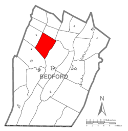 Map of Bedford County, Pennsylvania highlighting East St. Clair Township | |
 Map of Bedford County, Pennsylvania | |
| Country | United States |
| State | Pennsylvania |
| County | Bedford |
| Settled | 1794 |
| Incorporated | 1875 |
| Area | |
| • Total | 34.05 sq mi (88.18 km2) |
| • Land | 33.89 sq mi (87.78 km2) |
| • Water | 0.15 sq mi (0.40 km2) |
| Population (2010) | |
| • Total | 3,048 |
| • Estimate (2016)[2] | 2,930 |
| • Density | 86.45/sq mi (33.38/km2) |
| Time zone | UTC-5 (Eastern (EST)) |
| • Summer (DST) | UTC-4 (EDT) |
| Area code(s) | 814 |
| FIPS code | 42-009-21788 |
East St. Clair Township is a township in Bedford County, Pennsylvania, United States. The population was 3,048 at the 2010 census.[3]
History[]
The Osterburg Covered Bridge and Snooks Covered Bridge were listed on the National Register of Historic Places in 1980.[4]
Geography[]
The township is located in northwestern Bedford County. It is bordered to the north by King Township, to the northeast by South Woodbury Township, to the east by Bedford Township, to the southwest by Napier Township, to the west by West St. Clair Township, and at its northernmost point by Lincoln Township. It surrounds but does not include the borough of St. Clairsville.
According to the United States Census Bureau, the township has a total area of 34.1 square miles (88.2 km2), of which 33.9 square miles (87.8 km2) is land and 0.15 square miles (0.4 km2), or 0.45%, is water.[3]
Demographics[]
| Historical population | |||
|---|---|---|---|
| Census | Pop. | %± | |
| 2010 | 3,048 | — | |
| 2016 (est.) | 2,930 | [2] | −3.9% |
| U.S. Decennial Census[5] | |||
As of the census[6] of 2000, there were 3,123 people, 1,198 households, and 894 families residing in the township. The population density was 92.3 people per square mile (35.6/km2). There were 1,406 housing units at an average density of 41.5/sq mi (16.0/km2). The racial makeup of the township was 98.43% White, 0.51% African American, 0.03% Native American, 0.67% Asian, 0.10% from other races, and 0.26% from two or more races. Hispanic or Latino of any race were 0.42% of the population.
There were 1,198 households, out of which 35.5% had children under the age of 18 living with them, 61.6% were married couples living together, 9.2% had a female householder with no husband present, and 25.3% were non-families. 22.0% of all households were made up of individuals, and 8.3% had someone living alone who was 65 years of age or older. The average household size was 2.61 and the average family size was 3.04.
In the township the population was spread out, with 26.0% under the age of 18, 8.1% from 18 to 24, 30.8% from 25 to 44, 22.4% from 45 to 64, and 12.6% who were 65 years of age or older. The median age was 36 years. For every 100 females there were 102.0 males. For every 100 females age 18 and over, there were 98.3 males.
The median income for a household in the township was $34,847, and the median income for a family was $38,429. Males had a median income of $28,776 versus $20,170 for females. The per capita income for the township was $16,211. About 6.6% of families and 8.4% of the population were below the poverty line, including 9.4% of those under age 18 and 9.0% of those age 65 or over.
References[]
- ^ "2016 U.S. Gazetteer Files". United States Census Bureau. Retrieved Aug 13, 2017.
- ^ a b "Population and Housing Unit Estimates". Retrieved June 9, 2017.
- ^ a b "Geographic Identifiers: 2010 Demographic Profile Data (G001): East St. Clair township, Bedford County, Pennsylvania". U.S. Census Bureau, American Factfinder. Archived from the original on February 12, 2020. Retrieved March 5, 2014.
- ^ "National Register Information System". National Register of Historic Places. National Park Service. July 9, 2010.
- ^ "Census of Population and Housing". Census.gov. Retrieved June 4, 2016.
- ^ "U.S. Census website". United States Census Bureau. Retrieved 2008-01-31.
Municipalities and communities of Bedford County, Pennsylvania, United States | ||
|---|---|---|
| Boroughs |  | |
| Townships | ||
| CDPs | ||
| Unincorporated communities | ||
| Footnotes | ‡This populated place also has portions in an adjacent county or counties | |
| ||

- Populated places established in 1794
- Townships in Bedford County, Pennsylvania
- 1794 establishments in Pennsylvania