Easton, Washington
Easton, Washington | |
|---|---|
 Easton as seen from the west side | |
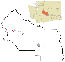 Location of Easton, Washington | |
| Coordinates: 47°14′18″N 121°10′42″W / 47.23833°N 121.17833°WCoordinates: 47°14′18″N 121°10′42″W / 47.23833°N 121.17833°W | |
| Country | United States |
| State | Washington |
| County | Kittitas |
| Area | |
| • Total | 3.22 sq mi (8.34 km2) |
| • Land | 3.21 sq mi (8.31 km2) |
| • Water | 0.02 sq mi (0.04 km2) |
| Elevation | 2,169 ft (661 m) |
| Population (2010) | |
| • Total | 478 |
| • Density | 149/sq mi (57.5/km2) |
| Time zone | UTC−8 (Pacific (PST)) |
| • Summer (DST) | UTC−7 (PDT) |
| ZIP code | 98925 |
| Area code(s) | 509 |
| FIPS code | 53-19700[1] |
| GNIS feature ID | 1519151[2] |

Easton is an unincorporated community and census-designated place (CDP) in Kittitas County, Washington, United States. The population was 478 at the 2010 census.[3]
History[]
Easton was platted in 1902. It was given its name by the Northern Pacific Railway due its location near the east end of the Stampede Tunnel through the Cascade Range.[4]
Geography[]
Easton is located in western Kittitas County at 47°14′18″N 121°10′42″W / 47.23833°N 121.17833°W (47.238368, -121.178327),[5] in the Yakima River valley. Interstate 90 passes through the community, with access from Exits 70 and 71. I-90 leads northwest over Snoqualmie Pass 70 miles (110 km) to Seattle and southeast 37 miles (60 km) to Ellensburg, the Kittitas county seat.
According to the United States Census Bureau, the Easton CDP has a total area of 3.2 square miles (8.3 km2), of which 0.02 square miles (0.04 km2), or 0.46%, are water.[3] Lake Easton, a reservoir at the junction of the Yakima and Kachess rivers, and Lake Easton State Park are at the west end of the community.
Climate[]
This region experiences warm (but not hot) and dry summers, with no average monthly temperatures above 71.6 °F. According to the Köppen Climate Classification system, Easton has a warm-summer Mediterranean climate, abbreviated "Csb" on climate maps.[6]
| hideClimate data for Easton, Washington (1981-2010 Averages) | |||||||||||||
|---|---|---|---|---|---|---|---|---|---|---|---|---|---|
| Month | Jan | Feb | Mar | Apr | May | Jun | Jul | Aug | Sep | Oct | Nov | Dec | Year |
| Average high °F (°C) | 35.4 (1.9) |
41.0 (5.0) |
46.9 (8.3) |
52.9 (11.6) |
61.0 (16.1) |
67.2 (19.6) |
75.9 (24.4) |
76.7 (24.8) |
70.3 (21.3) |
58.1 (14.5) |
42.1 (5.6) |
35.0 (1.7) |
55.1 (12.8) |
| Average low °F (°C) | 22.5 (−5.3) |
23.5 (−4.7) |
27.9 (−2.3) |
31.8 (−0.1) |
38.4 (3.6) |
45.5 (7.5) |
49.5 (9.7) |
49.4 (9.7) |
42.3 (5.7) |
34.8 (1.6) |
28.2 (−2.1) |
22.9 (−5.1) |
34.7 (1.5) |
| Average precipitation inches (mm) | 7.45 (189) |
4.73 (120) |
4.34 (110) |
3.26 (83) |
2.31 (59) |
1.81 (46) |
0.94 (24) |
0.67 (17) |
1.70 (43) |
3.62 (92) |
8.23 (209) |
6.47 (164) |
45.53 (1,156) |
| Source: [7] | |||||||||||||
Demographics[]

As of the census[1] of 2000, there were 383 people, 151 households, and 104 families residing in the CDP. The population density was 227.3 people per square mile (88.0/km2). There were 228 housing units at an average density of 135.3/sq mi (52.4/km2). The racial makeup of the CDP was 91.91% White, 0.78% Native American, 6.53% from other races, and 0.78% from two or more races. Hispanic or Latino of any race were 9.14% of the population.
There were 151 households, out of which 35.1% had children under the age of 18 living with them, 54.3% were married couples living together, 7.3% had a female householder with no husband present, and 31.1% were non-families. 21.9% of all households were made up of individuals, and 4.0% had someone living alone who was 65 years of age or older. The average household size was 2.54 and the average family size was 2.94.
In the CDP, the population was spread out, with 28.7% under the age of 18, 7.3% from 18 to 24, 29.5% from 25 to 44, 23.0% from 45 to 64, and 11.5% who were 65 years of age or older. The median age was 35 years. For every 100 females, there were 124.0 males. For every 100 females age 18 and over, there were 125.6 males.
The median income for a household in the CDP was $37,708, and the median income for a family was $37,917. Males had a median income of $33,750 versus $20,357 for females. The per capita income for the CDP was $19,773. About 3.7% of families and 7.5% of the population were below the poverty line, including 2.7% of those under age 18 and 26.7% of those age 65 or over.
Notable people[]
- Sherwood Egbert, president of the Studebaker-Packard and Studebaker corporations
Points of interest[]

- Lake Easton State Park
- Iron Horse State Park, former right-of-way for the Milwaukee Road which today serves as a path for bikers, hikers, cross-country skiers and horseback riders
See also[]
References[]
- ^ Jump up to: a b "U.S. Census website". United States Census Bureau. Retrieved 2008-01-31.
- ^ "Easton". Geographic Names Information System. United States Geological Survey.
- ^ Jump up to: a b "Geographic Identifiers: 2010 Census Summary File 1 (G001), Easton CDP, Washington". American FactFinder. U.S. Census Bureau. Archived from the original on February 13, 2020. Retrieved July 5, 2019.
- ^ Majors, Harry M. (1975). Exploring Washington. Van Winkle Publishing Co. p. 87. ISBN 978-0-918664-00-6.
- ^ "US Gazetteer files: 2010, 2000, and 1990". United States Census Bureau. 2011-02-12. Retrieved 2011-04-23.
- ^ Climate Summary for Easton, Washington
- ^ https://w2.weather.gov/climate/xmacis.php?wfo=pdt. Retrieved May 30, 2020. Missing or empty
|title=(help)
| show Places adjacent to Easton, Washington |
|---|
| show Municipalities and communities of Kittitas County, Washington, United States |
|---|

| show Authority control |
|---|
- Census-designated places in Kittitas County, Washington
- Census-designated places in Washington (state)
- Populated places on the Yakima River