Egmont National Park
| Egmont National Park | |
|---|---|
 Map of New Zealand | |
| Location | Taranaki, New Zealand |
| Nearest city | New Plymouth, New Zealand |
| Coordinates | 39°16′0″S 174°6′0″E / 39.26667°S 174.10000°ECoordinates: 39°16′0″S 174°6′0″E / 39.26667°S 174.10000°E |
| Area | 341.7 km2 (131.9 sq mi) |
| Established | 1900 |
| Governing body | Department of Conservation |


Egmont National Park (Māori: Te Papakura o Taranaki) is located south of New Plymouth, close to the west coast of the North Island of New Zealand. The park covers Mount Taranaki and its slopes. The park was first created in 1881 as a forest reserve and went on to become New Zealand’s second national park in 1900.[1][2]
The forest reserve was created within a 6-mile (9.6-kilometre) radius around the cone of the dormant volcano. Areas encompassing the older volcanic remnants of Pouakai and Kaitake were later added to the reserve at the northwest side. The forest is surrounded on all sides by pasture, giving it a distinctly circular shape.
Ecology[]
The park receives massive annual rainfall. Moist westerlies from the Tasman Sea form Orographic precipitation when they reach Mount Taranaki and the adjacent Pouakai and Kaitake ranges. Since the area has high annual rainfall and a mild coastal climate there is a lush rainforest covering the foothills, a forest that is nationally significant for the total absence of beech trees (genus Nothofagus).
A rich northern rata/rimu/broadleaf forest is present, although the entire park ecosystem displays distinct patterns of altitudinal zonation – the former two large species of tree are common at lower elevations whereas kamahi tends to dominate the stunted high altitude forest. In these old growth forests the crown fern (Blechnum discolor) is a dominant understory plant species.[3]
The character of the plant communities continues to change with increasing altitude, to subalpine and alpine shrublands at high elevations, which are in stark contrast to the surrounding pasture farmlands. Notable among the geographical features of the park is its clear radial drainage pattern, which can be discerned in the satellite picture at right.
The Ahukawakawa Swamp is a rare high-altitude (920 m) sphagnum moss wetland located between Mount Taranaki and the Pouakai Range. It contains many endemic species adapted to acid soils and low temperatures.[4]
Gallery[]
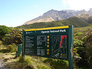
Entrance sign, Egmont NP, New Zealand

Low on the trail to the summit of Mount Taranaki


See also[]
- National parks of New Zealand
- Forest parks of New Zealand
- Regional parks of New Zealand
- Protected areas of New Zealand
- Conservation in New Zealand
References[]
- ^ "Nature and history: Egmont National Park". Department of Conservation (NZ). 2020. Retrieved 30 June 2020.
- ^ "Volcano Fact Sheet: Mount Taranaki / Egmont Volcano" (PDF). GNS Science. 2010. Retrieved 10 January 2012.
- ^ C. Michael Hogan (2009). "Crown Fern: Blechnum discolor". Archived from the original on 13 February 2012. Retrieved 10 January 2012.
- ^ "Ahukawakawa Swamp".
External links[]
![]() Media related to Egmont National Park at Wikimedia Commons
Media related to Egmont National Park at Wikimedia Commons
| show Authority control |
|---|
- IUCN Category II
- National parks of New Zealand
- Protected areas of Taranaki
- Protected areas established in 1900