El Rosario, Olancho
El Rosario | |
|---|---|
Municipality | |
 El Rosario | |
| Coordinates (centroid of municipality): 14°55′N 86°42′W / 14.917°N 86.700°WCoordinates: 14°55′N 86°42′W / 14.917°N 86.700°W | |
| Country | |
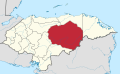
| Department | Olancho |
| Villages | 8 |
| Area | |
| • Total | 143.11 km2 (55.26 sq mi) |
| Population (2015) | |
| • Total | 4,265 |
| • Density | 30/km2 (77/sq mi) |

El Rosario (Spanish pronunciation: [el roˈsaɾjo]) is a town[1] (14°54′18″N 86°42′08″W / 14.90500°N 86.70222°W) and a municipality[2] in the west of the Honduran department of Olancho.
It is south-east of Yocón, north-east of Guayape and north-west of Salamá.
The town had a lumber mill, school, clinic, and a public library, La Biblioteca Regional de Dr. Dean J. Seibert.
In 2018, El Rosario experienced drought and failures of the corn and bean crops, as the August rains did not come. Residents have attributed the drought to climate change, and to logging which has depleted the pine forests surrounding the town.[3]
See also[]
- Central American dry corridor
Notes[]
- ^ El Rosario (Approved) at GEOnet Names Server, United States National Geospatial-Intelligence Agency
- ^ El Rosario (Approved) at GEOnet Names Server, United States National Geospatial-Intelligence Agency
- ^ Gustin, Georgina (2019-07-08). "Ravaged by Drought, a Honduran Village Faces a Choice: Pray for Rain or Migrate". InsideClimate News. Retrieved 2019-08-03.
Olancho Department | ||
|---|---|---|
Capital: Juticalpa | ||
| Municipalities |
|  |
This Honduras location article is a stub. You can help Wikipedia by . |
Categories:
- Municipalities of the Olancho Department
- Honduras geography stubs