Electoral district of Maldon
| Maldon Victoria—Legislative Assembly | |
|---|---|
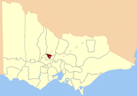 Location in Victoria | |
| State | Victoria |
| Created | 1859 |
| Abolished | 1904 |
| Namesake | Maldon, Victoria |
| Demographic | Rural |
The Electoral district of Maldon was an electoral district of the Victorian Legislative Assembly.[1]
Maldon was created in the expansion of the Assembly in 1859 by the Victorian Electoral Act, 1858.[2] Its area was defined by the Act:
Bounded on the north by a line drawn from the junction of McNeil's Creek[a] and the River Loddon to Barker's Creek near Mount Prospect; thence on the east by Barker's Creek and Campbell's Creek to the River Loddon; and thence by the River Loddon to the commencing point, excepting the country included within the electoral district of Castlemaine.[2]
- [a] also known as Bet Bet Creek.[3]
It was abolished by the post-Federation Electoral Districts Boundaries Act 1903[4] which took effect in 1904.
Members of Maldon[]
| Member | Party | Term | |
|---|---|---|---|
| George Harker | Unaligned | 1859–1860 | |
| Unaligned | 1860–1861 | ||
| Unaligned | 1861–1867 | ||
| Unaligned | 1867–1874 | ||
| James Service | Unaligned | 1874–1881 | |
| Sir John McIntyre | Unaligned | 1881–1902 | |
| Ministerialist | 1902–1904 | ||
See also[]
- Parliaments of the Australian states and territories
- List of members of the Victorian Legislative Assembly
References[]
- ^ "Re-Member (Former Members)". Parliament of Victoria. Retrieved 29 December 2013.
- ^ a b "An Act to alter the Electoral Districts of Victoria and to increase the number of Members of the Legislative Assembly thereof" (PDF). 1858. Retrieved 29 December 2013.
- ^ "The Legislative Council Act 1881". Australasian Legal Information Institute. Retrieved 18 April 2014.
- ^ "Electoral Districts Boundaries Act 1903". Retrieved 28 December 2013.
Coordinates: 36°59′30″S 144°4′0″E / 36.99167°S 144.06667°E

- Former electoral districts of Victoria (Australia)
- 1859 establishments in Australia
- 1904 disestablishments in Australia