Ellerhoop
Ellerhoop | |
|---|---|
 Coat of arms | |
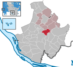
show Location of Ellerhoop within Pinneberg district | |
 Ellerhoop | |
| Coordinates: 53°43′39″N 9°46′14″E / 53.72750°N 9.77056°ECoordinates: 53°43′39″N 9°46′14″E / 53.72750°N 9.77056°E | |
| Country | Germany |
| State | Schleswig-Holstein |
| District | Pinneberg |
| Municipal assoc. | Rantzau |
| Government | |
| • Mayor | Wiebke Uhl (CDU) |
| Area | |
| • Total | 10.8 km2 (4.2 sq mi) |
| Elevation | 11 m (36 ft) |
| Population (2020-12-31)[1] | |
| • Total | 1,531 |
| • Density | 140/km2 (370/sq mi) |
| Time zone | UTC+01:00 (CET) |
| • Summer (DST) | UTC+02:00 (CEST) |
| Postal codes | 25373 |
| Dialling codes | 04120 |
| Vehicle registration | PI |
| Website | www.ellerhoop.de |


Ellerhoop is a municipality in the district of Pinneberg in Schleswig Holstein, Germany. It is twinned with the village of Hurst Green, East Sussex, UK.
Geography[]
Ellerhoop is situated to the north of Hamburg, close to the A23 Autobahn.
Points of interest[]
- Arboretum Ellerhoop-Thiensen
References[]
| show Towns and municipalities in Pinneberg (district) |
|---|
| Authority control |
|---|
This Pinneberg district location article is a stub. You can help Wikipedia by . |
Categories:
- Municipalities in Schleswig-Holstein
- Pinneberg (district)
- Pinneberg district geography stubs