Elsa, Texas
Elsa, Texas | |
|---|---|
City | |
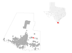
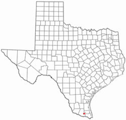 Location of Elsa, Texas | |
 | |
| Coordinates: 26°17′52″N 97°59′34″W / 26.29778°N 97.99278°WCoordinates: 26°17′52″N 97°59′34″W / 26.29778°N 97.99278°W | |
| Country | |
| State | |
| County | |
| Area | |
| • Total | 2.09 sq mi (5.41 km2) |
| • Land | 2.09 sq mi (5.41 km2) |
| • Water | 0.00 sq mi (0.00 km2) |
| Elevation | 66 ft (20 m) |
| Population (2010) | |
| • Total | 5,660 |
| • Estimate (2019)[4] | 7,174 |
| • Density | 3,437.47/sq mi (1,326.93/km2) |
| Time zone | UTC-6 (Central (CST)) |
| • Summer (DST) | UTC-5 (CDT) |
| ZIP code | 78543 |
| Area code(s) | 956 |
| FIPS code | 48-24036[2] |
| GNIS feature ID | 1335417[3] |
| Website | cityofelsa |

Elsa is a city in Hidalgo County, Texas, United States. The population was 5,660 at the 2010 census,[5] and in 2018 the estimated population was 7,107.[6] It is part of the McAllen–Edinburg–Mission and Reynosa–McAllen metropolitan areas.
Geography[]
Elsa is located in eastern Hidalgo County at 26°17′52″N 97°59′34″W / 26.29778°N 97.99278°W (26.297672, -97.992770),[7] 9 miles (14 km) north of Weslaco and 11 miles (18 km) east of Edinburg on State Highway 107 and FM 88. It is bordered to the east by the city of Edcouch and to the west by the unincorporated community of La Blanca.
According to the United States Census Bureau, Elsa has a total area of 1.5 square miles (3.9 km2), all land.[5]
Demographics[]
| Historical population | |||
|---|---|---|---|
| Census | Pop. | %± | |
| 1940 | 1,006 | — | |
| 1950 | 3,179 | 216.0% | |
| 1960 | 3,847 | 21.0% | |
| 1970 | 4,400 | 14.4% | |
| 1980 | 5,061 | 15.0% | |
| 1990 | 5,242 | 3.6% | |
| 2000 | 5,549 | 5.9% | |
| 2010 | 5,660 | 2.0% | |
| 2019 (est.) | 7,174 | [4] | 26.7% |
| U.S. Decennial Census[8] | |||
As of the census[2] of 2000, there were 5,549 people, 1,575 households, and 1,324 families residing in the city. The population density was 3,756.8 people per square mile (1,447.6/km2). There were 1,754 housing units at an average density of 1,187.5 per square mile (457.6/km2). The racial makeup of the city was 74.5% White, 0.34% African American, 0.45% Native American, 0.05% Asian, 21.7% from other races, and 2.97% from two or more races. Hispanic or Latino of any race were 97.28% of the population.
There were 1,575 households, out of which 44.2% had children under the age of 18 living with them, 55.7% were married couples living together, 22.3% had a female householder with no husband present, and 15.9% were non-families. 14.9% of all households were made up of individuals, and 8.6% had someone living alone who was 65 years of age or older. The average household size was 3.52 and the average family size was 3.90.
In the city, the population was spread out, with 34.7% under the age of 18, 11.4% from 18 to 24, 25.0% from 25 to 44, 17.3% from 45 to 64, and 11.6% who were 65 years of age or older. The median age was 28 years. For every 100 females, there were 90.3 males. For every 100 females age 18 and over, there were 86.0 males.
The median income for a household in the city was $19,232, and the median income for a family was $21,831. Males had a median income of $21,957 versus $17,107 for females. The per capita income for the city was $7,550. About 33.5% of families and 38.3% of the population were below the poverty line, including 51.9% of those under age 18 and 32.2% of those age 65 or over.
Government and infrastructure[]
The United States Postal Service operates the Elsa Post Office.[9]
Education[]
Elsa is served by the Edcouch-Elsa Independent School District.[10] In addition, South Texas Independent School District operates magnet schools that serve the community.
The Elsa Public Library is located in Elsa.
History[]
Elsa was settled as ranch land before 1800. Anglo-Americans settled in the area in the early 1900s; the town was laid out with the coming of the Texas and New Orleans Railroad in 1927, and incorporated in 1940.[11]
The Ro-Tel brand of tomatoes and green chile, now known as a basic ingredient of Tex-Mex cooking, began in 1943 as a family canning plant in Elsa established by Carl Roetelle.[12]
References[]
- ^ "2019 U.S. Gazetteer Files". United States Census Bureau. Retrieved August 7, 2020.
- ^ Jump up to: a b "U.S. Census website". United States Census Bureau. Retrieved 2008-01-31.
- ^ "US Board on Geographic Names". United States Geological Survey. 2007-10-25. Retrieved 2008-01-31.
- ^ Jump up to: a b "Population and Housing Unit Estimates". United States Census Bureau. May 24, 2020. Retrieved May 27, 2020.
- ^ Jump up to: a b "Geographic Identifiers: 2010 Census Summary File 1 (G001): Elsa city, Texas". American Factfinder. U.S. Census Bureau. Archived from the original on February 13, 2020. Retrieved February 15, 2018.
- ^ "Population and Housing Unit Estimates". Retrieved September 14, 2019.
- ^ "US Gazetteer files: 2010, 2000, and 1990". United States Census Bureau. 2011-02-12. Retrieved 2011-04-23.
- ^ "Census of Population and Housing". Census.gov. Retrieved June 4, 2015.
- ^ "Post Office Location - ELSA Archived 2012-06-06 at the Wayback Machine." United States Postal Service. Retrieved on May 9, 2010.
- ^ Edcouch-Elsa Isd: Viva La Maquina!
- ^ Elsa, Texas in The Handbook of Texas Online (accessed 2016-04-12).
- ^ Nola McKey (1 April 2005). Cooking with Texas Highways. University of Texas Press. p. 7. ISBN 978-0-292-70629-3.
External links[]
| show Municipalities and communities of Hidalgo County, Texas, United States |
|---|

| show Authority control |
|---|
- Cities in Texas
- Cities in Hidalgo County, Texas