Elyashiv
Elyashiv
אֶלְיָשִׁיב إلياشيف | |
|---|---|
 | |
 Elyashiv | |
| Coordinates: 32°22′48″N 34°54′35″E / 32.38000°N 34.90972°ECoordinates: 32°22′48″N 34°54′35″E / 32.38000°N 34.90972°E | |
| Country | |
| District | Central |
| Council | Hefer Valley |
| Affiliation | Hitahdut HaIkarim |
| Founded | 13 November 1933 |
| Founded by | Yemenite immigrants |
| Population (2019)[1] | 714 |


Elyashiv (Hebrew: אֶלְיָשִׁיב, lit. God will bring back) is a moshav in central Israel. Located in the Sharon plain, it falls under the jurisdiction of Hefer Valley Regional Council. In 2019 it had a population of 714.[1]
History[]
The moshav was founded on a site once occupied by the Arab village Khirbet esh Sheikh Mohammed ("The ruin of Sheikh Mohammed").[2][3][4] Kh. esh Sheikh Muhammed became settled during the rule of Ibrahim Pasha, either by Egyptians or by (extended families) from mountain villages.[5] In 1882, the PEF's Survey of Western Palestine found that it consisted of a few adobe huts among ruins.[6] Ancient glazed pottery has been found there.[3]
Although Yemenite neighborhoods had been established near many agricultural settlements, it was not until 1930 that independent Yemenite settlements were approved.[7] After a prolonged struggle by the Yemenite Workers Federation in Palestine, three moshav ovdim were established: Marmorek in 1930, Tirat Shalom in 1931, and Elyashiv on 13 November 1933.[7][8] Of these, Elyashiv was the largest and the only one that survived as a moshav.[7] The original fifty families were Yemenite Jews who had been in Palestine since the 1920s.[7] They belonged to an organization of Yeminite Jews called "Shabazi", founded in Petach-Tikva in 1931.[9] It is named after a high priest in the time of Nehemiah (Nehemiah 3:1).[10]
The land for the moshav was provided by the Jewish National Fund, which had purchased a very large tract from a Lebanese Maronite in 1929 with the help of a bribe paid to the seller's legal representative.[11] Agricultural instructors were provided by the Jewish Agency .[12] However, unlike with other moshavot in the Hefer Valley, no financial assistance was provided by the moshav movement.[13] The first decades were marked by continual conflict with the Jewish Agency.[14]
The population was 310 in 1945 and 460 in 1952.[8][15]

Elyashiv 1939

Elyashiv 1939 1:20,000

Vicinity of Yemenite moshav Elyashiv in 1941, with location of modern roads added in green
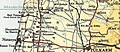
Elyashiv 1945 1:250,000


References[]
- ^ Jump up to: a b "Population in the Localities 2019" (XLS). Israel Central Bureau of Statistics. Retrieved 16 August 2020.
- ^ Survey of Palestine (1941). QAQŪN (Map). 1:20000. Topocadrastal series.
- ^ Jump up to: a b Pringle, 1986, p. 71
- ^ Palmer, 1881, p. 175
- ^ Karmon, The Sharon. Cited in Karmon, 1960, p. 246
- ^ Conder and Kitchener, 1882, SWP II, p. 135
- ^ Jump up to: a b c d Sharaby, 1998, p.21
- ^ Jump up to: a b State of Israel, Government Year-Book 5713, 1952, p. VI.
- ^ Sharaby, 2001, p. 38.
- ^ Bitan, Hanna: 1948-1998: Fifty Years of 'Hityashvut': Atlas of Names of Settlements in Israel, Jerusalem 1999, Carta, p.11, ISBN 965-220-423-4
- ^ Adler, 1988, pp. 200–202.
- ^ Sharaby, 2001, p. 41.
- ^ Sharaby, 1998, p. 34.
- ^ Sharaby, 1998, and Sharaby, 2001, passim.
- ^ Government of Palestine, Village Statistics 1945, p. 20.
Bibliography[]
| Wikimedia Commons has media related to Elyashiv. |
- Adler (Cohen), Raya (1988). "The Tenants of Wadi Hawarith: Another view of the Land Question in Palestine". International Journal of Middle East Studies. 20: 197–220.
- Conder, C.R.; Kitchener, H.H. (1882). The Survey of Western Palestine: Memoirs of the Topography, Orography, Hydrography, and Archaeology. 2. London: Committee of the Palestine Exploration Fund.
- Department of Statistics (1945). Village Statistics, April, 1945. Government of Palestine.
- Hadawi, S. (1970). Village Statistics of 1945: A Classification of Land and Area ownership in Palestine. Palestine Liberation Organization Research Center.
- Karmon, Y. (1960). "An Analysis of Jacotin's Map of Palestine" (PDF). Israel Exploration Journal. 10 (3, 4): 155–173, 244–253.
- Palmer, E.H. (1881). The Survey of Western Palestine: Arabic and English Name Lists Collected During the Survey by Lieutenants Conder and Kitchener, R. E. Transliterated and Explained by E.H. Palmer. Committee of the Palestine Exploration Fund.
- Denys R. Pringle (1986). The Red Tower (al-Burj al-ahmar): Settlement in the Plain of Sharon at the time of the Crusaders and the Mamluks A.D. 1099–1516. Jerusalem Monograph Series no. 1. London: British School of Archaeology in Jerusalem.
- Sharaby, Rachel (1998). "Farming and Ethnic Identity: Yemenite Settlers Confront Modern Agriculture in Israel". The Journal of Israeli History. 19 (2): 21–37.
- Sharaby, Rachel (2001). "Conflict, Adjustment, and Compromise: The Case of a Yemenite Moshav". The Jewish Journal of Sociology. 43 (1–2): 37–52.
External links[]
- Survey of Western Palestine, Map 10: IAA, Wikimedia commons
- Google-map
| show Authority control |
|---|
- Hefer Valley Regional Council
- Moshavim
- Hitahdut HaIkarim
- Populated places established in 1933
- Jewish villages in Mandatory Palestine
- Populated places in Central District (Israel)
- Yemeni-Jewish culture in Israel
- 1933 establishments in Mandatory Palestine