Central District (Israel)
Central District | |
|---|---|
| - transcription(s) | |
| • Hebrew | מְחוֹז הַמֶּרְכָּז |
| • Arabic | المنطقة الوسطى |
 | |
| Cities | 18 |
| Local Councils | 22 |
| Regional Councils | 12 |
| Capital | Ramla |
| Government | |
| • Appointee | Jonathan Bar-Siman-Tov |
| Area | |
| • Total | 1,293 km2 (499 sq mi) |
| Population (2016)[2] | |
| • Total | 2,115,800 |
| ISO 3166 code | IL-M |
The Central District (Hebrew: מְחוֹז הַמֶּרְכָּז, Meḥoz haMerkaz; Arabic: المنطقة الوسطى) of Israel is one of six administrative districts, including most of the Sharon region. It is further divided into 4 sub-districts: Petah Tikva, Ramla, Sharon, and Rehovot. The district's largest city is Rishon LeZion. Its population as of 2017 was 2,115,800. According to the Israeli Central Bureau of Statistics, 88% of the population is Jewish, 8.2% is Arab, and 4% are “non-classified”, being mostly former Soviet Union immigrants of partial or nominal Jewish ethnic heritage or household members of Jews.[3]
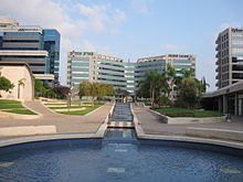
Petah Tikva, Central District
Administrative sub-regions[]
| Subdistricts | ||
|---|---|---|
| Cities | Local Councils | Regional Councils |
|
| |
Former municipalities[]
| Former municipalities |
|---|
|
Economy[]
El Al Airlines maintains its corporate headquarters on the grounds of Ben Gurion Airport and in the Central District.[5]
See also[]
References[]
- ^ https://www.gov.il/he/Departments/General/board. Missing or empty
|title=(help) - ^ "Localities by Population, by District, Sub-District and Type of Locality". Statistical Abstract of Israel. Israel Central Bureau of Statistics. 2015. Retrieved March 10, 2016.
- ^ "Localities and Population, by Population Group, District, Sub-District and Natural Region" (PDF). Statistical Abstract of Israel. Israel Central Bureau of Statistics. 2016. Archived from the original (PDF) on 2018-06-19.
- ^ Local Council of Pardesiya (Israel) Archived November 3, 2005, at the Wayback Machine
- ^ Orme, William A. Jr. "El Al at a Turning Point; A Mirror of Israel's Divisions Prepares to Go 49% Public." The New York Times. March 5, 1999. C1, New York Edition. 1. Retrieved on February 15, 2010.
| show Places adjacent to Central District (Israel) |
|---|
| Authority control |
|
|---|

Categories:
- Districts of Israel
- Central District (Israel)