Empire Township, Michigan
Empire Township, Michigan | |
|---|---|
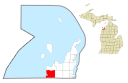 Location within Leelanau County (red) and the administered village of Empire (pink) | |
 Empire Township Location within the state of Michigan | |
| Coordinates: 44°50′02″N 86°00′49″W / 44.83389°N 86.01361°WCoordinates: 44°50′02″N 86°00′49″W / 44.83389°N 86.01361°W | |
| Country | |
| State | |
| County | |
| Area | |
| • Total | 42.8 sq mi (110.9 km2) |
| • Land | 35.3 sq mi (91.3 km2) |
| • Water | 7.6 sq mi (19.6 km2) |
| Elevation | 961 ft (293 m) |
| Population (2000) | |
| • Total | 1,085 |
| • Density | 30.8/sq mi (11.9/km2) |
| Time zone | UTC-5 (Eastern (EST)) |
| • Summer (DST) | UTC-4 (EDT) |
| ZIP code(s) | 49630 |
| Area code(s) | 231 |
| FIPS code | 26-26000[1] |
| GNIS feature ID | 1626241[2] |
| Website | www |


Empire Township is a civil township of Leelanau County in the U.S. state of Michigan. The population was 1,085 at the 2000 census. The village of Empire is located within the township.
Geography[]
According to the United States Census Bureau, the township has a total area of 42.8 square miles (111 km2), of which 35.3 square miles (91 km2) is land and 7.6 square miles (20 km2) (17.66%) is water.
History[]
A village called Burdickville was established with the construction of a sawmill and gristmill on the east shore of Glen Lake in 1864. The mills burned in 1870, but there was still a general store. It was entirely abandoned in 1912 and later turned into a park.[3]
Demographics[]
As of the census[1] of 2000, there were 1,085 people, 500 households, and 325 families residing in the township. The population density was 30.8 per square mile (11.9/km2). There were 940 housing units at an average density of 26.7 per square mile (10.3/km2). The racial makeup of the township was 98.53% White, 0.65% Native American, 0.18% Asian, 0.09% from other races, and 0.55% from two or more races. Hispanic or Latino of any race were 0.28% of the population.
There were 500 households, out of which 22.8% had children under the age of 18 living with them, 55.8% were married couples living together, 5.6% had a female householder with no husband present, and 35.0% were non-families. 31.6% of all households were made up of individuals, and 13.0% had someone living alone who was 65 years of age or older. The average household size was 2.17 and the average family size was 2.69.
In the township the population was spread out, with 18.8% under the age of 18, 5.3% from 18 to 24, 19.4% from 25 to 44, 33.8% from 45 to 64, and 22.6% who were 65 years of age or older. The median age was 47 years. For every 100 females, there were 96.9 males. For every 100 females age 18 and over, there were 96.7 males.
The median income for a household in the township was $40,263, and the median income for a family was $51,806. Males had a median income of $32,308 versus $26,164 for females. The per capita income for the township was $24,975. About 3.0% of families and 6.3% of the population were below the poverty line, including 7.7% of those under age 18 and 3.5% of those age 65 or over.
References[]
Notes[]
- ^ a b "U.S. Census website". United States Census Bureau. Retrieved 2008-01-31.
- ^ U.S. Geological Survey Geographic Names Information System: Empire Township, Michigan
- ^ Romig 1986, p. 87.
Sources[]
- Romig, Walter (October 1, 1986) [1973]. Michigan Place Names: The History of the Founding and the Naming of More Than Five Thousand Past and Present Michigan Communities. Great Lakes Books Series (Paperback). Detroit, Michigan: Wayne State University Press. ISBN 978-0-8143-1838-6.
Further reading[]
External links[]
Municipalities and communities of Leelanau County, Michigan, United States | ||
|---|---|---|
| City |  | |
| Villages | ||
| Charter township | ||
| General law townships | ||
| CDPs | ||
| Other unincorporated communities | ||
| Indian reservation | ||
| Footnotes | ‡This populated place also has portions in an adjacent county or counties | |
| ||
- Townships in Leelanau County, Michigan
- Traverse City micropolitan area
- Townships in Michigan