Enniskillen, Ontario
Enniskillen | |
|---|---|
Township (lower-tier) | |
| Township of Enniskillen | |
 Oil City | |
 Enniskillen | |
| Coordinates: 42°49′N 82°7.5′W / 42.817°N 82.1250°WCoordinates: 42°49′N 82°7.5′W / 42.817°N 82.1250°W | |
| Country | |
| Province | |
| County | Lambton |
| Settled | 1830s |
| Incorporated | 1855 |
| Government | |
| • Mayor | Kevin Marriott |
| • Federal riding | Sarnia—Lambton |
| • Prov. riding | Sarnia—Lambton |
| Area | |
| • Land | 338.16 km2 (130.56 sq mi) |
| Population (2016)[1] | |
| • Total | 2,796 |
| • Density | 8.3/km2 (21/sq mi) |
| Time zone | UTC-5 (EST) |
| • Summer (DST) | UTC-4 (EDT) |
| Postal Code FSA | N0N |
| Area code(s) | 519, 226, 548 |
| Website | www.enniskillen.ca |


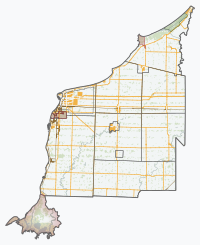
Enniskillen is a township in the Canadian province of Ontario, within Lambton County. It is located at the intersection of Highway 21 (Oil Heritage Road) and Rokeby Line. The economy of the township is based on agriculture. It was named after Sir Galbraith Lowry Cole's father who was the Earl of Enniskillen, Northern Ireland.
Communities[]
The township comprises the communities of Oil City, Glen Rae and Marthaville, and surrounds but does not include the independent municipalities of Petrolia and Oil Springs.
Demographics[]
| Canada census – Enniskillen, Ontario community profile | |||
|---|---|---|---|
| 2016 | 2011 | 2006 | |
| Population: | 2,796 (-4.6% from 2011) | 2,930 (-6.1% from 2006) | 3,122 (-4.2% from 2001) |
| Land area: | 338.16 km2 (130.56 sq mi) | 338.18 km2 (130.57 sq mi) | 338.18 km2 (130.57 sq mi) |
| Population density: | 8.3/km2 (21/sq mi) | 8.7/km2 (23/sq mi) | 9.2/km2 (24/sq mi) |
| Median age: | 49.1 (M: 47.2, F: 50.5) | 42.6 (M: 41.2, F: 43.4) | |
| Total private dwellings: | 1,093 | 1,124 | 1,123 |
| Median household income: | $89,728 | $67,778 | |
| References: 2016[2] 2011[3] 2006[4] earlier[5] | |||
| Year | Pop. | ±% |
|---|---|---|
| 1991 | 3,167 | — |
| 1996 | 3,288 | +3.8% |
| 2001 | 3,259 | −0.9% |
| 2006 | 3,122 | −4.2% |
| 2011 | 2,930 | −6.1% |
| 2016 | 2,796 | −4.6% |
| [6][4][7][1] | ||
See also[]
References[]
- ^ a b c "Census Profile, 2016 Census: Enniskillen, Township". Statistics Canada. Retrieved June 17, 2019.
- ^ "2016 Community Profiles". 2016 Canadian Census. Statistics Canada. February 21, 2017. Retrieved 2019-06-17.
- ^ "2011 Community Profiles". 2011 Canadian Census. Statistics Canada. July 5, 2013. Retrieved 2012-02-09.
- ^ a b "2006 Community Profiles". 2006 Canadian Census. Statistics Canada. March 30, 2011. Retrieved 2011-02-22.
- ^ "2001 Community Profiles". 2001 Canadian Census. Statistics Canada. February 17, 2012.
- ^ Statistics Canada: 1996, 2001, 2006 census
- ^ "Enniskillen census profile". 2011 Census of Population. Statistics Canada. Retrieved 2012-02-09.
Places adjacent to Enniskillen, Ontario | |
|---|---|
This Southwestern Ontario geographical article is a stub. You can help Wikipedia by . |
Categories:
- Township municipalities in Ontario
- Lower-tier municipalities in Ontario
- Municipalities in Lambton County
- Western Ontario geography stubs