Esher Commons
| Site of Special Scientific Interest | |
 Oxshott Heath on the escarpment | |
| Location | Surrey |
|---|---|
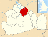
| Grid reference | TQ 132 622[1] |
| Interest | Biological |
| Area | 360.1 hectares (890 acres)[1] |
| Notification | 1986[1] |
| Location map | Magic Map |

Esher Commons is a 360.1-hectare (890-acre) biological Site of Special Scientific Interest south-west of Esher in Surrey.[1][2] It includes Esher Common, Fairmile Common, West End Common and Oxshott Heath. Esher Common[3][4] and West End Common are Local Nature Reserves.[5][6]
Geology and terrain[]
The geology of the Commons consists of the damp clay soils of the Claygate Beds and acidic soils of the Bagshot Beds and Plateau Gravels with peat on top. The terrain is lowland heath, predominantly covered by woodland, including both deciduous and coniferous trees, notably: oak; beech; silver birch; birch; and Scots Pine in various stages of maturity. There is also grassland, and areas of marsh, bog and open water which provide a rich variety of habitats to support many species of plant and animal life.
The Common was not always wooded, and much of the area was formerly open heathland used as common grazing land. It had not been grazed for many years and much of the area is now secondary woodland, including conifer plantations from the 1950s. Grazing trials began on a small area of Esher Commons in 2015. In the first year 15 goats were introduced to a 2.5ha area of heath for a period of six months.[7] Esher Commons Site of Special Scientific Interest covers a large part of Arbrook, Esher, Oxshott, West End and Fairmile Commons and the Ledges. Arbrook Common is the easternmost, named after the Arbrook, at other points and sources known as the 'Rythe'. Otherwise much of the remainder of the commons is a subterranean aquifer.[8][9] A programme to fell tracts of secondary woodland has led to various public protests.[10] In spite of the SSSI designation, the A3 Esher bypass was built through the middle of Esher Common in 1974. As compensation, approximately 90 acres (360,000 m2) of "exchange land" became part of the Commons. The Ledges were added to West End Common, and an area including Middle Pond became part of Esher Common.
Esher Common[]

Esher Common is a [11][12] It contains several ponds and lakes, the largest of which is Black Pond. This was once used as a water supply for the nearby Claremont Landscape Garden now owned and managed by the National Trust. The main piece of high ground is Round Hill, close to Copsem Lane.
There are parking facilities on the A307 (old Portsmouth Road) and the A244 (Copsem Lane).
West End Common[]

West End Common includes The Ledges, which is a bank of high ground alongside the River Mole.
The common shares the parking facilities on the A307, and can also be accessed from the direction of West End.
| Wikimedia Commons has media related to Esher Commons. |
References[]
- ^ a b c d "Designated Sites View: Esher Commons". Sites of Special Scientific Interest. Natural England. Retrieved 7 November 2018.
- ^ "Map of Esher Commons". Sites of Special Scientific Interest. Natural England. Retrieved 7 November 2018.
- ^ "Esher Common". Local Nature Reserves. Natural England. Retrieved 7 November 2018.
- ^ "Map of Esher Common". Local Nature Reserves. Natural England. Retrieved 7 November 2018.
- ^ "West End Common". Local Nature Reserves. Natural England. Retrieved 7 November 2018.
- ^ "Map of West End Common". Local Nature Reserves. Natural England. Retrieved 7 November 2018.
- ^ "Archived copy". Archived from the original on 26 February 2015. Retrieved 26 February 2015.CS1 maint: archived copy as title (link)
- ^ "Esher Commons citation" (PDF). Sites of Special Scientific Interest. Natural England.
- ^ "Map of Esher Commons". Sites of Special Scientific Interest. Natural England.
- ^ Esher News and Mail 7 August 2007
- ^ "Esher Common". Local Nature Reserves. Natural England.
- ^ "Map of Esher Common". Local Nature Reserves. Natural England.
External links[]
| Towns, villages and neighbourhoods |
|  | ||||||||||||||||
|---|---|---|---|---|---|---|---|---|---|---|---|---|---|---|---|---|---|---|
| Notable parks | ||||||||||||||||||
| Places of worship | ||||||||||||||||||
| Education | ||||||||||||||||||
| Transport |
| |||||||||||||||||
| Buildings and structures |
| |||||||||||||||||
| Sport | ||||||||||||||||||
Places listed are articles notable as settlements, arranged by post town The M25 motorway follows approximately a boundary and is included for its regional importance. | ||||||||||||||||||
- Forests and woodlands of Surrey
- Borough of Elmbridge
- Parks and open spaces in Surrey
- Sites of Special Scientific Interest in Surrey
- Local Nature Reserves in Surrey