Eugene Township, Vermillion County, Indiana
Eugene Township | |
|---|---|
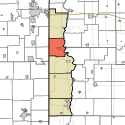 Location in Vermillion County | |
| Coordinates: 39°57′32″N 87°28′26″W / 39.95889°N 87.47389°WCoordinates: 39°57′32″N 87°28′26″W / 39.95889°N 87.47389°W | |
| Country | United States |
| State | Indiana |
| County | Vermillion |
| Government | |
| • Type | Indiana township |
| Area | |
| • Total | 35.34 sq mi (91.5 km2) |
| • Land | 34.93 sq mi (90.5 km2) |
| • Water | 0.41 sq mi (1.1 km2) 1.16% |
| Elevation | 551 ft (168 m) |
| Population (2010) | |
| • Total | 2,025 |
| • Density | 58/sq mi (22/km2) |
| Time zone | UTC-5 (Eastern (EST)) |
| • Summer (DST) | UTC-4 (EDT) |
| ZIP codes | 47847, 47928, 47974 |
| Area code(s) | 765 |
| GNIS feature ID | 453282 |

Eugene Township is one of five townships in Vermillion County, in the U.S. state of Indiana. As of the 2010 census, its population was 2,025 and it contained 901 housing units.[2]
Geography[]
According to the 2010 census, the township has a total area of 35.34 square miles (91.5 km2), of which 34.93 square miles (90.5 km2) (or 98.84%) is land and 0.41 square miles (1.1 km2) (or 1.16%) is water.[2]
Cities[]
Unincorporated towns[]
(This list is based on USGS data and may include former settlements.)
Cemeteries[]
The township contains five cemeteries: Brown, Eugene, Groenendyke, Isle and Patrick.
Landmarks[]
- County Fairgrounds
- The Eugene Covered Bridge was listed on the National Register of Historic Places in 1994.[3]
School districts[]
- North Vermillion Community School Corporation
Political districts[]
- Indiana's 8th congressional district
- State House District 42
- State Senate District 38
References[]
- ^ "US Board on Geographic Names". United States Geological Survey. October 25, 2007. Retrieved 2017-05-09.
- ^ a b "Population, Housing Units, Area, and Density: 2010 - County -- County Subdivision and Place -- 2010 Census Summary File 1". United States Census. Archived from the original on 2020-02-10. Retrieved 2013-05-10.
- ^ "National Register Information System". National Register of Historic Places. National Park Service. July 9, 2010.
External links[]
Places adjacent to Eugene Township, Vermillion County, Indiana | |
|---|---|
Municipalities and communities of Vermillion County, Indiana, United States | ||
|---|---|---|
| City | ||
| Towns | ||
| Townships | ||
| CDPs | ||
| Other unincorporated communities | ||
| Ghost towns | ||
| Footnotes | ‡This populated place also has portions in an adjacent county or counties | |
| ||
Categories:
- Townships in Vermillion County, Indiana
- Townships in Indiana