Eureka Airport (Nevada)
Eureka Airport | |||||||||||
|---|---|---|---|---|---|---|---|---|---|---|---|
 | |||||||||||
| Summary | |||||||||||
| Airport type | Public | ||||||||||
| Owner | County of Eureka | ||||||||||
| Serves | Eureka, Nevada | ||||||||||
| Elevation AMSL | 5,958 ft / 1,816 m | ||||||||||
| Coordinates | 39°36′14″N 116°00′13″W / 39.60389°N 116.00361°WCoordinates: 39°36′14″N 116°00′13″W / 39.60389°N 116.00361°W | ||||||||||
| Map | |||||||||||
 Ø5U | |||||||||||
| Runways | |||||||||||
| |||||||||||
| Statistics (2012) | |||||||||||
| |||||||||||

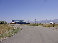
Eureka Airport (IATA: EUE[2][3], FAA LID: Ø5U) is seven miles northwest of Eureka, in Eureka County, Nevada, United States. It is owned by the County of Eureka.[1] The airport is toward the south end of the Diamond Valley.
It is also known as Eureka County Airport and in 2007 it was named Booth Bailey Field, honoring Booth Bailey, a Eureka native and founder of Diamond Aviation, the airport's fixed-base operator.[4][5][6]
The FAA's National Plan of Integrated Airport Systems for 2009–2013 categorizes it as a general aviation facility.[7]
Facilities[]
Eureka Airport covers 800 acres (324 ha) at an elevation of 5,958 feet (1,816 m). Its single runway, 18/36, is 7,300 by 60 feet (2,225 x 18 m) asphalt.[1]
In the year ending August 31, 2012 the airport had 2,000 general aviation aircraft operations, average 166 per month. Three aircraft were then based at this airport, all single-engine.[1]
References[]
- ^ a b c d FAA Airport Form 5010 for 05U PDF. Federal Aviation Administration. Effective November 15, 2012.
- ^ "Eureka Airport, Nevada (IATA: EUE, FAA: 05U)". Great Circle Mapper. Retrieved August 7, 2010.
- ^ "IATA Airport Code Search (EUE: Eureka)". International Air Transport Association. Retrieved June 13, 2014.
- ^ "Diamond Aviation". Eureka County Economic Development. Retrieved August 7, 2010.
- ^ "Eureka County Board of Commissioners - March 20, 2007" (PDF).[permanent dead link]
- ^ "Obituary: Mr. Booth Bailey". Humboldt Sun. June 19, 2007. Archived from the original on 2010-09-20. Retrieved 2010-08-07.
- ^ National Plan of Integrated Airport Systems for 2009–2013: Appendix A: Part 4 (PDF, 1.61 MB) Archived June 6, 2011, at the Wayback Machine. Federal Aviation Administration. Updated October 15, 2008.
External links[]
| Wikimedia Commons has media related to Eureka Airport (Nevada). |
- "Diagram of Eureka Airport (Ø5U)" (PDF). Archived from the original (PDF) on 2016-03-03. from Nevada DOT
- Aerial image as of June 1994 from USGS The National Map
- FAA Terminal Procedures for 05U, effective February 24, 2022
- Resources for this airport:
- FAA airport information for 05U
- AirNav airport information for 05U
- FlightAware airport information and live flight tracker
- SkyVector aeronautical chart for 05U
This Nevada airport-related article is a stub. You can help Wikipedia by . |
- Airports in Nevada
- Buildings and structures in Eureka County, Nevada
- Transportation in Eureka County, Nevada
- Nevada building and structure stubs
- Nevada transportation stubs
- Western United States airport stubs