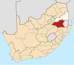
Evander, Mpumalanga
Evander | |
|---|---|
 Evander | |
| Coordinates: 26°28′19″S 29°06′36″E / 26.47194°S 29.11000°ECoordinates: 26°28′19″S 29°06′36″E / 26.47194°S 29.11000°E | |
| Country | South Africa |
| Province | Mpumalanga |
| District | Gert Sibande |
| Municipality | Govan Mbeki |
| Area | |
| • Total | 23.78 km2 (9.18 sq mi) |
| Elevation | 1,655 m (5,430 ft) |
| Population (2011)[1] | |
| • Total | 10,166 |
| • Density | 430/km2 (1,100/sq mi) |
| Racial makeup (2011) | |
| • Black African | 49.5% |
| • White | 40.1% |
| • Coloured | 6.7% |
| • Indian/Asian | 2.9% |
| • Other | 0.7% |
| First languages (2011) | |
| • Afrikaans | 40.7% |
| • Zulu | 16.9% |
| • English | 12.6% |
| • Sotho | 7.4% |
| • Other | 22.4% |
| Time zone | UTC+2 (SAST) |
| Postal code (street) | 2280 |
| PO box | 2280 |
| Area code | +27 (0)17 |
Evander is a town in Mpumalanga, South Africa. It is approximately 8 km north west of Secunda.
History[]
The town was founded in 1955 when the Union Corporation started its mining activities and was originally part of the Bethal district (named after a town 36 km to the east).[2]:302 The town is named after Evelyn Anderson, the wife of Peter Maltitz Anderson, one of the directors of the corporation.[2]:302
Economy[]
Gold mining[]
The Union Corporation acquired options in the Kinross area, 64 km east of Springs. Mining started in 1955 though their subsidiary Winkelhaak Mines Ltd.[3] The Evander mine is currently operating in its 9thh shaft and employs around 3 300 people.[4] These operations, now owned by Harmony Gold, mine the Kimberley Reef in the Evander Basin and produced over 16 000 kg of gold from 2008 to 2010. The ore is milled and processed at Kinross, 7 km north.
Education[]
The town has a 5 primary schools (Emdibini, Hoëveld, Isikhumbuzo, Inqanawe, and T P Stratten), a high school (Evander High School) and hosts one of the four campuses of the Gert Sibande College (originally the Evander Technical Institute[5]).
Infrastructure[]
Airports[]
The Evander airfield is located just south-west of the town.
References[]
- ^ Jump up to: a b c d "Main Place Evander". Census 2011.
- ^ Jump up to: a b Erasmus, B.P.J. (2014). On Route in South Africa: Explore South Africa region by region. Jonathan Ball Publishers. p. 401. ISBN 9781920289805.
- ^ "Archived copy". Archived from the original on July 20, 2011. Retrieved May 7, 2011.CS1 maint: archived copy as title (link)
- ^ http://www.harmony.co.za/b/ops_sa_evander.asp
- ^ "Archived copy". Archived from the original on 2012-03-08. Retrieved 2011-05-07.CS1 maint: archived copy as title (link)
- Populated places in the Govan Mbeki Local Municipality
- Mining communities in South Africa
- Mpumalanga geography stubs


