Capitán FAP Carlos Martínez de Pinillos International Airport
(Redirected from )
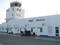
Capitán FAP Carlos Martínez de Pinillos International Airport | |||||||||||
|---|---|---|---|---|---|---|---|---|---|---|---|
 | |||||||||||
| Summary | |||||||||||
| Airport type | Public | ||||||||||
| Operator | ADP | ||||||||||
| Location | Trujillo | ||||||||||
| Elevation AMSL | 128 ft / 39 m | ||||||||||
| Coordinates | 8°4′50″S 79°6′30″W / 8.08056°S 79.10833°WCoordinates: 8°4′50″S 79°6′30″W / 8.08056°S 79.10833°W | ||||||||||
| Map | |||||||||||
 TRU Location of the airport in Peru | |||||||||||
| Runways | |||||||||||
| |||||||||||
| Statistics (2016) | |||||||||||
| |||||||||||

Capitán FAP Carlos Martínez de Pinillos International Airport (IATA: TRU, ICAO: SPRU), known as Aeropuerto Internacional Capitán FAP Carlos Martínez de Pinillos in Spanish, is an airport serving Peru's third largest city, Trujillo, as well as the beach community of Huanchaco. It is the main air hub in northern Peru.
The Trujillo VOR-DME (Ident: TRU) is located on the field.[3]
Airlines and destinations[]
The following airlines serve the airport:
| Airlines | Destinations |
|---|---|
| Iquitos, Tarapoto | |
| JetSmart | Santiago de Chile |
| LATAM Perú | Lima |
| Chachapoyas, Tarapoto[4] | |
| Sky Airline Peru | Lima[5] |
See also[]
References[]
External links[]
- OpenStreetMap - Trujillo
- OurAirports - Trujillo
- SkyVector Aeronautical Charts
- Accident history for Trujillo Airport at Aviation Safety Network
This article about an airport in Peru is a stub. You can help Wikipedia by . |
Categories:
- Airports in Peru
- Buildings and structures in La Libertad Region
- Peruvian airport stubs