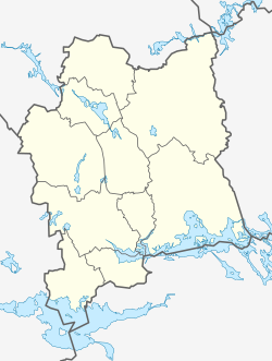
Fagersta
This article needs additional citations for verification. (March 2010) |
Fagersta | |
|---|---|
 Fagersta railway station | |
 Fagersta | |
| Coordinates: 60°00′15″N 15°47′36″E / 60.00417°N 15.79333°ECoordinates: 60°00′15″N 15°47′36″E / 60.00417°N 15.79333°E | |
| Country | Sweden |
| Province | Västmanland |
| County | Västmanland County |
| Municipality | Fagersta Municipality |
| Founded | 1944 |
| Area | |
| • Total | 9.47 km2 (3.66 sq mi) |
| Elevation | 102 m (335 ft) |
| Population (31 December 2010)[1] | |
| • Total | 11,130 |
| • Density | 1,175/km2 (3,040/sq mi) |
| Time zone | UTC+1 (CET) |
| • Summer (DST) | UTC+2 (CEST) |
| Postal code | 737 xx |
| Area code(s) | (+46) 223 |
| Website | Official website |
Fagersta is a locality and the seat of Fagersta Municipality in Västmanland County, Sweden, with 11,130 inhabitants in 2010.[1]
Geography[]
The city is located at the junction of two railways between Ludvika-Västerås and Avesta (Krylbo)-Örebro, in the heart of the historic Bergslagen region which is rich in copper and iron ore. The 60th parallel north passes through the town.
History[]
There has been mining activity in the Fagersta area since the 15th century but it was not organized until the 17th century and was not made a corporation until 1873, when was founded.[2]
Fagersta was made a city in 1944 when the industrial hot spot of Fagersta merged with its service-oriented neighbour Västanfors. It is now the seat of Fagersta Municipality. The Fagersta airspace surveillance tower is a Second World War observation platform located to protect a nearby steel mill.
Industry[]
Today's industry is focused on hard metal tools ( and ) and stainless steel products ( and ).
Notable natives[]
- Ulf Samuelsson, ice hockey player (NHL)
- Tomas Sandström, ice hockey player (NHL)
- The Hives, garage rock band
- 59 Times the Pain, garage rock band
- Johan August Brinell, metallurgist and inventor of the Brinell hardness test at the Fagersta Iron and Steel Works in 1900
- , Drummer for punk rock band (No Fun At All)
References[]
- ^ a b c "Tätorternas landareal, folkmängd och invånare per km2 2005 och 2010" (in Swedish). Statistics Sweden. 14 December 2011. Archived from the original on 2012-01-10. Retrieved 10 January 2012.
- ^ "Allmänna val 17 september 2006".
- Municipal seats of Västmanland County
- Swedish municipal seats
- Populated places in Västmanland County
- Populated places in Fagersta Municipality
- Sweden geography stubs

