Kungsör Municipality
Kungsör Municipality
Kungsörs kommun | |
|---|---|
 Kungsörs town hall | |
 Coat of arms | |
 | |
| Coordinates: 59°25′N 16°05′E / 59.417°N 16.083°ECoordinates: 59°25′N 16°05′E / 59.417°N 16.083°E | |
| Country | Sweden |
| County | Västmanland County |
| Seat | Kungsör |
| Area | |
| • Total | 227.13 km2 (87.70 sq mi) |
| • Land | 202.65 km2 (78.24 sq mi) |
| • Water | 24.48 km2 (9.45 sq mi) |
| Area as of 1 January 2014. | |
| Population (31 December 2019)[2] | |
| • Total | 8,675 |
| • Density | 38/km2 (99/sq mi) |
| Time zone | UTC+1 (CET) |
| • Summer (DST) | UTC+2 (CEST) |
| ISO 3166 code | SE |
| Province | Södermanland and Västmanland |
| Municipal code | 1960 |
| Website | www.kungsor.se |

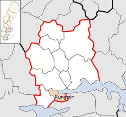
Kungsör Municipality (Kungsörs kommun) is a municipality in Västmanland County in central Sweden. Its seat is located in the town of Kungsör.
The present municipality was formed in 1971 when Kungsör and Kung Karl (from which Kungsör had been detached as a market town (köping) in 1907) were amalgamated
Kungsör is located at the western end of lake Mälaren. The landscape is open, dominated by fields and meadows.
Localities[]
Historically, the town grew around the Royal Mansion that King Gustav Vasa had built in the 16th century. Parts of the mansion are still preserved and open for visits. It is located on a cape into the Mälaren.
Riksdag elections[]
| Year | % | Votes | V | S | MP | C | L | KD | M | SD | NyD | Left | Right |
|---|---|---|---|---|---|---|---|---|---|---|---|---|---|
| 1973[3] | 92.6 | 4,931 | 5.6 | 49.7 | 24.9 | 10.5 | 1.1 | 7.9 | 55.2 | 43.3 | |||
| 1976[4] | 93.2 | 5,325 | 4.4 | 47.1 | 25.9 | 12.2 | 1.0 | 9.1 | 51.5 | 47.2 | |||
| 1979[5] | 92.9 | 5,441 | 4.7 | 49.0 | 19.5 | 10.9 | 1.2 | 14.4 | 53.7 | 44.8 | |||
| 1982[6] | 93.7 | 5,555 | 5.3 | 50.1 | 1.8 | 17.0 | 6.9 | 1.3 | 17.5 | 55.4 | 41.4 | ||
| 1985[7] | 91.0 | 5,474 | 5.0 | 49.5 | 2.2 | 13.3 | 13.2 | 16.4 | 54.5 | 42.9 | |||
| 1988[8] | 87.5 | 5,247 | 5.7 | 48.5 | 5.9 | 13.0 | 12.1 | 1.9 | 12.3 | 60.1 | 37.3 | ||
| 1991[9] | 87.2 | 5,370 | 4.3 | 43.2 | 3.7 | 9.5 | 9.9 | 5.5 | 16.8 | 7.0 | 47.5 | 41.6 | |
| 1994[10] | 87.3 | 5,377 | 7.2 | 49.0 | 5.4 | 8.9 | 6.0 | 2.8 | 18.2 | 0.9 | 61.6 | 35.9 | |
| 1998[11] | 81.9 | 4,892 | 13.6 | 39.7 | 4.4 | 7.2 | 3.9 | 10.7 | 19.0 | 57.8 | 40.7 | ||
| 2002[12] | 80.2 | 4,820 | 8.3 | 45.3 | 3.6 | 8.9 | 11.7 | 8.5 | 12.2 | 0.5 | 57.2 | 41.2 | |
| 2006[13] | 81.1 | 4,963 | 5.8 | 38.8 | 3.7 | 10.9 | 5.6 | 5.0 | 23.4 | 3.2 | 48.2 | 46.0 | |
| 2010[14] | 84.8 | 5,206 | 5.7 | 35.3 | 5.0 | 6.9 | 7.0 | 4.8 | 27.3 | 7.1 | 46.0 | 45.9 | |
| 2014[15] | 86.2 | 5,332 | 5.0 | 36.3 | 3.6 | 7.2 | 4.9 | 4.4 | 18.7 | 17.5 | 45.0 | 35.2 | |
| 2018[16] | 88.3 | 5,370 | 5.9 | 31.4 | 2.1 | 8.6 | 4.4 | 5.6 | 16.7 | 23.9 | 47.9 | 50.6 |
Sister city[]
- Spydeberg, Norway
References[]
- ^ "Statistiska centralbyrån, Kommunarealer den 1 januari 2014" (in Swedish). Statistics Sweden. 2014-01-01. Archived from the original (Microsoft Excel) on 2016-09-27. Retrieved 2014-04-18.
- ^ "Folkmängd i riket, län och kommuner 31 december 2019" (in Swedish). Statistics Sweden. February 20, 2020. Retrieved February 20, 2020.
- ^ "Allmänna valen 1973" (PDF) (in Swedish). SCB.
- ^ "Allmänna valen 1976" (PDF) (in Swedish). SCB.
- ^ "Allmänna valen 1979" (PDF) (in Swedish). SCB.
- ^ "Allmänna valen 1982" (PDF) (in Swedish). SCB.
- ^ "Allmänna valen 1985" (PDF) (in Swedish). SCB.
- ^ "Allmänna valen 1988" (PDF) (in Swedish). SCB.
- ^ "Allmänna valen 1991" (PDF) (in Swedish). SCB.
- ^ "Allmänna valen 1994" (PDF) (in Swedish). SCB.
- ^ "Allmänna valen 1998" (PDF) (in Swedish). SCB.
- ^ "Kungsör - summering" (in Swedish). Valmyndigheten.
- ^ "Kungsör - Allmänna val 17 september 2006" (in Swedish). Valmyndigheten.
- ^ "Kungsör - Röster Val 2010" (in Swedish). Valmyndigheten.
- ^ "Kungsör - Röster Val 2014" (in Swedish). Valmyndigheten.
- ^ "Kungsör - Röster Val 2018" (in Swedish). Valmyndigheten.
External links[]
| Wikimedia Commons has media related to Kungsör Municipality. |
- Kungsör Municipality - Official site
Places adjacent to Kungsör Municipality | |
|---|---|
Municipalities and seats of Västmanland County | ||
|---|---|---|
| Municipalities | ||
| Municipal seats | ||
Categories:
- Municipalities of Västmanland County