Fannin, Texas
Fannin, Texas | |
|---|---|
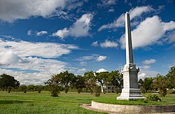 Fannin Battleground State Historic Site | |
 Fannin | |
| Coordinates: 28°41′44″N 97°14′9″W / 28.69556°N 97.23583°WCoordinates: 28°41′44″N 97°14′9″W / 28.69556°N 97.23583°W | |
| Country | United States |
| State | Texas |
| County | Goliad |
| Elevation | 141 ft (43 m) |
| Time zone | UTC-6 (Central (CST)) |
| • Summer (DST) | UTC-5 (CDT) |
| GNIS feature ID | 1373703 |


Fannin is an unincorporated community in eastern Goliad County, Texas, United States.[1] Its elevation is 141 feet (43 m).[2] It is part of the Victoria, Texas Metropolitan Statistical Area.
History[]
Fannin is named for James Fannin,[3] who commanded the group of Texans killed in the Goliad Massacre during the Texas Revolution.
Recreation[]
Fannin is home to the Coleto Creek Reservoir. It is a venue for camping, fishing and other outdoor recreation.
References[]
- ^ Rand McNally. The Road Atlas '05. Skokie: Rand McNally, 2005, p. 98.
- ^ U.S. Geological Survey Geographic Names Information System: Fannin, Texas, Geographic Names Information System, 1979-11-30. Accessed 2007-12-22.
- ^ Gannett, Henry (1905). The Origin of Certain Place Names in the United States. Govt. Print. Off. pp. 123.
Municipalities and communities of Goliad County, Texas, United States | ||
|---|---|---|
| City |  | |
| Unincorporated communities | ||
| ||
| This article about a location in Goliad County, Texas is a stub. You can help Wikipedia by . |
Categories:
- Unincorporated communities in Goliad County, Texas
- Unincorporated communities in Texas
- Victoria, Texas metropolitan area
- South Texas geography stubs