Fanuatapu
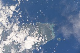 Satellite image of the Aleipata Islands | |
| Geography | |
|---|---|
| Area | 0.06 km2 (0.023 sq mi) |
| Coastline | 1.79 km (1.112 mi) |
Fanuatapu, an uninhabited island, is a volcanic tuff ring off the eastern tip of Upolu Island, Samoa. It is the smallest and easternmost of the four Aleipata Islands, with an area of 15 hectares. It has an automated lighthouse.
See also[]
- Samoa Islands
- List of islands
- Desert island
References[]
- "Upolu". Global Volcanism Program. Smithsonian Institution. (includes Fanuatapu)
Traditional center: Lufilufi | ||
| Villages |  | |
| Landmarks | ||
| Islands |
| |
| Environment | ||
| Electoral constituencies: Faipule Districts |
| |
Coordinates: 14°00′50″S 171°24′1″W / 14.01389°S 171.40028°W

This article about a geographical location in Samoa is a stub. You can help Wikipedia by . |
Categories:
- Uninhabited islands of Samoa
- Volcanoes of Samoa
- Tuff cones
- Atua (district)
- Samoa geography stubs