Fasano
Fasano | |
|---|---|
| Comune di Fasano | |
 Balì Palace | |
 Coat of arms | |
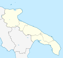
 Fasano within the Province of Brindisi | |
show Location of Fasano | |
 Fasano Location of Fasano in Italy | |
| Coordinates: 40°50′N 17°22′E / 40.833°N 17.367°E | |
| Country | Italy |
| Region | Apulia |
| Province | Brindisi (BR) |
| Frazioni | Canale di Pirro, Laureto, Montalbano, Pezze di Greco, Pozzo Faceto, Savelletri, Selva di Fasano, Speziale, Torre Canne, Torre Spaccata |
| Government | |
| • Mayor | Francesco Zaccaria |
| Area | |
| • Total | 128 km2 (49 sq mi) |
| Elevation | 111 m (364 ft) |
| Population (31 March 2018)[3] | |
| • Total | 39,711 |
| • Density | 310/km2 (800/sq mi) |
| Demonym(s) | Fasanesi |
| Time zone | UTC+1 (CET) |
| • Summer (DST) | UTC+2 (CEST) |
| Postal code | 72015, 72010 |
| Dialing code | 080 |
| Patron saint | Madonna del Pozzo e San Giovanni Battista |
| Saint day | Third Sunday in June |
| Website | Official website |


Fasano (Italian pronunciation: [faˈzaːno]; Barese: Fasciànë) is a town and comune in the Province of Brindisi, Apulia, southern Italy. It is the second most populated town of the province after Brindisi, and has a population (2016) of 40,227.[3]
History[]
According to a folk etymology, the name Fasano derives from the "Faso", a large wild columbus dove (also represented on the civic coat of arms) which drank from the fogge, which was a type of swamp or pool in the open air formed from the water that flowed down from the surrounding hills. This area where the pool once was is now a communal garden.
Via Appia, the road used to go from Brindisi to Rome during ancient times runs along Fasano's costal frazioni, including Savelletri and is visible today.
Geography[]
Location[]
It marks the border between the Salento and the Metropolitan City of Bari. It lies about 50 kilometres (31 mi) from all three of the provincial capitals in Apulia, namely Bari, Taranto and Brindisi.
The municipality borders with Alberobello (BA), Cisternino, Locorotondo (BA), Monopoli (BA) and Ostuni.[4] It counts the hamlets (frazioni) of Canale di Pirro, Laureto, Montalbano, Pezze di Greco, Pozzo Faceto, Savelletri, Selva di Fasano, Speziale, Torre Canne and Torre Spaccata.
Environment[]
Fasano is situated in an extended area with secular olive trees and its territory extends from hills to the sea with rich Mediterranean vegetation.
Coming down from hills the town of Fasano occupies a dominant position in the valley which then leads down to the sea: coastal resorts include Savelletri with its beaches, the archaeological digs at Gnatia and a golf course and the quaint fishing town of Torre Canne. The coast is characterized by a peaceful atmosphere that prevails despite growing tourism.
Around Fasano are Pezze di Greco, Montalbano, Speziale and Pozzo Faceto, centres of secular olive cultivation; and a range of medieval fortified masserie, or farmhouses, aimed at agricultural tourism.
Population[]

Main sights[]
Religious[]
- Archaeological Park of Egnatia, an Ancient Italic city and former bishopric Egnazia Appula
- Church of San Giovanni Battista (Chiesa Matrice), built in the 17th century.
- Tempietto di Seppannibale, an early Christian church
- The minaret of Fasano, an Islamic-style construction from 1918.
Other[]
- Dolmen of Montalbano
- Torrione delle Fogge, the last remaining tower of the original eleven ones.
- The , today a garden with villas
- Original trulli houses
- Fasanolandia, the first zoo safari of its kind in Europe
Transport[]
Fasano station is an important stop, both for regional and long-distance trains, on the Adriatic railway. The SS 16 highway "Adriatica" Padova-Otranto serves the town with two exits, "Fasano" and "Savelletri".
Sport[]
The A.S. Fasano is the town's football club, and its home ground is the . The local handball clubs are the Junior Fasano and .
Personalities[]
- Vittorio Ghirelli (b. 1994), racing driver
- Renato Olive (b. 1971), former footballer
- (b. 1972), Kickboxer three times world champion
See also[]
References[]
- ^ "Superficie di Comuni Province e Regioni italiane al 9 ottobre 2011". Istat. Retrieved 16 March 2019.
- ^ "Popolazione Residente al 1° Gennaio 2018". Istat. Retrieved 16 March 2019.
- ^ Jump up to: a b (in Italian) Source: Istat 2016
- ^ 40778 Fasano on OpenStreetMap
External links[]
| Wikimedia Commons has media related to Fasano. |

| show Authority control |
|---|
- Cities and towns in Apulia
- Municipalities of the Province of Brindisi
- Fasano