Felix Township, Grundy County, Illinois
Felix Township | |
|---|---|
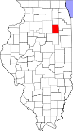
 Location in Grundy County | |
 Grundy County's location in Illinois | |
| Coordinates: 41°18′40″N 88°16′42″W / 41.31111°N 88.27833°WCoordinates: 41°18′40″N 88°16′42″W / 41.31111°N 88.27833°W | |
| Country | United States |
| State | Illinois |
| County | Grundy |
| Established | November, 1854 |
| Area | |
| • Total | 11.99 sq mi (31.1 km2) |
| • Land | 10.88 sq mi (28.2 km2) |
| • Water | 1.11 sq mi (2.9 km2) 9.26% |
| Elevation | 545 ft (166 m) |
| Population (2010) | |
| • Estimate (2016)[1] | 4,322 |
| • Density | 406.9/sq mi (157.1/km2) |
| Time zone | UTC-6 (CST) |
| • Summer (DST) | UTC-5 (CDT) |
| ZIP codes | 60416, 60450 |
| FIPS code | 17-063-25778 |

Felix Township is one of seventeen townships in Grundy County, Illinois, USA. As of the 2010 census, its population was 4,427 and it contained 1,919 housing units.[2]
History[]
Felix Township, Grundy County, is named for Felix Grundy, Senator from Tennessee.[3] The township was formed from portions of Wauponsee and Aux Sable townships in November, 1854.[4] Most of old Felix township was partitioned to form Goose Lake Township on September 15, 1897. These early boundary changes occurred mainly due to coal mining activity.
Geography[]
According to the 2010 census, the township has a total area of 11.99 square miles (31.1 km2), of which 10.88 square miles (28.2 km2) (or 90.74%) is land and 1.11 square miles (2.9 km2) (or 9.26%) is water.[2]
Cities, towns, villages[]
- Carbon Hill
- Coal City (north quarter)
- Diamond (west quarter)
Unincorporated towns[]
(This list is based on USGS data and may include former settlements.)
Demographics[]
| Historical population | |||
|---|---|---|---|
| Census | Pop. | %± | |
| 2016 (est.) | 4,322 | [1] | |
| U.S. Decennial Census[5] | |||
School districts[]
- Coal City Community Unit School District 1
Political districts[]
- Illinois' 11th congressional district
- State House District 75
- State Senate District 38
References[]
- "Felix Township, Grundy County, Illinois". Geographic Names Information System. United States Geological Survey. Retrieved 2010-01-17.
- United States Census Bureau 2007 TIGER/Line Shapefiles
- United States National Atlas
- ^ a b "Population and Housing Unit Estimates". Retrieved June 9, 2017.
- ^ a b "Population, Housing Units, Area, and Density: 2010 - County -- County Subdivision and Place -- 2010 Census Summary File 1". United States Census. Archived from the original on 2020-02-12. Retrieved 2013-05-28.
- ^ Gannett, Henry (1905). The Origin of Certain Place Names in the United States. Govt. Print. Off. pp. 125.
- ^ "Archived copy". Archived from the original on 2007-10-20. Retrieved 2007-10-20.
{{cite web}}: CS1 maint: archived copy as title (link) - ^ "Census of Population and Housing". Census.gov. Retrieved June 4, 2016.
External links[]
Places adjacent to Felix Township, Grundy County, Illinois | |
|---|---|
Municipalities and communities of Grundy County, Illinois, United States | ||
|---|---|---|
| Cities | ||
| Villages | ||
| Townships | ||
| Unincorporated communities | ||
| Footnotes | ‡This populated place also has portions in an adjacent county or counties | |
| ||
- Townships in Grundy County, Illinois
- Townships in Illinois
- 1854 establishments in Illinois
- Populated places established in 1854