Ferla
Ferla | |
|---|---|
| Comune di Ferla | |
 Ferla | |
show Location of Ferla | |
 Ferla Location of Ferla in Italy | |
| Coordinates: 37°7′N 14°57′E / 37.117°N 14.950°ECoordinates: 37°7′N 14°57′E / 37.117°N 14.950°E | |
| Country | Italy |
| Region | Sicily |
| Province | Syracuse (SR) |
| Government | |
| • Mayor | Michelangelo Giansiracusa (Action) |
| Area | |
| • Total | 24.9 km2 (9.6 sq mi) |
| Elevation | 556 m (1,824 ft) |
| Population (30 November 2017)[3] | |
| • Total | 2,450 |
| • Density | 98/km2 (250/sq mi) |
| Demonym(s) | Ferlesi |
| Time zone | UTC+1 (CET) |
| • Summer (DST) | UTC+2 (CEST) |
| Postal code | 96010 |
| Dialing code | 0931 |
| Patron saint | Saint Sebastian |
| Saint day | 20 July |
| Website | Official website |


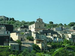
Ferla (Sicilian: A Ferra) is a town and comune in the Province of Syracuse, Sicily (southern Italy).
The Necropolis of Pantalica, part of the UNESCO World Heritage Site of "Syracuse and the Rocky Necropolis of Pantalica" is situated between Ferla and Sortino.
References[]
- ^ "Superficie di Comuni Province e Regioni italiane al 9 ottobre 2011". Istat. Retrieved 16 March 2019.
- ^ "Popolazione Residente al 1° Gennaio 2018". Istat. Retrieved 16 March 2019.
- ^ All demographics and other statistics from the Italian statistical institute (Istat)
| show Authority control |
|---|
This Sicilian location article is a stub. You can help Wikipedia by . |
Categories:
- Cities and towns in Sicily
- Municipalities of the Province of Syracuse
- Sicily geography stubs