Fernwood, Idaho
Fernwood, Idaho | |
|---|---|
Town | |
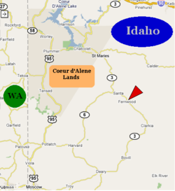 Fernwood in North Idaho | |
| Coordinates: 47°06′44″N 116°23′34″W / 47.11222°N 116.39278°WCoordinates: 47°06′44″N 116°23′34″W / 47.11222°N 116.39278°W | |
| Country | United States |
| State | Idaho |
| County | Benewah |
| Elevation | 2,733 ft (833 m) |
| Population (2000) | |
| • Total | 684 |
| Time zone | UTC-8 (Pacific Time Zone) |
| • Summer (DST) | UTC-7 |
| ZIP code | 83830 |
| Area code(s) | 208 |

Fernwood is a small unincorporated community in the southeastern corner of Benewah County, Idaho, United States, located just to the east of State Highway 3. The city shares a public K-6 school with the communities of Clarkia, Santa and Emida. All students attend high school and middle school in St. Maries.[2]
The 2000 census recorded a population of 684[3] with an average household income of $27,578. The median age in the tabulation area is 41.2 and the average household size is 2.51.[4]
History[]
The Coeur d’Alene people initially inhabited this area for thousands of years prior to the coming of white settlers. The native name of the area is Epschssups'n or “It has a little tail.”[5]
Fernwood's population was estimated at 250 in 1960.[6]
References[]
- ^ U.S. Geological Survey Geographic Names Information System: USGS Place names
- ^ Upriver School District #41, District website, archived from the original on 2011-07-18, retrieved 2007-03-17
- ^ The figure represents the entire area of Fernwood-Santa-Emida ZCTA and not the actual population of the city.
- ^ United States Census Bureau (2000), 2000 Census of Population, archived from the original on 2020-02-12, retrieved 2007-03-17
- ^ Coeur d'Alene Tribe GIS Program
- ^ World Book Encyclopedia. Vol. I. Field Enterprises Corporation. 1960. p. 27.
Municipalities and communities of Benewah County, Idaho, United States | ||
|---|---|---|
| Cities | ||
| CDPs | ||
| Other unincorporated communities | ||
| Indian reservation | ||
| Footnotes | ‡This populated place also has portions in an adjacent county or counties | |
| ||
This Benewah County, Idaho state location article is a stub. You can help Wikipedia by . |
- Unincorporated communities in Benewah County, Idaho
- Unincorporated communities in Idaho
- Benewah County, Idaho geography stubs