Festus Memorial Airport
Festus Memorial Airport | |||||||||||
|---|---|---|---|---|---|---|---|---|---|---|---|
 | |||||||||||
| Summary | |||||||||||
| Airport type | Public use | ||||||||||
| Owner | Wings Portco, Inc. | ||||||||||
| Serves | Festus, Missouri | ||||||||||
| Elevation AMSL | 433 ft / 132 m | ||||||||||
| Coordinates | 38°11′42″N 090°23′08″W / 38.19500°N 90.38556°WCoordinates: 38°11′42″N 090°23′08″W / 38.19500°N 90.38556°W | ||||||||||
| Website | FestusAirport.net | ||||||||||
| Map | |||||||||||
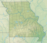 FES Location of airport in Missouri | |||||||||||
| Runways | |||||||||||
| |||||||||||
| Statistics (2019) | |||||||||||
| |||||||||||

Festus Memorial Airport (ICAO: KFES, FAA LID: FES) is a public use airport situation located two nautical miles (4 km) south of the central business district of Festus, a city in Jefferson County, Missouri, United States.[1]
Although many U.S. airports use the same three-letter location identifier for the FAA and IATA, this airport is assigned FES by the FAA[1] but has no designation from the IATA.[2][3]
Facilities and aircraft[]
Festus Memorial Airport sits on an area of 72 acres (29 ha) at an elevation of 433 feet (132 m) above mean sea level. It has one runway designated 1/19 with an asphalt surface measuring 2,202 by 49 feet (671 x 15 m).[1]
For the 12-month period ending December 31, 2019, the airport had 9,006 individual operations, an average of 25 per day: 99.9% general aviation and <0.1% military. At that time there were 25 aircraft based at this airport: 24 single-engine aircraft based at this airport, and one multi-engine aircraft.[1]
See also[]
References[]
- ^ a b c d e FAA Airport Form 5010 for FES PDF. Federal Aviation Administration. Effective August 8, 2019.
- ^ "IATA Airport Code Search (FES)". International Air Transport Association. Retrieved March 14, 2014.
- ^ "Festus Memorial Airport (IATA: none, ICAO: KFES, FAA: FES)". Great Circle Mapper. Retrieved March 14, 2014.
External links[]
- FestusAirport.net
- "Festus Memorial (FES)" (PDF). Archived from the original (PDF) on 2012-08-25. Retrieved 2014-03-15. at Missouri DOT Airport Directory
- Aerial image as of March 1996 from USGS The National Map
- FAA Terminal Procedures for FES, effective January 27, 2022
- Resources for this airport:
- FAA airport information for FES
- AirNav airport information for KFES
- FlightAware airport information and live flight tracker
- SkyVector aeronautical chart for KFES
- Airports in Missouri
- Transportation in Jefferson County, Missouri
- Buildings and structures in Jefferson County, Missouri