Fir Mountain (New York)
| Fir Mountain | |
|---|---|
 Fir Mountain | |
| Highest point | |
| Elevation | 3620+ ft (1103+ m) NGVD 29[1] |
| Prominence | 420 ft (130 m)[1] |
| Listing | Catskill High Peaks 25th |
| Coordinates | 42°01′39″N 74°28′09″W / 42.0275916°N 74.4690414°WCoordinates: 42°01′39″N 74°28′09″W / 42.0275916°N 74.4690414°W[2] |
| Geography | |
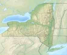
| Location | Ulster County, New York |
| Parent range | Catskill Mountains |
| Topo map | USGS Shandaken |


Fir Mountain is a mountain located in Ulster County, New York. The mountain is part of the Catskill Mountains. Fir Mountain is flanked to the northwest by Big Indian Mountain, and to the southeast by Spruce Mountain.
The east side of Fir Mountain drains into Esopus Creek, thence into the Hudson River, and into New York Bay. The northwest end of Fir Mtn. drains into Elk Bushkill, thence into Esopus Creek. The west and south sides of Fir Mtn. drain into Biscuit Brook, thence into the of the Neversink River, the Delaware River, and into Delaware Bay.
Fir Mountain is within the of New York's Catskill State Park.
See also[]
- List of mountains in New York
References[]
- ^ Jump up to: a b "Fir Mountain, New York". Peakbagger.com. Retrieved 2012-12-18.
- ^ "Fir Mountain". Geographic Names Information System. United States Geological Survey. Retrieved 2012-12-18.
External links[]

| show Authority control |
|---|
This article about a location in Ulster County, New York is a stub. You can help Wikipedia by . |
Categories:
- Catskill High Peaks
- Mountains of Ulster County, New York
- Mountains of New York (state)
- Catskill Mountains, New York geography stubs