Giant Mountain
| Giant Mountain | |
|---|---|
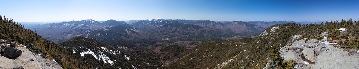
 Giant, seen from Noonmark | |
| Highest point | |
| Elevation | 4,626 feet[1] |
| Prominence | 2,953 feet[2] |
| Listing | Adirondack High Peaks 12th |
| Coordinates | 44°09′40″N 73°43′13″W / 44.16114316°N 73.72020911°WCoordinates: 44°09′40″N 73°43′13″W / 44.16114316°N 73.72020911°W[1] |
| Geography | |
 Giant Mountain Location of Giant Mountain within New York | |
| Location | Keene, New York, U.S. |
| Parent range | Adirondacks |
| Topo map | USGS Elizabethtown |
| Climbing | |
| Easiest route | Hike |


Giant Mountain is the twelfth-highest peak in the High Peaks Region of the Adirondack Park, in New York, USA. The peak is also known as "Giant of the Valley," due to its stature looking over Keene Valley and St. Huberts to the west. The prominent rock slides on the mountain's steep western face and its location away from most other large peaks make it quite an imposing figure, leading to its name.
Ascents[]
On 2 June 1797, Charles Broadhead and his survey party made the first recorded ascent of Giant Mountain, recorded as Giant-of-the-Valley.[3] They were surveying the boundaries of the Old Military Tract.[4] Broadhead's was the first recorded ascent of any of the 46 Adirondack High Peaks.
Trails[]
There are three main trails up Giant, one from the east, and two from the west. The two most popular routes begin on trailheads along New York State Route 73, one near St. Huberts ("Roaring Brook Trail") and the other near Chapel Pond ("Zander Scott Trail"). The two trails climb the southern ridge of the mountain, meeting up about a mile south of the summit. The Zander Scott Trail is shorter than the Roaring Brook Trail but steeper.
The third trail begins from the east, near the town of New Russia, and is not as commonly climbed due to the longer hike. The route climbs Bald Peak, a smaller mountain with unusual krummholz that is predominately Northern White Cedar (Thuja occidentalis), then begins the ascent of Rocky Peak Ridge. After summiting Rocky Peak Ridge, hikers descend a small coll before ascending to the Giant summit. This route is more commonly used by those attempting to become Adirondack Forty-Sixers, since Rocky Peak is a required peak.
References[]
- ^ a b "Giant". NGS data sheet. U.S. National Geodetic Survey.
- ^ "Giant Mountain, New York". Peakbagger.com.
- ^ unknown. "Adirondack History Center Museum: Essex County Historical Society: Nature Timeline". Adirondack History Center Museum.
- ^ The Old Military Tract was created on 5 May 1786 to award land to New York veterans of the U.S. Revolutionary War, as a substitute for the original proposal to award lands in central New York. The land was in Clinton, Essex, and Franklin counties. Henry, Marian S. (5 July 2002). "Bounty Lands in the Military Tract in Post-Revolutionary War New York State". New England Historic Genealogical Society. Archived from the original on 10 December 2010.
External links[]
- "Giant Mountain, New York". Peakbagger.com.
- "Giant Mountain". SummitPost.org.
- Towns and Trails: Giant Mountain Day Hike
- Giant Mountain - LetsGoPlayOutside.com
This article about a location in Essex County, New York is a stub. You can help Wikipedia by . |
- Mountains of Essex County, New York
- Adirondack High Peaks
- Mountains of New York (state)
- Essex County, New York geography stubs