Fitjanuten
| Fitjanuten | |
|---|---|
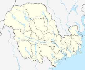
 Fitjanuten Location of the mountain | |
| Highest point | |
| Elevation | 1,504 m (4,934 ft) |
| Prominence | 50 m (160 ft) |
| Coordinates | 59°42′50″N 7°06′59″E / 59.7139°N 7.1163°ECoordinates: 59°42′50″N 7°06′59″E / 59.7139°N 7.1163°E[1] |
| Geography | |
| Location | Rogaland, Norway |


Fitjanuten is a mountain in southern Norway. The 1,504-metre (4,934 ft) tall mountain lies on the border of the municipality of Suldal (in Rogaland county) and the municipality of Vinje (in Vestfold og Telemark county). The mountain lies just north of the lake Holmavatnet and about 5 kilometres (3.1 mi) south of the mountain Vassdalseggi.[2]
References[]
- ^ "Fitjanuten, Vinje (Vestfold og Telemark)" (in Norwegian). yr.no. Retrieved 2020-08-14.
- ^ Lauritzen, Per Roger, ed. (2009). "Fitjanuten". Norsk Fjelleksikon (in Norwegian). Arendal: Friluftsforlaget. ISBN 9788291495477.
This article about a mountain, mountain range, or peak in Vestfold og Telemark is a stub. You can help Wikipedia by . |
This article about a mountain, mountain range, or peak in Rogaland is a stub. You can help Wikipedia by . |
Categories:
- Mountains of Vestfold og Telemark
- Mountains of Rogaland
- Suldal
- Vinje
- Norway mountain stubs
- Vestfold og Telemark geography stubs
- Rogaland geography stubs