Florida Township, Parke County, Indiana
Florida Township | |
|---|---|
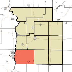 Location in Parke County | |
| Coordinates: 39°39′02″N 87°18′59″W / 39.65056°N 87.31639°WCoordinates: 39°39′02″N 87°18′59″W / 39.65056°N 87.31639°W | |
| Country | |
| State | |
| County | Parke |
| Government | |
| • Type | Indiana township |
| Area | |
| • Total | 48.47 sq mi (125.5 km2) |
| • Land | 48.17 sq mi (124.8 km2) |
| • Water | 0.3 sq mi (0.8 km2) 0.62% |
| Elevation | 614 ft (187 m) |
| Population (2010) | |
| • Total | 2,378 |
| • Density | 49.4/sq mi (19.1/km2) |
| Time zone | UTC-5 (Eastern (EST)) |
| • Summer (DST) | UTC-4 (EDT) |
| ZIP codes | 47862, 47872, 47874 |
| Area code(s) | 765 |
| GNIS feature ID | 453297 |

Florida Township is one of thirteen townships in Parke County, Indiana, United States. As of the 2010 census, its population was 2,378 and it contained 1,073 housing units.[2]
History[]
Florida Township was established in 1821, the same year the county was created, though it was first settled circa 1816. It was named after a township in the state of New York, from which pioneer David Loree had emigrated.[3]
The Harry Evans Covered Bridge, Roseville Covered Bridge, Thorpe Ford Covered Bridge, and Zacke Cox Covered Bridge were listed on the National Register of Historic Places in 1978.[4]
Geography[]
According to the 2010 census, the township has a total area of 48.47 square miles (125.5 km2), of which 48.17 square miles (124.8 km2) (or 99.38%) is land and 0.3 square miles (0.78 km2) (or 0.62%) is water.[2]
Cities, towns, villages[]
Unincorporated towns[]
- Coxville at 39°39′07″N 87°17′40″W / 39.651983°N 87.294461°W
- Hudnut at 39°39′34″N 87°22′37″W / 39.659482°N 87.376963°W
- Jessup at 39°39′26″N 87°15′24″W / 39.657262°N 87.256683°W
- Lyford at 39°39′00″N 87°22′15″W / 39.650038°N 87.370851°W
- Numa at 39°37′51″N 87°22′13″W / 39.630871°N 87.370296°W
- West Atherton at 39°36′32″N 87°22′15″W / 39.608926°N 87.370852°W
(This list is based on USGS data and may include former settlements.)
Cemeteries[]
The township contains these five cemeteries: Adams, Bound, Mount Pleasant, Orlea and Rukes.
Major highways[]
Airports and landing strips[]
- Heaton Private Airport
School districts[]
- Southwest Parke Community School Corporation
Political districts[]
- State House District 42
- State Senate District 38
References[]
- "Florida Township, Parke County, Indiana". Geographic Names Information System. United States Geological Survey. Retrieved 2009-11-01.
- United States Census Bureau 2009 TIGER/Line Shapefiles
- IndianaMap
- ^ "US Board on Geographic Names". United States Geological Survey. October 25, 2007. Retrieved 2017-05-09.
- ^ a b "Population, Housing Units, Area, and Density: 2010 - County -- County Subdivision and Place -- 2010 Census Summary File 1". United States Census. Archived from the original on 2020-02-12. Retrieved 2013-05-10.
- ^ Bowen 1913, pp. 175–180.
- ^ "National Register Information System". National Register of Historic Places. National Park Service. July 9, 2010.
Bibliography[]
- History of Parke and Vermillion Counties Indiana. Indianapolis: B. F. Bowen and Company. 1913. pp. 25–225. Retrieved 2010-12-17.
External links[]
- Indiana Township Association
- United Township Association of Indiana
- City-Data.com page for Florida Township
Places adjacent to Florida Township, Parke County, Indiana | |
|---|---|
Municipalities and communities of Parke County, Indiana, United States | ||
|---|---|---|
| Towns | ||
| Townships | ||
| Unincorporated communities |
| |
| Ghost town | ||
| Footnotes | ‡This populated place also has portions in an adjacent county or counties | |
| ||
- Townships in Parke County, Indiana
- Townships in Indiana